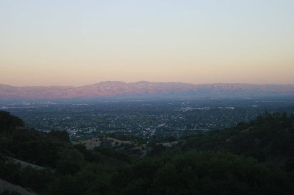
A short drive and a mildly strenuous hike deliver great rewards at one of the South Bay's most accessible open spaces. Located on the western, urban fringe of Santa Clara County, the Fremont Older Open Space Preserve protects over 739 rugged acres. Overlooking Cupertino, the preserve offers recreational opportunities for hikers, cyclists, equestrians, and dog walkers alike, plus million dollar views from the upper reaches (740 feet up) of this four mile loop.

How to Get There
You'll find the preserve at the end of Prospect Road in Cupertino.
1. Head south on De Anza Blvd. from Highway 85 for a .5 mile, t
2. Turn right on Prospect Rd. and then after another .5 mile bear left to stay on Prospect crossing the railroad track.
3. Prospect meanders up, and after 1.4 miles you'll come to the parking area.
There's only about two dozen spaces, so come early. There are port-potties, but no drinking water and trails maps are usually available at the map board (consider downloading the PDF map on your smartphone).

The Hike, Step by Step
1. There are three possible ways up for the hiker: The first trail to the right of the gate is the only route for cyclists, and can be busy and dusty. Instead, go straight ahead, stay on the road or take the Creekside trail—they merge after .4 miles. At .5 miles, the MTB trail comes in from the right and shortly thereafter you'll reach the ridge where many options become evident.
2. Head left and up another .1 mile to the intersection with the Hayfield Trail and again head left.
3. After .3 miles we meet the Toyon Trail (our return route) and continue up for another .2 miles to the Coyote Ridge Trail. The views become more expansive as we climb higher.
4. Bear left on Coyote, passing the Fern trail entrance on the right and a connector trail on the left.
5. After .2 miles you'll see the short trail up to the summit, Maisie's Peak, at almost 1,100 feet an ideal lookout to enjoy the vistas of the bay and far off Mt. Diablo.
6. Our descent begins by continuing on the Coyote ridge Trail for .6 miles to its intersection with the Bay View Trail (ignore the temptation to descend on the Vista Loop, which would lead you down to Stevens Creek Park).
7. The Toyon Trail beckons after only .2 miles and this seasonal track (it closes during the winter) offers excellent shade as it loops us back to the Hayfield Trail and the return route to the parking area (see step 3).

Trail Notes
There are nine miles of trails in the preserve to tackle if these four miles weren't enough to get your heart rate up. Some cautionary points: don't leave valuables in your car, poison oak is plentiful here so keep on the trails, and summer afternoons can hot here, so plenty of water and sunscreen are warranted.
Other Things to Do Nearby
On the first Saturday of month take in the huge De Anza College Flea Market. For after hike eats there are numerous restaurants on De Anza Blvd. with virtually every ethnic cuisine represented.
A side note: the preserve is named for newspaperman Fremont Older (1856-1935). A former editor of the San Francisco Bulletin, Older led a pretty colorful life as outlined on his Wikipedia page.