


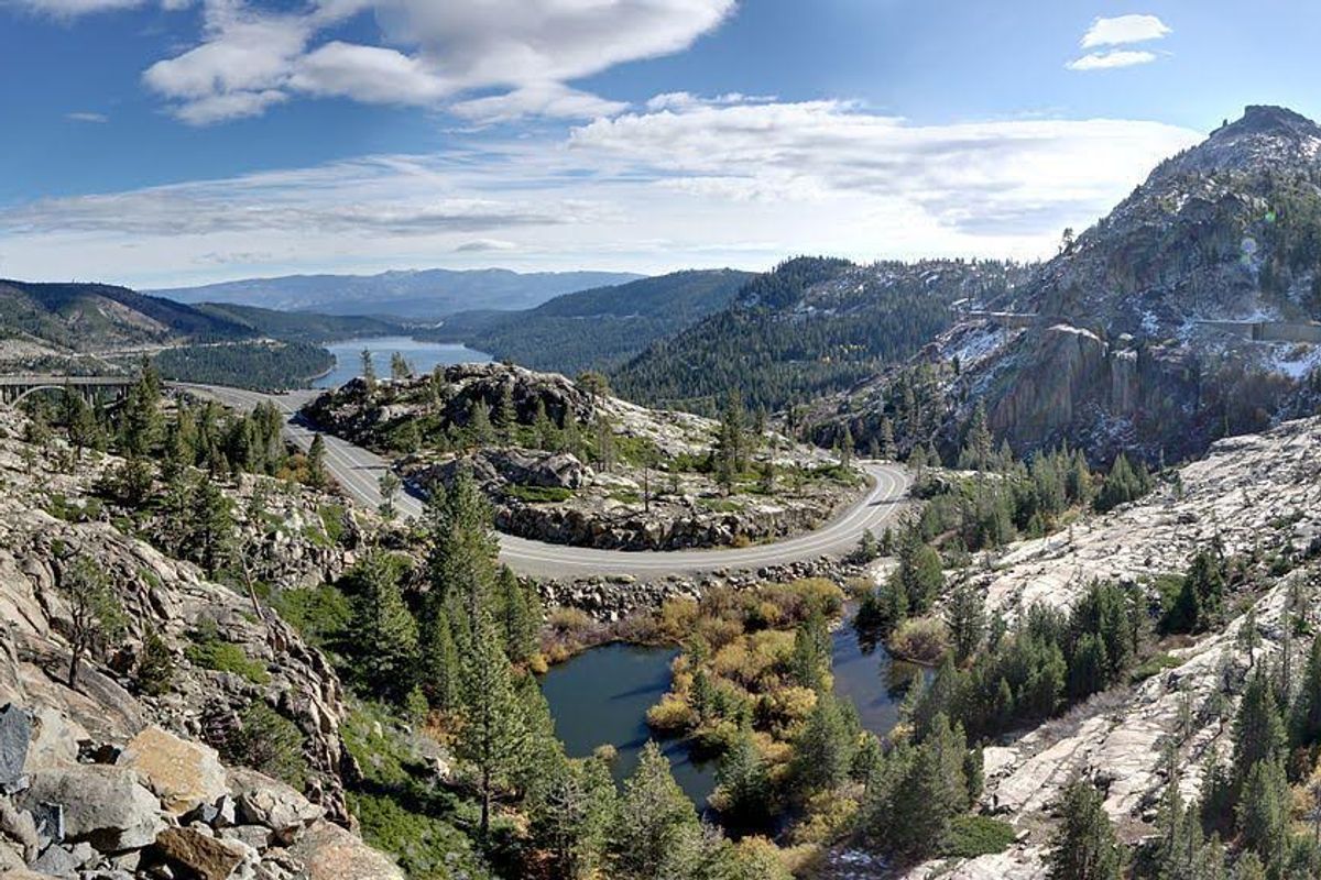
Donner Pass (about 9 miles west of Truckee) is most famous for its role in destroying the unfortunate Donner Party more than 150 years ago. If the thought of getting trapped in a snowstorm (and having to eat your family) terrifies you, may we suggest tackling Donner Pass during the summer— the high pass and its peaks have some of the area's most diverse hiking trails, and the views are incredible. Here are five awesome hikes to choose from on your next trip to Tahoe.
Coldstream Trail to Tinker Knob
For a shorter hike, check out what the locals have dubbed the Lost Trail (since so few people hike it). This 10-mile round trip hike goes along the Coldstream Trail and weaves above Donner Lake up to Tinker Knob — a granite bump on the ridges above I-80. It's pretty difficult, but rewards include gorgeous views of Coldstream Valley and Donner Lake. Heads up, you will need to pay the Donner Memorial State Park parking fee to park your car near the trailhead. More info.
Directions to trailhead: From I-80, take the Donner Pass Road exit (184) and follow the signs for the Donner Memorial State Park. The trailhead is past the Ridge and Creek Campgrounds at a signed junction for Coldstream Valley.
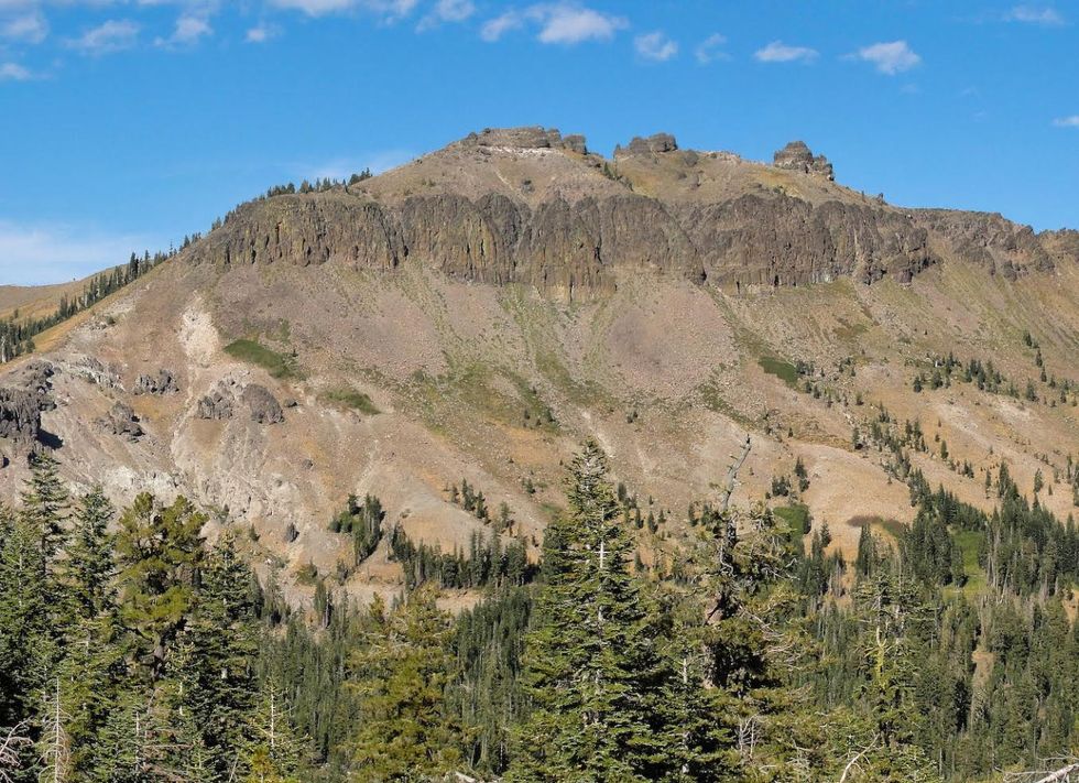 Castle Peak(Courtesy of Wikipedia)
Castle Peak
With any hiking trip to Donner, you can't miss out on Castle Peak. This popular 9.6-mile round trip hike follows the Pacific Crest Trail up to the top of one of North Tahoe's highest summits. The trail will lead you to the base of Castle Peak and (if you're not afraid of heights) you can scramble to the top to get views of Lassen Peak to the north and the coastal hills of California to the west. More info.
Directions to trailhead: Take the Castle Peak/Boreal Ridge exit from I-80 and take the frontage road on the south side of the freeway to the Pacific Crest Trail parking area. Well marked signs will show you the trail.
Lake Angela
If you want something shorter, this pretty 6.4-mile hike winds around granite cliffs and boulders to Lake Angela just behind Boreal Mountain Resort. The trail offers views of Donner Lake and the Rainbow Bridge along the way. As the trail begins to head down toward the end of 3.2 miles, keep an eye out for the power lines to the west and head down to the lake which can be seen from the ridge. More info.
Directions to trailhead: Take the Castle Peak/Boreal Ridge exit from I-80 and take the frontage road on the south side of the freeway to the Pacific Crest Trail parking area. Well marked signs will show you the trail.
 Summit Tunnel(ChiefRanger, via Flickr)
Summit Tunnels
For something unique, the 3.0 Summit Tunnel Hike at the Rainbow Bridge overlook takes you along petroglyphs (walls built by Chinese immigrant railroad workers in the mid-1800s) and into the creepy-yet-cool tunnels of the old railroad. From the trailhead, keep heading west and up the incline to visit the stone walls and through the underpass of the old railroad bed. Tunnel 7 and Tunnel 6 have a fair amount of graffiti, but make for great photos. Flashlights are recommended for the tunnel portion. More info.
Directions to trailhead: Park your car at the Rainbow Bridge overlook on U.S. Route 40. Carefully cross Donner Pass Road. The trail starts near the markers for the petroglyphs.
 Donner Pass tunnels(Courtesy of Wikipedia)
Warren Lake
If you have a long weekend and want to do some overnight backpacking, take a portion of the Pacific Crest Trail to Warren Lake north of Donner Summit. This 15-mile round trip hike is strenuous with an elevation gain of 2,250 feet and a loss of 2,125 feet. The trail winds through wildflower areas and provides views of Castle Peak and Carpenter Valley. Warren Lake is ringed by granite cliffs and has a few small islands, so be sure to bring a camera! More info.
Directions to trailhead: Take the Castle Peak/Boreal Ridge exit from I-80 and take the frontage road on the south side of the freeway to the Pacific Crest Trail parking area. The trail begins on the east side of the parking area. A good topographic map of the area is recommended.


