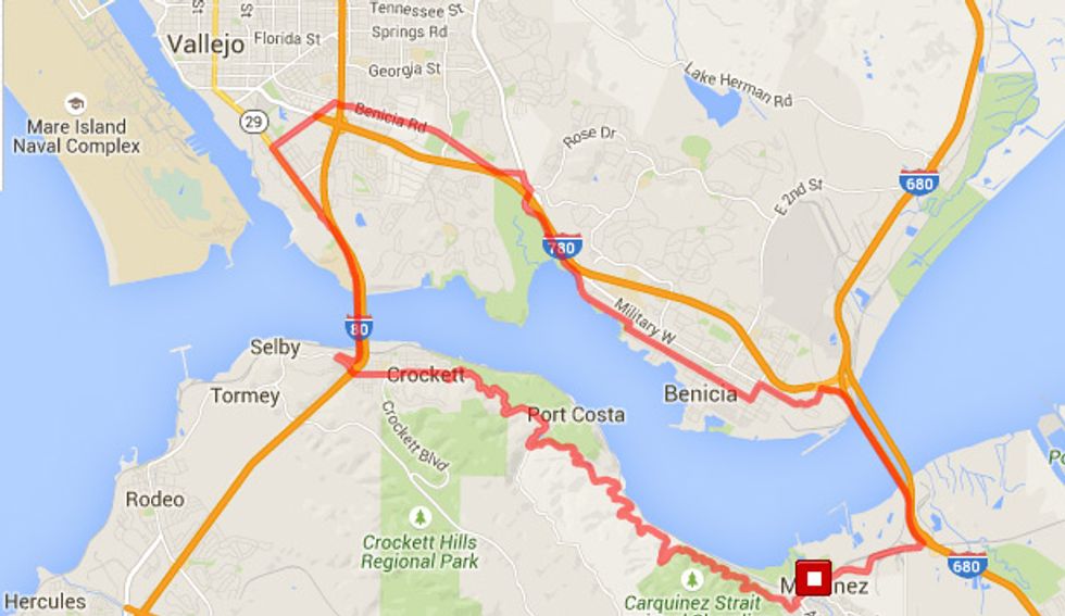
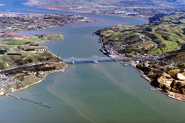
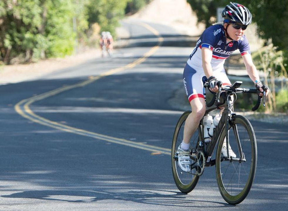
This week's ultimate Sunday ride is an opportunity to cruise across two of the Bay Area's major bridges in a two county loop. You'll enjoy fantastic views of the Carquinez Strait, cover 23 miles, climb 1,550 feet.
What You'll See
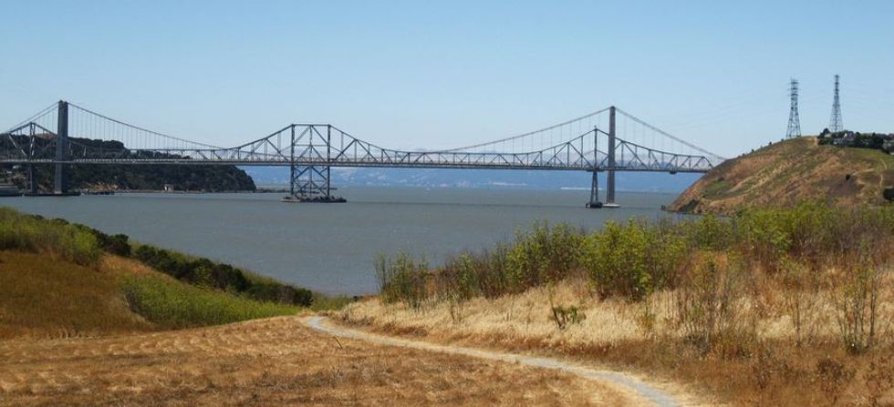
Superb vistas are to be had from both sides of the strait as well as from both the Carquinez Strait Bridge and the George Miller Jr. Memorial Bridge, which link Contra Costa to Solano County. You'll also get to amble through the historic downtowns of Benicia and Martinez as well as enjoy riding through a number of parks.
How to Get There
While there are numerous places to access this loop, the Bike the Bridges Ride starts at the Martinez Waterfront Park, on Joe DiMaggio Dr. in Martinez (Google Maps Link).
1. On Hwy 680 north from Concord take exit 56
2. Turn left onto Waterfront Rd, heading west.
3. It turns into Marina Vista, then turn right on Ferry St.
4. Go two blocks and turn right onto Joe DiMaggio Dr.
The Ride
- Leave the park as you came in, making a right turn on Marina Vista.
- Six blocks later make a right on Talbert St.
- Two blocks later, at Foster St. make a diagonal left turn to join the George Miller Trail.
- You'll pass Alhambra cemetery on your right as you enter the Carquinez Strait Regional Shoreline Park on what was formerly know as Snake Rd.
- At the 2.5 mile point you'll leave the park but still be on the GM Trail.
- Next up at 5.5 miles is Reservoir St. (which will take you to Port Costa – which we profiled in our last article, and is well worth a detour).
- You'll enter Crockett at 7.75 miles and soon cross under the bridge approach after passing through downtown.
- Next you'll pedal up to the Carquinez Strait Bridge and reach mid-span at 9.4 miles.
- Upon reaching Vallejo, continue straight and at 10.75 miles bear left, then right, onto Maritime Academy Dr.
- At the intersection and stoplight at Sonoma Blvd. (Hwy. 29) carefully turn left and then merge right to the bike lane.
- At Lemon St. (11.8 miles) turn right.
- Make a right turn onto Benicia Rd. at 12.7 miles.
- Turn right at Columbus Pkwy. at 14.9 miles, followed by an almost immediate right onto the bike path alongside Rose Dr. to pass over Hwy. 780.
- Upon reaching the crosswalk at Dillon Pt. Rd. bear left onto the San Francisco Bay Trail bike path (15.4 miles) within the Benicia State Recreation Area.
- As you near the shoreline the path ends at W. K St. and you'll enter Benica.
- At 17 miles turn right on W. 9th St. the immediately turn left onto W. J St.
- Ride five blocks and turn left onto E. 5th St. (17.7 miles).
- Six short blocks brings a right turn onto Military East.
- Bear left at the 19.35 point, then turn up Jefferson St. and continue up the hill on Park Rd. going under Hwy. 780.
- Cross the intersection and turn right onto the bike path (19.75 miles).
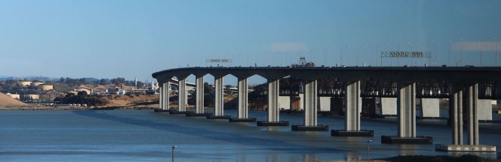
- Ride over the George Miller Jr. Bridge (mid-span marks the 20.6 mile point).
- The path intersects Moroco Rd. Jog right, then left, then right to get onto Marina Vista Ave. for the return back to Martinez Waterfront Park.
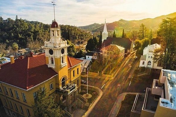
Downtown Martinez offers numerous post ride dining options including the Beaver Creek Smokehouse, Yanni's Greek Cafe, and Creek Monkey Tap House.