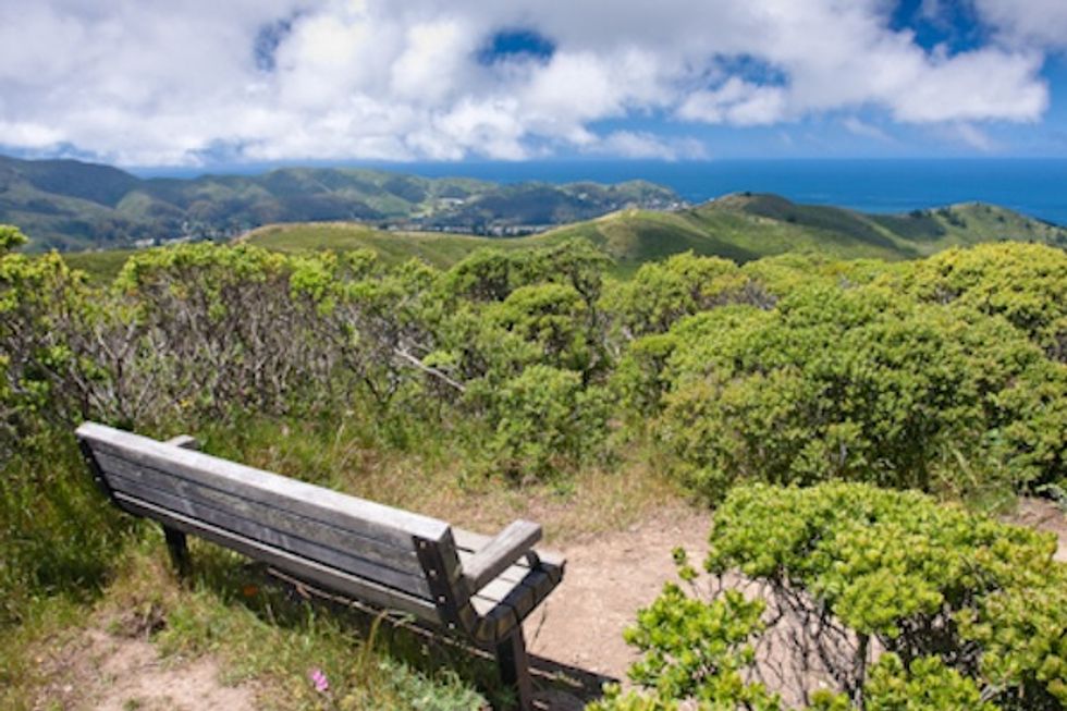
The climb to the top of Sweeney Ridge is breathtaking, both for the pitch that gradually steepens as you ascend and for the magnificant vistas of the Bay Area's varied geography once you've reached the ridgeline.
How to Get There
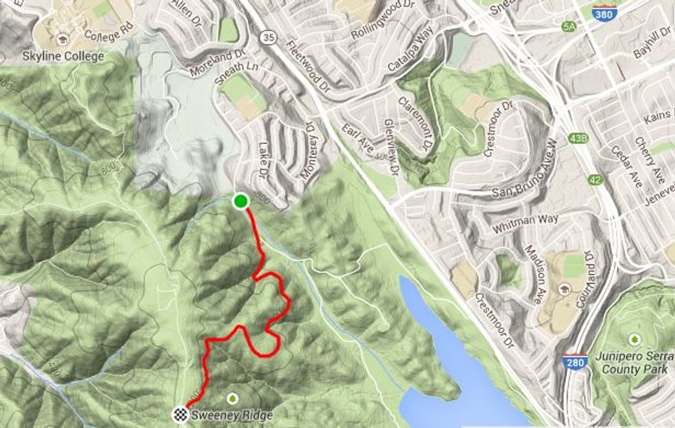
The trailhead is located at the end of Sneath Lane in San Bruno. Take the Sneath Lane exit from Hwy. 280, head west and drive to the end. There is ample parking, but no other facilities or amenties are provided. Unfortunately, there is no viable public transportation to get to the trailhead.
The Hike
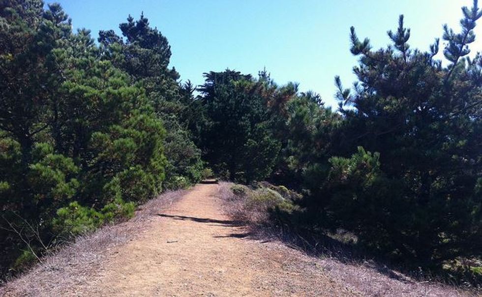
The route is very straightforward: From the trailhead, follow the paved service road—it was once used to access the radar installation, erected at the height of the Cold War to guide missiles towards Soviet bombers that, thankfully, never came. The Sneath Lane Trail starts at a gradual incline, getting steeper as it curves up towards the ridge (the 1.7 miles up to the ridge trail averages 6-percent, but can be as steep as 11- to 13-percent in places). Overall, you’ll climb 610 feet up to the 1,200 foot ridge.
Once you reach the ridgeline, you’ll most likely want to explore more and go north on the Sweeney Ridge Trail to the highest point, where the radar station once stood. The trail, steep and eroded, continues down to Skyline College. In the opposite direction, the trail intersects with the Bacquiano Trail, which takes you down into a beautiful little valley on the west side of the ridge.
What You’ll See
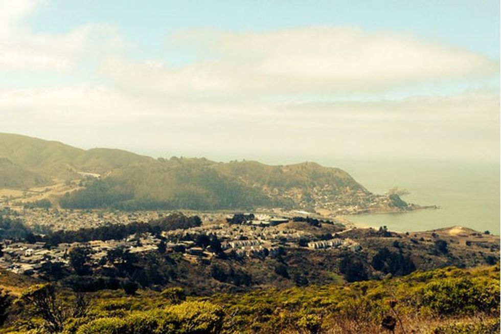
On very clear days, you can see the Farallon Islands to the west, with the town of Pacifica and Mori Point below. Further out, Pt. Reyes sits to the northwest, along with Mt. Tamalpais, the Marin Headlands and the Golden Gate Bridge. Directly north, you can see Mt. Davidson and all of San Francisco, with Mt. San Bruno in front and Alcatraz and Angel Islands as a backdrop in the center of the Bay. To the east, Mt. Diablo looms behind the East Bay hills, ships lay at anchor, and busy SFO sits directly below us. Looking southeast, you see San Andreas Lake and Hwy. 280 and, as looking south, the Sweeny Ridge recedes away as the northernmost point in the Santa Cruz mountain range. To the southeast, Montara Mountain dominates the view towards Half Moon Bay.
One caveat: While this hike can be enjoyed virtually anytime of year, it’s a rare day in June, July, and August that the ridge is not enveloped in fog.
History
San Francisco Bay was first “discovered” by Native Americans and then, many thousands of years later, by the Spanish (Catalonian) explorer Gaspar de Portolà in 1769. Dispatched from San Diego, Portolà’s intended destination was Monterey Bay, however it didn’t seem as majestic as the bay that had been described to him, so the party pushed north in continued search. It was up on Sweeney Ridge that Portolà and his men realized that they had indeed found a bay more spectacular. Their camp was just a short ways south down the ridgeline from the end of the paved road.