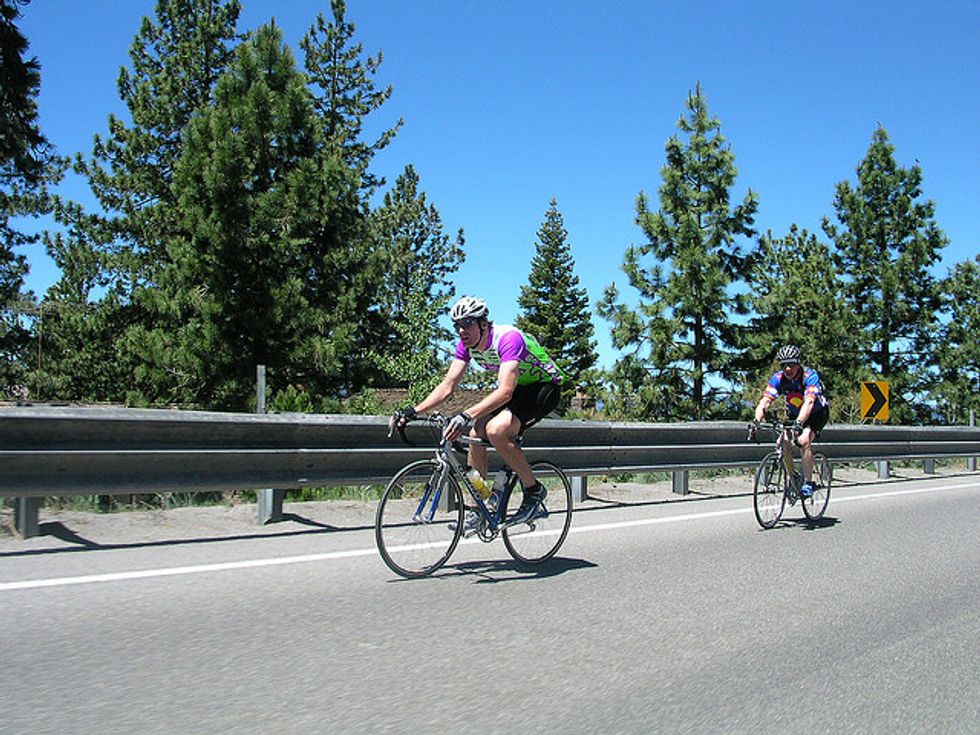
Although outdoor recreation in the Lake Tahoe area is more synonymous with skiing and snowboarding in the winter and boating in the summer, the roadways that provide access to the basin are great for epic two-wheeled adventures. Here are five rides that are the perfect slice of what the region has to offer, starting with the most mellow and ending with a circumnavigation of Big Blue itself.
1. Truckee-Squaw Valley-Truckee
This mostly flat, 19-mile ride starts at the Gateway (or Safeway) Center in Truckee. From the intersection of Donner Pass Road (Old Highway 40) and Highway 89, head south along 89 under the freeway and through the Mouse Hole (the short tunnel under the railroad tracks) for almost 8 miles until you reach the turnoff to Squaw. Make a right at the signal and ride another 1.5 miles to the base of the former Winter Olympics site. Enjoy a refreshment at the Village before retracing your ride back to Truckee. To extend your ride by nine miles, turn left at the Donner Pass Road-Highway 89 intersection and head west on old Highway 40, crossing over the freeway and skirting the north shore of Donner Lake; retrace your route back to Truckee when you reach Donner Lake Village at the west end of the lake.
2. Carson Valley out-and-back
Just east of Lake Tahoe and some 1,800 below lake level is the semi-arid Carson Valley. A relatively flat 35-mile ride through this area starts and ends in Genoa, the oldest continuously inhabited town in Nevada. From Mormon Station State Park, head south on Foothill Road for about 15 miles until you reach Highway 88; cross the highway, then make an immediate right to ascend the Carson River Road to the turnaround point at the general store in Woodfords. Retrace your route to Genoa, or to add another 11 miles, head south on Highway 89 a ways until the left turn on to Diamond Valley road, which loops through the eponymous valley until returning to the Highway 88/Foothill road juncture mentioned previously.
3. Truckee-Kings Beach-Tahoe City loop
This 38-mile circuit has a killer climb up to Brockway Summit (elevation 7,179 feet) but it is very doable by most fairly fit riders. The route can start/finish anywhere, but we'll begin in downtown Truckee. Head across the railroad tracks and the Truckee River along Brockway Road (old Highway 267), then make a right at the signal on Highway 267 proper. Cruise through Martis Valley before beginning the long slog up to the top of Brockway Summit. Enjoy the descent -- and the stunning views of Lake Tahoe -- into Kings Beach, where you will make a right at the signal at the junction of Highway 28. Follow 28 for 14 undulating miles until you reach the northwest end of Tahoe City and the Highway 28-Highway 89 junction. Stay to the right and follow 89 for about 13 miles until the signal at West River Street in Truckee where you will make a right. Follow West River until you reach Brockway Road; make a left, cross the tracks and you're back in downtown Truckee.
4. South Lake Tahoe-Carson Valley-Hope Valley-Meyers loop
This 56-mile route -- a.k.a., Tour de Groan -- is a pretty good test of fitness: It traverses two passes (Daggett at 7,334 feet and Luther at 7,740 feet) and goes through a wide range of mountain and desert terrain. Begin at the Village Shopping Center in South Lake Tahoe and follow Highway 50 east for about a mile until the junction of Nevada Highway 207; make a right and begin the 1,000 foot climb up Kingsbury Grade to the top of Daggett. An exhilarating, 7-mile, 2,800-vertical-foot descent brings you to the junction of Foothill Road; turn right and follow Foothill to the crossing of Highway 88; turn right on the Carson River Road and after about 30 or so total miles of riding you'll find yourself at the Woodfords store. Continue west on Highways 88/89 for nearly six miles (a surprisingly steep climb along the West Fork of the Carson River) until you reach Picketts Junction. Turn right on Highway 89 and begin the easy ascent to Luther Pass; at the top it's a mellow descent into Christmas Valley. At the junction with Highway 50 in Meyers, make a right and then another right less than a mile later at the signal. Follow Pioneer Trail through the backside of South Lake for about 8 miles until you reach Highway 50 again and the Village Shopping Center.
5. Lake Tahoe loop
Riding around Big Blue is a must for anyone bringing his or her road bike to the lake. Start anywhere you like, and it's 72 miles of blissfully easy pedaling, although the climb from Camp Richardson to the ridge above Emerald Bay and the long uphill slog from Sand Harbor to the junction of Highway 50 will get your attention. Two pieces of advice: Ride the route in a clockwise direction so you are only making right turns at various highway junctions, and try to ride on a Monday or a Tuesday, when traffic is generally lighter.
Where are your favorite spots to ride in the Lake Tahoe region?