Lake Tahoe and its surroundings are resplendent with geological wonders and biological diversity to boot. A visitor can get a sample of Tahoe's natural bounty by car or bike, but to get an authentic taste of Tahoe, to savor Big Blue in all its glory, it's best to put on a pair of trail shoes or hiking boots and explore it by foot.
The following five hikes, ranging from easy rambles to moderately strenuous outings, are a great way to get, if you will, a foot in the door. All but Rubicon are dog friendly, but your pup should be leashed.
Tahoe Meadows: This is a relatively flat, wheelchair- and stroller-accessible trail just west of the Mt. Rose summit on Highway 431. The 1.2-mile interpretive trail weaves through wildflower patches, over streams, past stands of fir and pine and around large granite boulders. To access the trail from Incline Village, drive about 6 miles east on 431 to the trailhead parking lot on right.
Eagle Rock: Rising a couple hundred feet immediately above Tahoe's West Shore, Eagle Rock has been a popular destination for locals and visitors alike to get a sweeping vista of the lake. Last summer a new, three-quarter-mile trail (short but steep) to the summit was constructed, obviating the need for tramping up the many makeshift, erosion-causing trails that had existed for years. To reach the trailhead, drive about five miles south of Tahoe City on Highway 89 and park in the lot just south of Eagle Rock, where you will find an information kiosk.
Faye-Luther: This bi-state trail system in the Carson Valley just east of Lake Tahoe goes from a desert eco-system in Nevada to the lower reaches of sub-alpine terrain in California. The 8.9-mile network of trails includes a 1.2-mile interpretive loop that explains the human-made history of the area and its flora, fauna and geology. To access the trailhead, head east out of South Lake Tahoe on Highway 207 (Kingsbury Grade) over Daggett Summit to the valley floor; at the bottom of Kingsbury, make a right on Foothill Road and drive about 4.5 miles south to the signed parking area.
Rubicon: If you want an up-close view of Tahoe and Emerald Bay, this is the hike for you and your family. The 8-mile (round-trip) trail begins at Vikingsholm parking area off Highway 89 on the northwest side of Emerald Bay, descends a couple hundred feet to nearly the bay's shoreline and then heads north along the cobalt-blue water. The relatively flat track parallels Tahoe shore, weaving in an out of the forest until it hits the campground at D.L. Bliss State Park. Retrace your steps back to the trailhead.
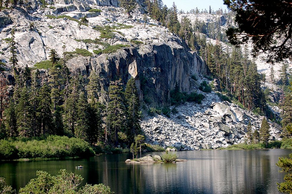
Shirley Canyon: This moderately strenuous hike wanders up through thick forests, over granite slabs and along burbling Shirley Creek for four miles (and about 1,500 feet of elevation gain) to Shirley Lake, one of the jewels of Squaw Valley resort. The hike begins at the west end of Squaw Peak Road at the ski resort's base area. Most people tramp to the lake and back, but for another couple miles of hiking and about 500 feet of ascent you can make your way to the High Camp complex (swimming pool, cafe, restaurant, bar, etc) and take the aerial tram, which affords stunning views of Lake Tahoe and the surrounding mountains, back down to the valley.