Today’s ride will be a test of your climbing legs as we venture to the top of one of the more little known areas of the GGNRA in San Mateo county, Sweeney Ridge. Although it has been immortalized in one of the many iconic posters from the Parks Conservancy, it gets nowhere near the visitors other areas of the park receive.
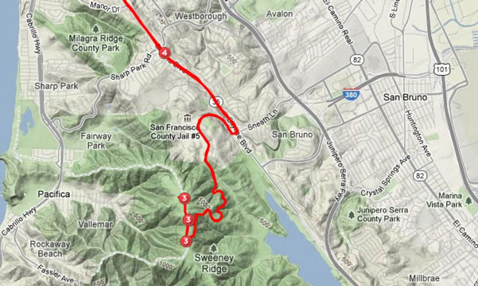
This ride can begin anywhere in San Francisco or the Peninsula –our map shows an approach from the north, via Skyline Blvd. A good start point from the city is at the intersection of Sloat Blvd. and the Great Highway –from here it’s a 25 miler in and out.
While this ride was done on a road bike, it’s also a delight for mountain bikers and hikers as well, who have more loop options once they’ve topped the ridge, as flat-prone, skinny-tired riders are better off reversing the route for the return.
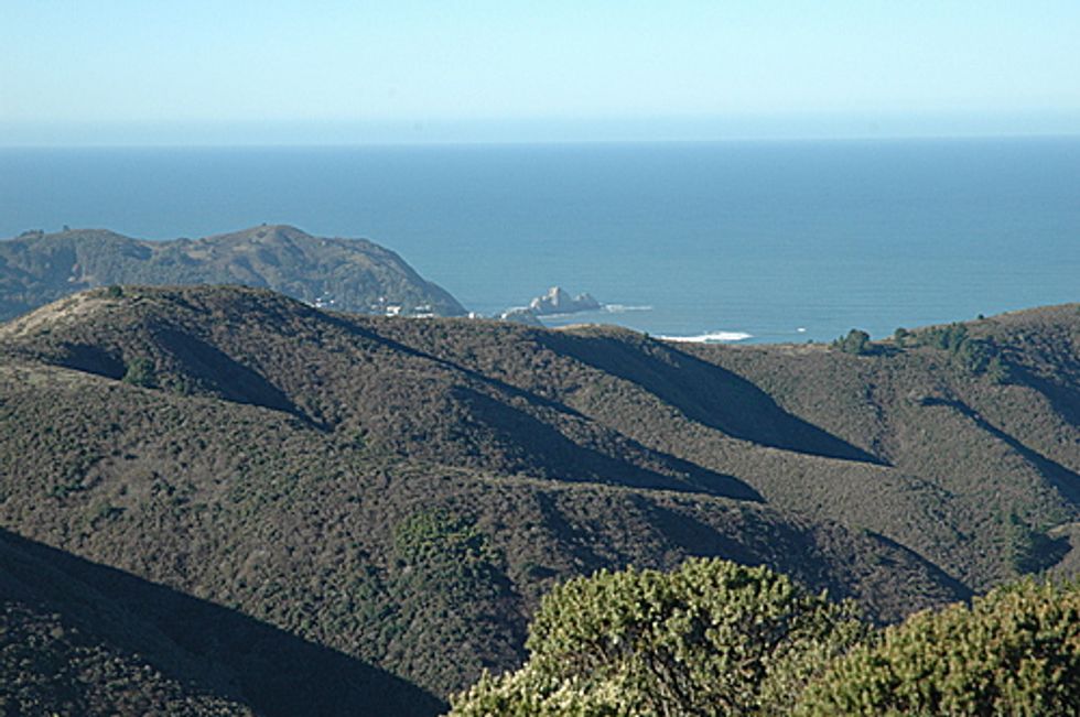
The ridge sits at 1250 feet above the Pacific, and on a clear day (most likely in the fall and spring) there are fabulous vistas in all directions–with San Andreas Lake to the southeast, Pacifica to the west, Mt. Tam and perhaps the Point Reyes to the north, and nearby San Bruno Mountain and SFO to the east.
The access point from Skyline Blvd. (as well as Hwy. 280) is Sneath Lane. It immediately gets a bit steep going up Sneath in a couple of sections, so be prepared for a downshift and perhaps a little traversing to make it up those pitches. The sinister-looking facility nestled in the valley on your right is the San Francisco County Jail #5, looking very out of place in this bucolic setting. At about a mile and a half, you’ll come to the gate that bars vehicle access to Sweeney Ridge. There is parking here for hikers or those wanting an extended MTB ride. No water or restrooms are available.
Here the fun begins: While the average grade to the top is only 4.7%, you’ll see a lot of double digit gradient on the climb up. If it’s a foggy day (a frequent occurrence here) the road can be slick under the trees, especially if you’re climbing out of the saddle. About 2.75 miles after the gate you’ll reach the unpaved ridge road–go right to get up to the highest point–and be rewarded for your efforts with the killer views.