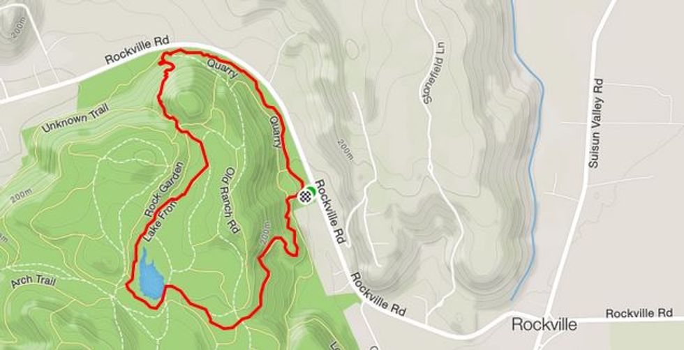
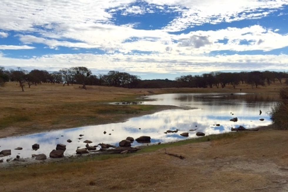
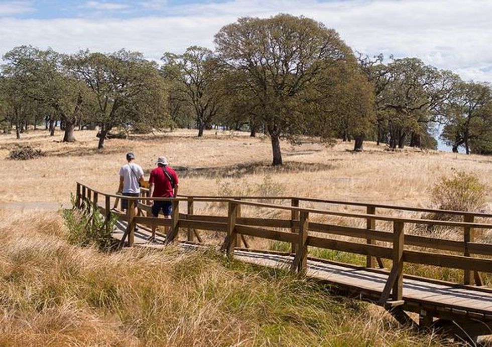
The rugged, volcanic rock hills of Rockville Regional Park offer a splendid hike through a timeless landscape of California blue oaks, brush chaparral, and seasonal wetlands. The route includes a couple of remote ponds situated in a delightful grassy valley, a hidden cave, and views of Mt. Diablo to the south, Elkhorn Peak to the west, and the Twin Sisters to the north.
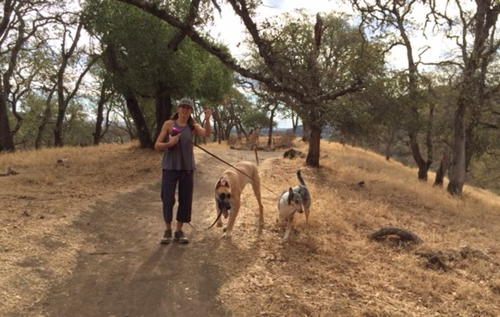
(Photo by Eugene Kim, via Flickr Creative Commons)
How to Get There
Rockville Regional Park is easily accessible from Hwy. 80 in Fairfield. Take exit 41 (Suisun Valley Rd/Pittman Rd), turn left onto Suisun Valley Rd., head west for 1.6 miles to Rockville Corners, then turn left on Rockville Rd. for 0.8 miles. The park entrance is on the left. There is no parking fee, however, each person using the park must purchase a day permit, which is $3.00 and must be carried while you hike. Dogs on leash are an additional $1.00.
The Hike
- From the entrance turnstile take the Rockville Trail uphill.
- Bear left on the Rockville when it joins the Lower Quarry Trail
- Continue on the Rockville as it ascends and curves to the right. Enjoy the views northwest as you gain elevation.
- At the 0.5 mile point you’ll cross a paved service road. Restrooms are located a tenth of a mile to the left on this road. Continue straight alongside the seasonal pond.
- Walk left at the top of the dam, going clockwise around the lake. Keep an eye open for a blue heron or two among the wading egrets.
- Turn right on the Lakefront Trail after passing through the stile in the cattle fence.
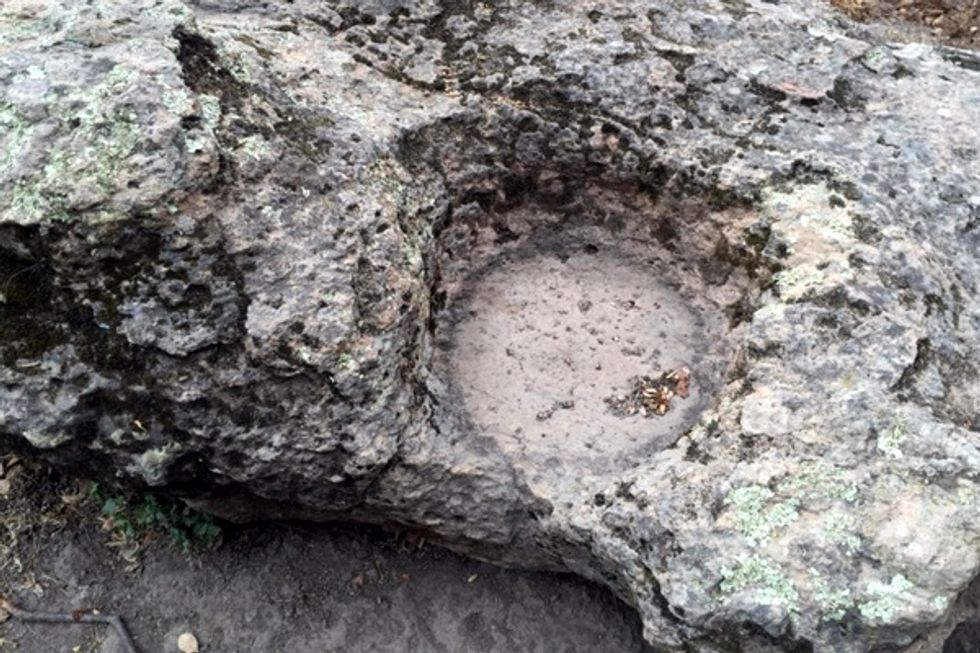
- Continue on the Lakefront parallel to the fence. At the 1.1 mile point, look for a cluster of large rocks, one of which has a couple of round, deep indentations made by Native Americans of the Ion culture when grinding acorns. Some of the oldest artifacts discovered in California were discovered nearby.
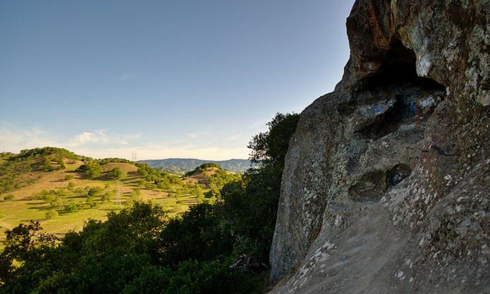
- At 1.4 miles, take the Cave Trail uphill to the saddle – note the interesting rock formation to your left as you start the short climb.
(The Cave - Photo by Tom Hilton, via Flickr Creative Commons) - Descend carefully on the Cave, going right at the intersection with the Unknown Trail at 1.7 miles.
- While the views to the west are outstanding, be sure to look up and to your right to see the small cave in the cliff above. You can scramble up to it, but it’s not advised as too many visitors have eroded the approach.
- Continue down via the Quarry Trail, which is also eroded from overuse. Hiking poles are useful here.
- The Quarry parallels Rockville Rd. as it takes you back to the parking area.
While a worthwhile destination in itself, this is also is a delightful diversion to take on any Tahoe trip due to its easy access from Hwy. 80.
Other Things to Do
You’ll find a small deli at Rockville Corners, and picnic tables are dotted around the park. There’s a Saturday Farmer’s Market April through October in nearby Green Valley.
Those interested in wine tasting can choose to visit either (or both!) the Wooden Valley Winery or Vezer Family Vineyard which are close by. Another interesting side trip is a visit to the Travis Air Base Museum, but it has a caveat, as you’ll need to go through a security check before being allowed access.