*UPDATE Oct. 3, 2020: Yosemite National Park has reopened after closures due both to Covid-19 and wildfires. Day-use reservations will be required to enter the park until Nov. 1, 2020. Before your visit, please check nps.gov for the latest updates and possible closures. Be sure to bring your mask and keep distance from others. Also note that smoke from nearby fires may be causing poor quality; you can check current air quality index at iqair.com.
--
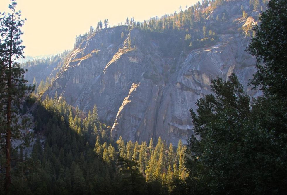
Fall in Yosemite, particularly past mid-October, offers a quieter, peaceful experience.
Fall is almost here and it's the perfect time for exploring the Yosemite Valley floor by bike. Tour the valley's iconic landmarks on your own time and without the stress of summer car traffic. If you're a climber, then you already know that fall is one of the best times to climb in the valley. Daytime temperatures are generally mild, and you won't encounter lines, as can sometimes happen in summer, to climb the valley classics.
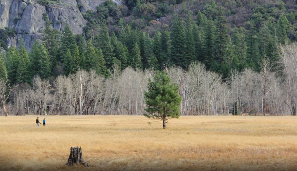
By mid fall, even the odds of getting a campsite within Yosemite Valley without planning months in advance are in your favor. Upper Pines Campground, which remains open year round, typically has spots available upon arrival this time of year. Walk-in Camp 4 is less crowded, too. We'd still recommend stopping by the campground reservations office on the earlier side of the day to ensure you get a spot, but cold valley nights typically mean fewer Yosemite campers. Just make sure to bring plenty of firewood to keep warm.
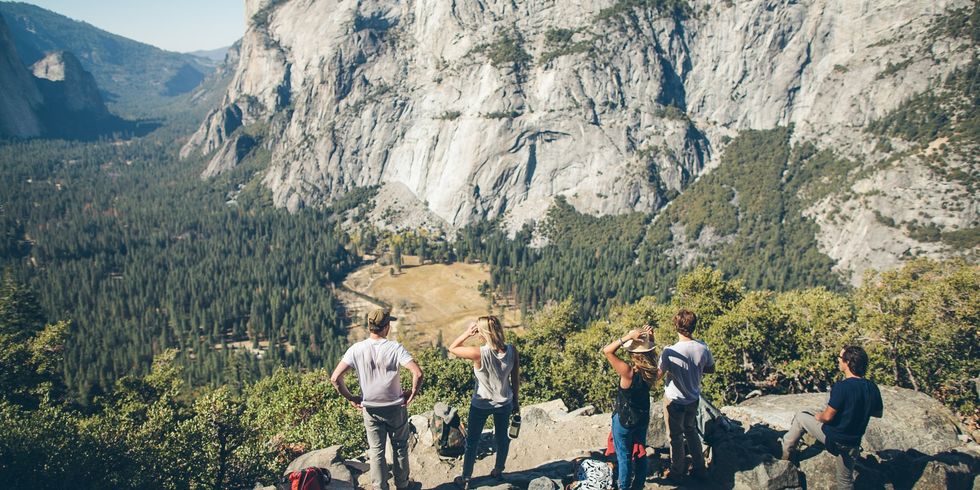 A crew soaks up the view along the Four Mile Trail(Photo by Taylor Stitch)
Four Mile Trail to Glacier Point
Glacier Point via the Four Mile Trail undoubtedly ranks as one of the top day hikes beginning from Yosemite Valley. Climbing 3,200 feet from the valley floor to Yosemite's most famous viewpoint on the edge of the south rim, the trail provides inspiring views of Yosemite's most notable landmarks and an aerial vantage on the valley floor that culminates with the sweeping vista at Glacier Point.
- PROS: Iconic Yosemite Valley and Half Dome views.
- CONS: Glacier Point can draw a crowd.
- REGION: Yosemite + Central Sierra, CA
- CONGESTION: Moderate
- PREFERABLE SEASON(S):Spring, Summer, Fall
- DAY-USE/PARKING PASS REQUIRED: National Park Pass
- TOTAL DISTANCE: 9.20 mi (14.81 km)
- TRAILHEAD ELEV.: 4,000 ft (1,219 m)
- NET ELEV. GAIN: 7,214 ft (2,199 m)
- TRAIL USES:Hiking, Horseback
- TRAIL TYPE: There-and-back
- DOGS ALLOWED: No
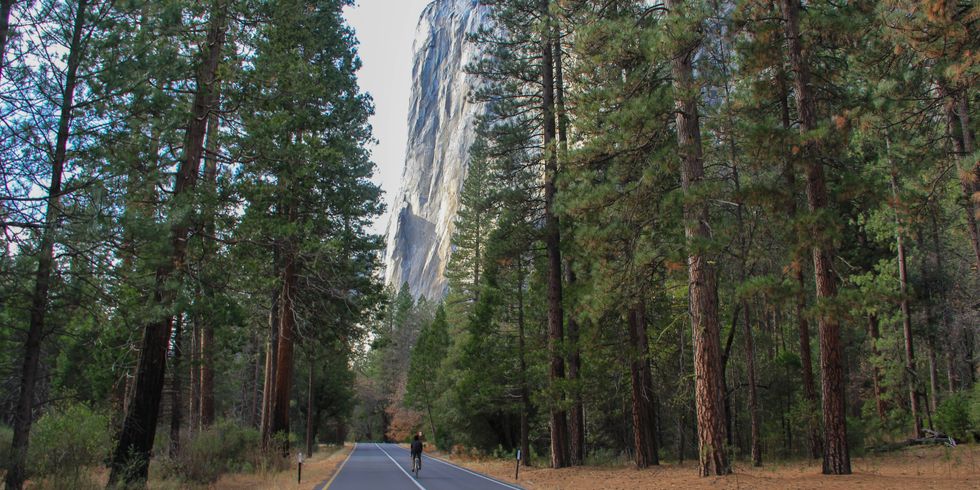 A cyclist enjoys the towering view of El Cap on a Yosemite Valley bike lap(Photo by Aron Bosworth)
Yosemite Vally Bicycle Loop
Exploring Yosemite Valley by bicycle opens a world of possibilities that aren't afforded by car. In addition to having an endless supply of bike parking (you can pull off just about anywhere), you have the open air freedom to take in the scenery while cruising and can stop on a whim to tour an a magnificent meadow, gaze up at granite monoliths, or warm up in front of a fire at the historic Ahwahnee Hotel.
- PROS: Great way to sightsee and cover the valley landmarks. Don't have to deal with parking.
- CONS: Bike path network is limited. Must share roads with cars.
- REGION: Yosemite + Central Sierra, CA
- CONGESTION: Moderate
- PREFERABLE SEASON(S):Spring, Summer, Fall
- DAY-USE/PARKING PASS REQUIRED: National Park Pass
- TOTAL DISTANCE: 20.50 mi (32.99 km)
- TERRAIN DIFFICULTY: GREEN
- TRAILHEAD ELEV.: 4,000 ft (1,219 m)
- NET ELEV. GAIN: 50 ft (15 m)
- TRAIL USES:Hiking, Biking
- TRAIL TYPE: Loop
- DOGS ALLOWED?: No
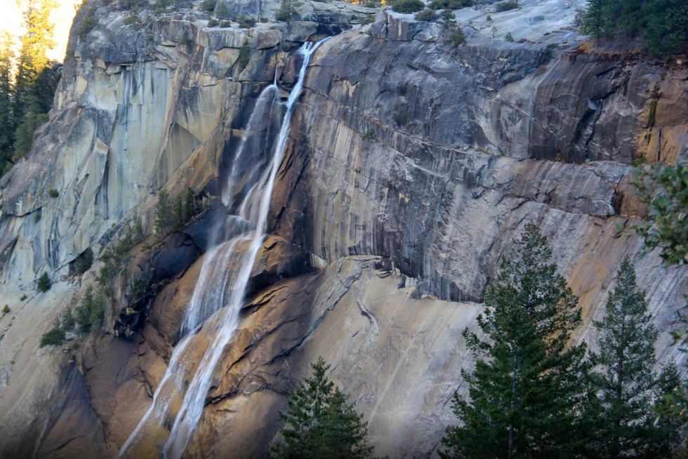 Nevada Falls(Aron Bosworth)
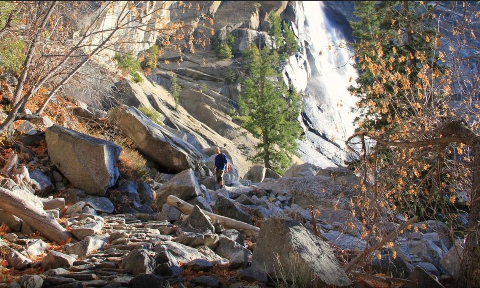
Nevada Falls via Giant Staircase Loop
Upon first viewing Yosemite's Giant Staircase, one can imagine how this section of the Merced River Canyon got its name. The Giant Staircase refers to a pair of immense granite steps that create a 2,000-foot drop between Little Yosemite Valley and the main Yosemite Valley floor. Adding to this dramatic landscape, the Merced River plummets over the ledges and creates two spectacular waterfalls: the lower 317-foot Vernal Fall and upper 594-foot Nevada Fall.
- PROS: Multiple waterfalls. Phenomonal veiws of Yosemite's glacial domes.
- CONS: Lower section of trail can get crowded.
- REGION: Yosemite + Central Sierra, CA
- CONGESTION: Moderate
- PREFERABLE SEASON(S):Spring, Summer, Fall
- DAY-USE/PARKING PASS REQUIRED:National Park Pass
- TOTAL DISTANCE: 6.30 mi (10.14 km)
- TRAILHEAD ELEV.: 4,000 ft (1,219 m)
- NET ELEV. GAIN: 1,090 ft (332 m)
- TRAIL USES:Hiking, HorsebackT
- RAIL TYPE: There-and-back/Loop
- DOGS ALLOWED: No
 An elevated view of Yosemite Valley from Columbia RockPhoto by Tyson Gillard
Columbia Rock Hike
Departing from the north edge of Yosemite Valley, the hike up to Columbia Rock ends at the ideal location to sit, catch your breath, unwind from the day, and take in the impressive views of the valley at sunset.
- PROS: Panoramic views of Yosemite Valley.
- CONS: Arduous and steep switchback trail.
- REGION: Yosemite + Central Sierra, CA
- CONGESTION: High
- PREFERABLE SEASON(S): Winter, Spring, Summer, Fall
- DAY-USE/PARKING PASS REQUIRED: National Park Pass
- TOTAL DISTANCE: 3.00 mi (4.83 km)
- TRAILHEAD ELEV.: 3,967 ft (1,209 m)
- NET ELEV. GAIN: 1,000 ft (305 m)
- TRAIL USES: Hiking
- TRAIL TYPE: There-and-back
- DOGS ALLOWED: No
The Ahwahnee Hotel
The Ahwahnee Hotel (happily no longer called the Majestic Yosemite Hotel) in Yosemite National Park is often called the queen of national park lodges. Named after the Miwok Native Americans that inhabited Yosemite Valley ("Ahwahnee" means place of gaping mouth), the hotel is arguably the grandest representation of America's parkitecture style that is so pervasive among flagship national park structures built in the early 20th century. While the hotel itself is an architectural marvel, it is the combination of the hotel's majestic Yosemite setting and the nature-inspired architecture that set it apart.
- PROS: Impressive lodge architecture. Lodging.
- CONS: Difficult to parking during peak season.
- REGION: Yosemite + Central Sierra, CA
- CONGESTION: High
- PREFERABLE SEASON(S): Winter, Spring, Summer, Fall
- DAY-USE/PARKING PASS REQUIRED: National Park Pass
- POINTS OF INTEREST: Historical landmark, Viewpoint
- DOGS ALLOWED: No
 Fall colors below Yosemite FallsPhoto by Aron Bosworth
Lower Yosemite Falls
Lower Yosemite Falls makes up the final drop of the impressively massive Yosemite Falls, the tallest waterfall in the United States. While the upper portion of the waterfall, Upper Yosemite Falls, receives the majority of attention (understandably so with a drop of 1,430 feet), it's little brother is nothing to scoff at with a 320-foot plummet top to bottom.
- PROS: Easy waterfall access. Impressive view of Half Dome from the base of the waterfall.
- CONS: Crowds.
- REGION: Yosemite + Central Sierra, CA
- CONGESTION: High
- PREFERABLE SEASON(S): Winter, Spring, Summer, Fall
- DAY-USE/PARKING PASS REQUIRED: National Park Pass
- POINTS OF INTEREST: Viewpoint, Old growth forest, Waterfall
- DOGS ALLOWED: No
 (Aron Bosworth)
Mirror Lake Loop
Located in the far eastern corner of Yosemite Valley near the mouth of Tenaya Canyon, Mirror Lake is formed by a shallow lake bed in which the waters of Tenaya Creek flow. The flat loop trail that circumnavigates the lake and continues east into Tenaya Canyon gives visitors an opportunity to explore this quiet and serene corner of the park.
- PROS: Rich in wildlife. Flat hike.
- CONS: None.
- REGION: Yosemite + Central Sierra, CA
- CONGESTION: Moderate
- PREFERABLE SEASON(S):Spring, Summer, Fall
- DAY-USE/PARKING PASS REQUIRED:National Park Pass
- TOTAL DISTANCE: 4.20 mi (6.76 km)
- TRAILHEAD ELEV.: 4,000 ft (1,219 m)
- NET ELEV. GAIN: 100 ft (30 m)
- TRAIL USES:Hiking
- TRAIL TYPE: Loop
- DOGS ALLOWED: No
Upper Pines Campground
Upper Pines Campground is one of two campgrounds located in Yosemite Valley proper that remain open year-round. It is the only winter option that is open to car, trailer, and RV camping; Camp 4 is open through the winter, but it is a walk-in, tent-only campground. Upper Pines consists of 238 sites spread among six loops, all of which sit under a canopy of ponderosa pine and incense cedar. The trees are beautiful, but they do obstruct views of the stunning surrounding granite. The campground is located near to some of the valley's best hiking trails, and it is only a walk away from the Happy Isles Trailhead and access to Vernal Fall and Nevada Fall.
- PROS: Open in winter. Within walking distance to multiple Yosemite trailheads.
- CONS: Campsites are huddled close together.
- REGION: Yosemite + Central Sierra, CA
- CONGESTION: High
- PREFERABLE SEASON(S):Winter, Spring, Summer, Fall
- CAMPING FEE: $20.00
- DAY-USE/PARKING PASS REQUIRED:National Park Pass
- TENT/CAR SITES: 238
- PICNIC TABLES: Yes
- DOGS ALLOWED: Yes
 (Aron Bosworth)
After Six
After Six is a six-pitch 5.7 Yosemite classic that has long been a favorite among the less time-committing group of free climbs in Yosemite Valley. Located on the western end of Manure Pile Buttress, the climb is popular with those looking for one of the easier Yosemite routes (it's a good introduction to Yosemite 5.7 multi-pitch traditional climbing) or for a climb that takes less than a full day's commitment. The route ascends 600 feet up the granite slabs of Manure Pile Buttress in a series of low angle cracks and face sections. Large belay ledges are frequent throughout and offer plenty of spots to break for a snack and enjoy the spectacular Yosemite Valley view.
- PROS: Half-day 5.7 free climb. Easy walk-off descent.
- CONS: Potential for line to form at base on crowded weekends.
- REGION: Yosemite + Central Sierra, CA
- CONGESTION: Moderate
- PREFERABLE SEASON(S):Spring, Summer, Fall
- DAY-USE/PARKING PASS REQUIRED:National Park Pass
- TRAILHEAD ELEV.: 4,000 ft (1,219 m)
- NET ELEV. GAIN: 600 ft (183 m)
- TRAIL TYPE: There-and-back
- DOGS ALLOWED: No
- RECOMMENDED EQUIPMENT:Harness, Rope, Anchors, Other
- MOST TECHNICAL PITCH: Class IV
Tunnel View
Perhaps made most famous by Ansel Adams*, the vantage of Yosemite Valley from Tunnel View is recognizable world round, regardless of whether you have ever stepped foot in Yosemite National Park.
- PROS: Iconic Yosemite Valley viewpoint.
- CONS: Crowds.
- REGION: Yosemite + Central Sierra, CA
- CONGESTION: High
- PREFERABLE SEASON(S):Winter, Spring, Summer, Fall
- DAY-USE/PARKING PASS REQUIRED:National Park Pass
- POINTS OF INTEREST:Viewpoint
- DOGS ALLOWED: Yes
 Hiking below Nevada Falls. (Aron Bosworth)
Taft Point
With less notoriety and fewer visitors than nearby Glacier Point, Taft Point is the other vista precipice that sits on Yosemite's south rim. Rising 3,500 feet above the valley floor, Taft Point is actually 300 feet taller than Glacier Point. The absence of guardrails gives this granite promontory more of a wild and exposed feeling than its counterpart located a couple miles east down Glacier Point Road.
- PROS: Hike along the edge of the south rim. The Fissures. Thrilling vista.
- CONS: Exposure may be problematic for some.
- REGION: Yosemite + Central Sierra, CA
- CONGESTION: Moderate
- PREFERABLE SEASON(S):Summer, Fall
- DAY-USE/PARKING PASS REQUIRED:National Park Pass
- TOTAL DISTANCE: 2.20 mi (3.54 km)
- TRAILHEAD ELEV.: 7,740 ft (2,359 m)
- NET ELEV. GAIN: 230 ft (70 m)
- TRAIL USES:Hiking
- TRAIL TYPE: There-and-back
- DOGS ALLOWED: No
Glacier Point
Chances are you've heard of Glacier Point. It's one of the most photographed vistas and better known viewpoints in the country. President Teddy Roosevelt and John Muir had a famous photograph made from the point on the President's trip to Yosemite in 1903. This trip resulted in Yosemite Valley being incorporated from state control into the National Park system and receiving greater protection.
PROS: One of the best views of Half Dome and eastern Yosemite Valley. Easy access when the road is open. Family friendly.- CONS: Crowds.
- REGION: Yosemite + Central Sierra, CA
- CONGESTION: High
- PREFERABLE SEASON(S):Spring, Summer, Fall
- DAY-USE/PARKING PASS REQUIRED:National Park Pass
- POINTS OF INTEREST:Viewpoint
- DOGS ALLOWED: No
![]() Sentinel Rock reflects in a clear Merced River. (Aron Bosworth)
Sentinel Rock reflects in a clear Merced River. (Aron Bosworth)
Vernal Falls Hike via Mist Trail
The lower of the two steps that make up the Giant Staircase, Vernal Falls via the Mist Trail explores a stretch of the Merced River Canyon as it rises off of the valley floor and up to the top of Vernal Falls. The hike is a nice there-and-back option if you are limited on time or are interested in a warm-up prior to setting out on a higher elevation hike such as Glacier Point via the 4-Mile Trail and Yosemite Falls Trail.
- PROS: Waterfalls. Can be combined with a longer loop hike to Nevada Falls.
- CONS: Lots of people on the lower section of Mist Trail.
- REGION: Yosemite + Central Sierra, CA
- CONGESTION: High
- PREFERABLE SEASON(S):Spring, Summer, Fall
- DAY-USE/PARKING PASS REQUIRED:National Park Pass
- TOTAL DISTANCE: 2.70 mi (4.35 km)
- TRAILHEAD ELEV.: 4,000 ft (1,219 m)
- NET ELEV. GAIN: 1,055 ft (322 m)
- TRAIL USES:Hiking
- TRAIL TYPE: There-and-back
- DOGS ALLOWED: No
Half Dome Hike via John Muir Trail
The Half Dome Hike in Yosemite National Park is easily among the most iconic and challenging in the United States. This hike will test you physically and mentally as you climb the last quarter-mile of trail and ascend the sheer flank of Half Dome using bolted cables. The hike up this Yosemite icon features incredible mountain and valley views, wildflowers, waterfalls, old-growth sequoias, and fascinating glimpses of some of California's most dynamic geological history.
- PROS: Great views. Wildflowers. Waterfalls. Giant sequoias.
- CONS: Big crowds. Afternoon lightening storms in summer.
- REGION: Yosemite + Central Sierra, CA
- CONGESTION: High
- PREFERABLE SEASON(S):Summer, Fall
- DAY-USE/PARKING PASS REQUIRED:National Park Pass
- TOTAL DISTANCE: 16.50 mi (26.55 km)
- TRAILHEAD ELEV.: 4,000 ft (1,219 m)
- NET ELEV. GAIN: 4,836 ft (1,474 m)
- TRAIL USES:Hiking, Horseback
- TRAIL TYPE: There-and-back
- DOGS ALLOWED: No