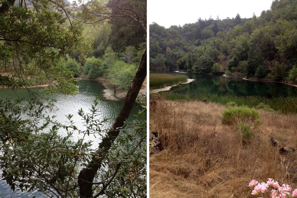
Tucked beneath a towering peak, Phoenix Lake is the smallest jewel in a necklace of reservoirs that surround the leeward side of Mt. Tamalpais and serves as a great introduction to the network of hiking trails that crisscross the Marin Municipal Water District’s 147-square-mile watershed.
What You’ll See
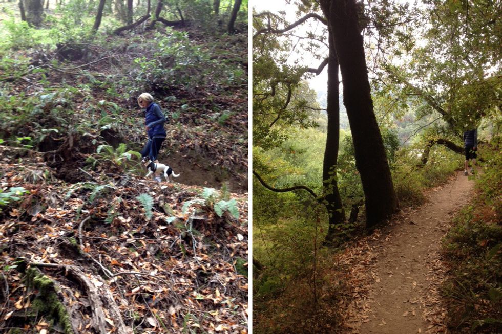
A hike on the delightful perimeter trail offers rewarding views, hidden fern grottoes, and shady oaks and laurels set above a serene and inviting body of water. Dogs on leash are permitted, as well as bikes (fire roads only) and horses (check individual roads and trails).
How to Get There
Due to its central location and easy access, it’s one of the most popular hiking spots in Marin, so an early arrival may secure a parking spot in the small lot located at the base of the dam.
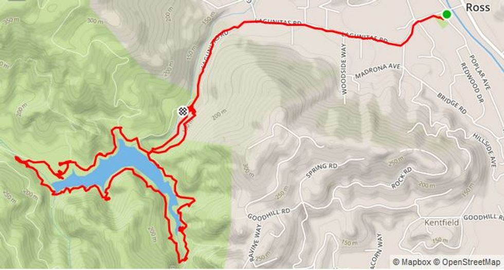
The lake is located in the posh community of Ross in Marin County.
1. Take Sir Francis Drake Blvd. west from Hwy. 101 for 2.5 miles.
2. After passing the College of Marin, turn left onto Lagunitas Rd. at the stoplight.
3. Proceed 1.1 miles to the end of the road, entering the Natalie Coffin Park (also known as Phoenix Lake Park).
As parking on Lagunitas Rd. (past Shady Ln.) is limited or prohibited, an alternative is to park at Ross Town Center (the green dot on the map below) and walk from there, extending this hike to 5.8 miles.
Transit options are via Marin Transit and Golden Gate Transit.
The Hike
This hike begins at the gate across the road from the parking area at the trailhead.
- Start by heading up the road to the dam itself. Restrooms are available here along with an impressive view of Mt. Tam.
- Go straight on the fire road. As it curves around to the right, there’s a water fountain next to the horse watering trough.
- Keep the lake on your left as you continue on the fire road. Note the floating platform in the middle of the lake - it’s usually occupied by turtles, ducks, grebes, or an occasional heron.
- As the road moves away from the lake, look for a trail down to the left that leads to a bridge across the creek. Cross the bridge and go left on the Gertrude-Ord trail. If you get to a junction of fire roads you’ve gone to far.
- Continue on this delightful trail, with vignette views appearing through the trees.
- After 1.1 miles, you’ll encounter some steps down to the creek below. Turn left and proceed back to the dam on the fire road.
- At the dam, look for a trail on your right that leads down to the picnic and parking areas.
Where to Eat
Packing a picnic lunch is an ideal way to enjoy the tranquility of the surroundings. At the base of the dam there are a number of picnic tables, atop the dam there are a few benches, all with a spectacular views.
There are a couple of restaurants in Ross as well as a deli/grocer across the street from the school and park. The nearby town of San Anselmo has numerous lunch and dinner possibilities. To get there, turn onto Shady Ln. from Lagunitas Rd. (at St. John’s church) for the scenic route. At the end of Shady Ln. make a right on Bolinas Ave. then a left at the stoplight onto San Anselmo Ave. to get to the downtown.
Our favorites here are Taqueria Mi Pueblo or Taco Janes (outdoor seating), Baan Thai is the Asian choice, Comforts for salads, or Insalata if you want something fancy.
Other Things to Do
Downtown San Anselmo has a great feel to it, with its curving main street. Be sure to check out Imagination Park, donated by longtime resident George Lucas, featuring statues of his iconic characters Yoda and Indiana Jones. Check out a map of MMWD’s extensive trail system.