
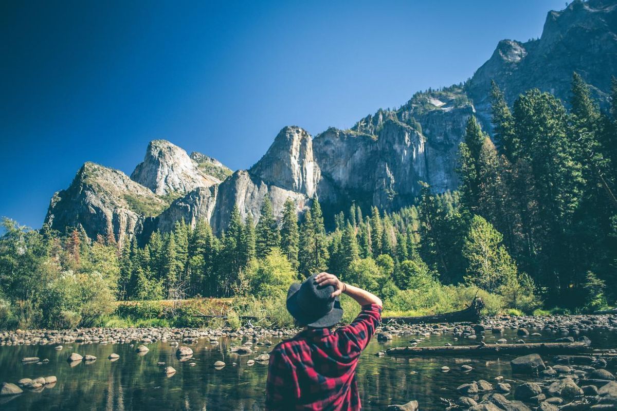
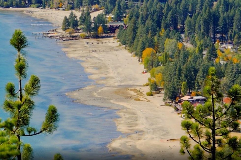
With its strong Sierra sun, enticing shoreline, and stunning natural beauty, Lake Tahoe is the perfect (and conveniently close) locale for a summer mountain getaway.
Whether you're looking for a picturesque beach from which to take a swim or paddle, a secluded cove, or even a panoramic trail that's sure to get the heart rate going, Lake Tahoe has you covered this summer.
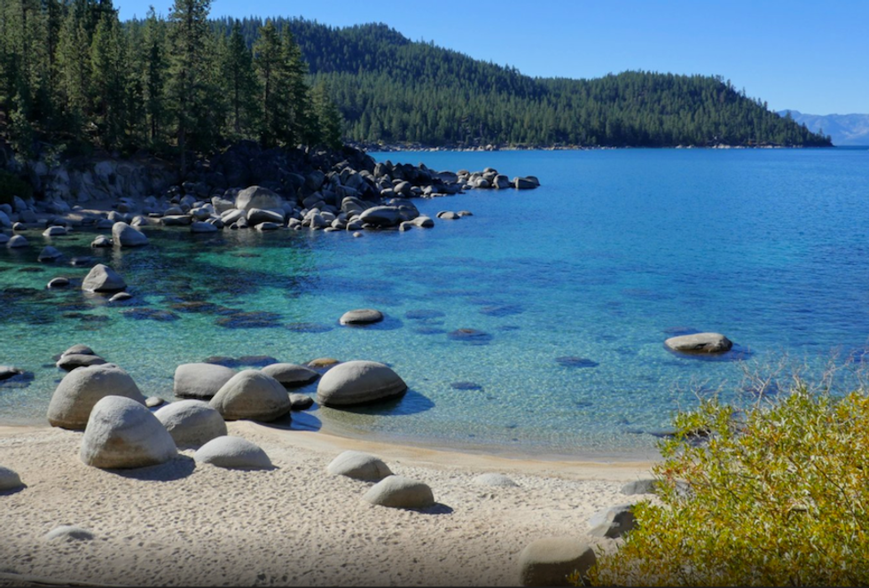
D.L. Bliss State Park
Lying just north of and contiguous with Emerald Bay State Park, D.L. Bliss State Park is a destination highlight along Lake Tahoe's southwestern shoreline. Together the two state parks boast more than 6 miles of shoreline. Named after Duane Leroy Bliss, a timber and mining tycoon of the 19th century who donated much of the land that now makes up the park, D.L. Bliss welcomes campers, beachgoers, and hikers to this scenic stretch of Tahoe shoreline.
Typically open from May through September, D.L. Bliss caters to summer visitors with the beaches and clear waters of Calawee Cove and Lester Beach. With easy access form both the campground and day use parking area, both beaches are well suited for families and for the launching of personal water craft. Read more.
Emerald Bay State Park
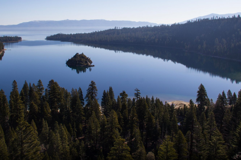
Aron Bosworth
Emerald Bay and its namesake state park are without question some of the gems of Lake Tahoe. Tucked into the southwest corner of the lake, the long bay opens up inside the narrow mouth at Emerald and Eagle Points, and its shimmering emerald green to azure blue waters beckon boaters, swimmers and hikers to explore its shoreline.
Adding to the natural beauty, Emerald Bay is surrounded by glacially carved granite peaks that rise steeply from the water's edge. Emerald Bay State Park is well known as the home of Vikingsholm, an impressive historic Scandinavian mansion turned museum, and the bay contains the only real island found in Lake Tahoe's waters. While Emerald Bay is accessible from May through September, you'll have to work just a bit to access park amenities. Most visitors walk a mile-long trail down to the main beach area at Vikingsholm or boat-in from elsewhere on the lake. Read more.
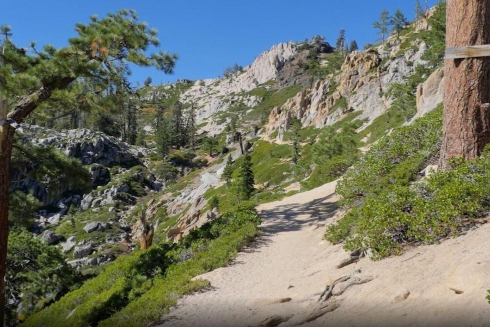
Rubicon Trail
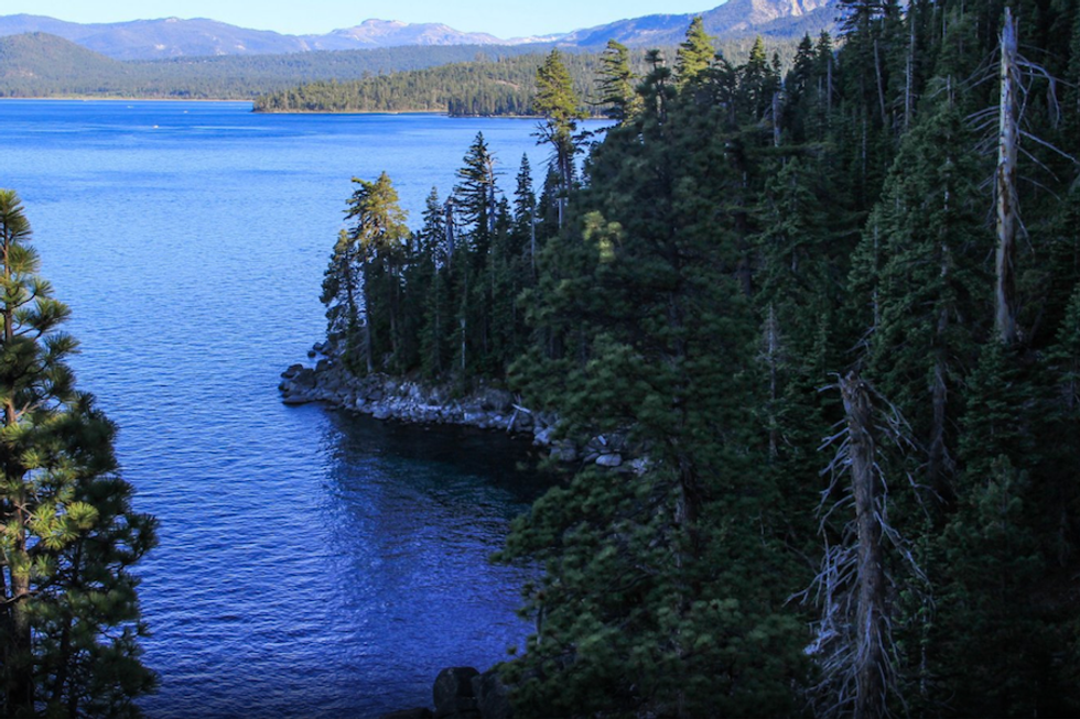
Aron Bosworth
If you have a free day in Tahoe or are just looking for a fantastic summer hike we highly recommend checking out the Rubicon Trail on Tahoe's southwest shore. Not to be confused with the 22-mile long, four-wheel drive route west of the lake, this lakeside foot trail is 6.5 miles long and connects two of Tahoe's premier state parks, D.L. Bliss and Emerald Bay. Most people set out do the section between Rubicon Point and Vikingsholm (4.6 miles one way), but the full length of the trail extends from Rubicon Point south around Emerald Bay to Eagle Point Campground.
This lake-oriented, moderately level trail offers an intimate look at Tahoe's blue waters from elevated vantages that hug rocky precipices and lakeside sections near the water's edge. Add in the D.L. Bliss State Park and Emerald Bay attractions of Rubicon Point, Vikingsholm, and state park beaches, and you've got one of Tahoe's premier hikes with a fantastic itinerary in store. Read more.
Mount Tallac Summer Trail
Aron Bosworth
Most who have visited Lake Tahoe have heard of Mount Tallac, or at the very least, have laid their eyes on it. Rising above the southwest shore of the lake, Mount Tallac is part of Desolation Wilderness and the tallest mountain on the lake's immediate shoreline. At 9,738 feet, the mountain stands as a commanding landmark, and it is a continual draw for hikers in the summer and backcountry skiers in the winter.
During the summer and shoulder season months, the Mount Tallac Summer Trail offers a reasonably direct and quick trail route up the mountain. Just shy of 5 miles, the trail meanders past lakes and through forests, climbing bowls and ridges to gain the summit nearly 3,300 feet above the trailhead. The 10-mile round trip takes most hikers around six hours, including time to soak in the panorama on the summit. Read more.
Eagle Lake
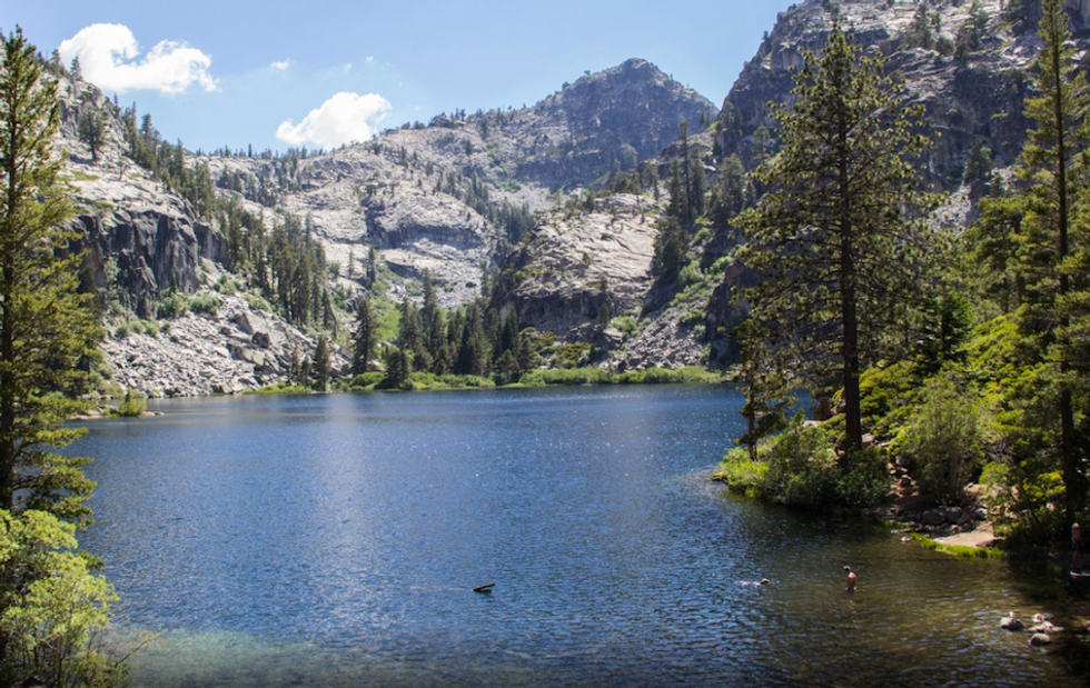
Aron Bosworth
Lying in a rugged glacial basin a short hike beyond the Eagle Falls Trailhead, Eagle Lake is a family-friendly destination for soaking the scenic alpine setting that rises above Emerald Bay. Just a mile in from the trailhead, the Eagle Lake Trail rises gradually as it follows the Eagle Creek drainage. The mile-long hike is a good option for families with kids or for those looking for a summer swim in the mountains. Read more.
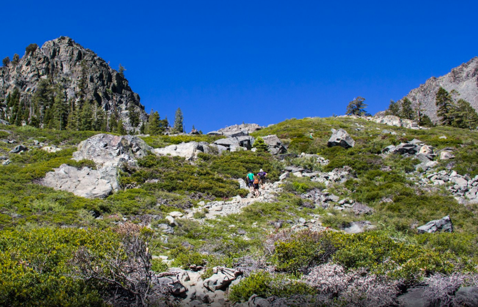
Five Lakes Trail
Brandon Katcher
The Granite Chief Wilderness Area is a 25,000-acre section of the Tahoe National Forest. Established in 1984, the park includes glaciated valleys, exposed granite formations, and 9,000-foot peaks. One of the most beautiful and thrilling hikes in the wilderness area is the 4.8-mile Five Lakes Trail. Few other trails in Tahoe exhibit the secluded charm of this location without an overnight camp in the middle.
The Five Lakes Trailhead is located right off the main Alpine Meadows road. Park across the street and prepare yourself for a strenuous climb of 1,200 feet in a little less than 2 miles. Along the way you will be presented with views of Alpine Meadows and the surrounding mountains. Take note of a phantom chairlift, which is rumored to be a future connection between Alpine and Squaw Valley. Once you have reached the Granite Chief Wilderness sign, your climb is finished. Read more.
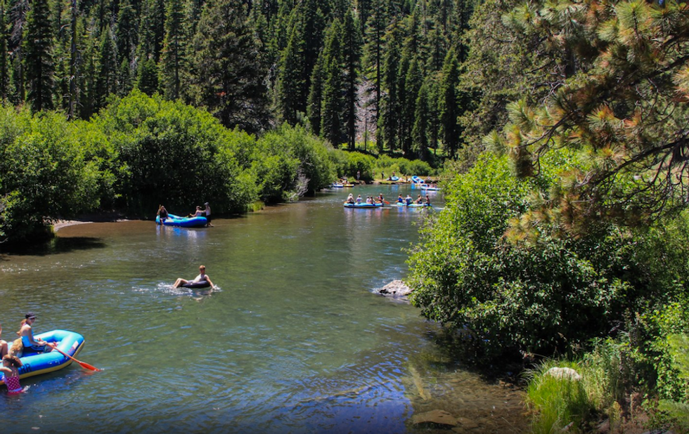
Truckee River Float
Aron Bosworth
Naturally, summertime in Tahoe draws attention toward the water. While Lake Tahoe itself is the star attraction, those in search of a fun, social water activity can take a float down the Truckee River. Floating the Truckee offers a relaxing way to cool off when the Sierra summer sun is at its peak. Floaters can bring their own equipment or hire a raft (self-guided) from one of two outfitters.
Flowing out of the northwest corner of the lake at Tahoe City, the Truckee runs north through a forested river canyon. The first 5 miles of the river, the float stretch, are calm with the occasional light rapid to break up the flat water. The float takes between 2-3 hours, passing through meadows and opening to occasional mountain views. The river parallels Highway 89, which sees a fair amount of summer traffic, but with attention focused on enjoying the river and cooling off, you'll hardly even notice. A shallow river bottom and plenty of accessible banks afford the opportunity to stop and soak up the setting along the way. The take-out is located at River Ranch Inn, near the entrance to Alpine Meadows. Read more.
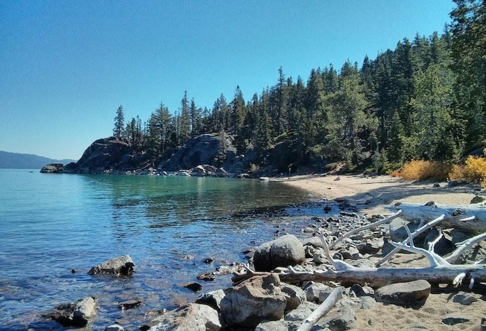
Secret Cove + Chimney Beach Loop
Brandon Katcher
Lake Tahoe has many beautiful coves and beaches surrounding its stunning blue waters. However, this particular location stands apart, providing a picturesque boulder-laden cove and spectacular views. Secret Cove, while not the out-of-the-way, locals-only scene that it once was, is still a spot that doesn't receive the crowds of nearby beaches. The retreat has a group of devoted regulars who have made a point of keeping the cove pristine by adopting a set of rules and even appointing a "mayor." Be aware that the beach is clothing optional.
This 2.6-mile hike begins at the Chimney Beach Overlook parking lot. For about three-quarters of a mile you will follow a fire road that parallels the main road. Once you reach the newly constructed bathrooms and a sign for Secret Cove, turn right and follow the path downhill until you reach the cove. Once you reach the beach, you will probably want to take photos, but please be respectful of anyone taking advantage of the clothing optional rule. Read more.
Stateline Fire Lookout
Brandon Katcher
You will be hard-pressed to find a nicer view in all of Lake Tahoe, particularly one that does not require a lengthy hike. Overlooking Crystal Bay, high above the casinos, resorts, and the California-Nevada state line, the Stateline Fire Lookout is one of the best lake views along the north shore. With informational plaques provided along the way, The Stateline Fire Lookout is both beautiful and educational.
To reach the lookout park near the blocked fire road at the end of Lookout Road. Park along the wall, making sure not to block the gate. The lookout is half a mile walk up the mostly-paved road. Informational signs along the path impart knowledge on the area and Lake Tahoe in general. Once you reach the end of the road, you can continue onto the rock lookout for a fantastic vista, including the majority of the lake, Kings Beach and the ski resorts in the distance. Make sure to bring your camera! Read more.
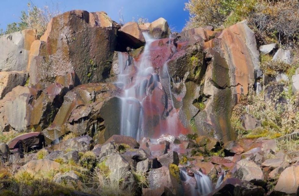
Tamarack Peak Loop
Brandon Katcher
Tamarack Peak may not look too exciting considering its proximity to taller peaks in the area, including Mount Rose and Relay Peak, but this 6-mile loop that encircles the peak is one of the most spectacular hikes in the area. With less than 500 feet of elevation gain throughout the hike, you can rush through the round-trip in two or three hours. However, a slower pace is rewarded with incredible views of both Lake Tahoe, western Nevada, and a magnificent waterfall at the halfway point. Read more.