


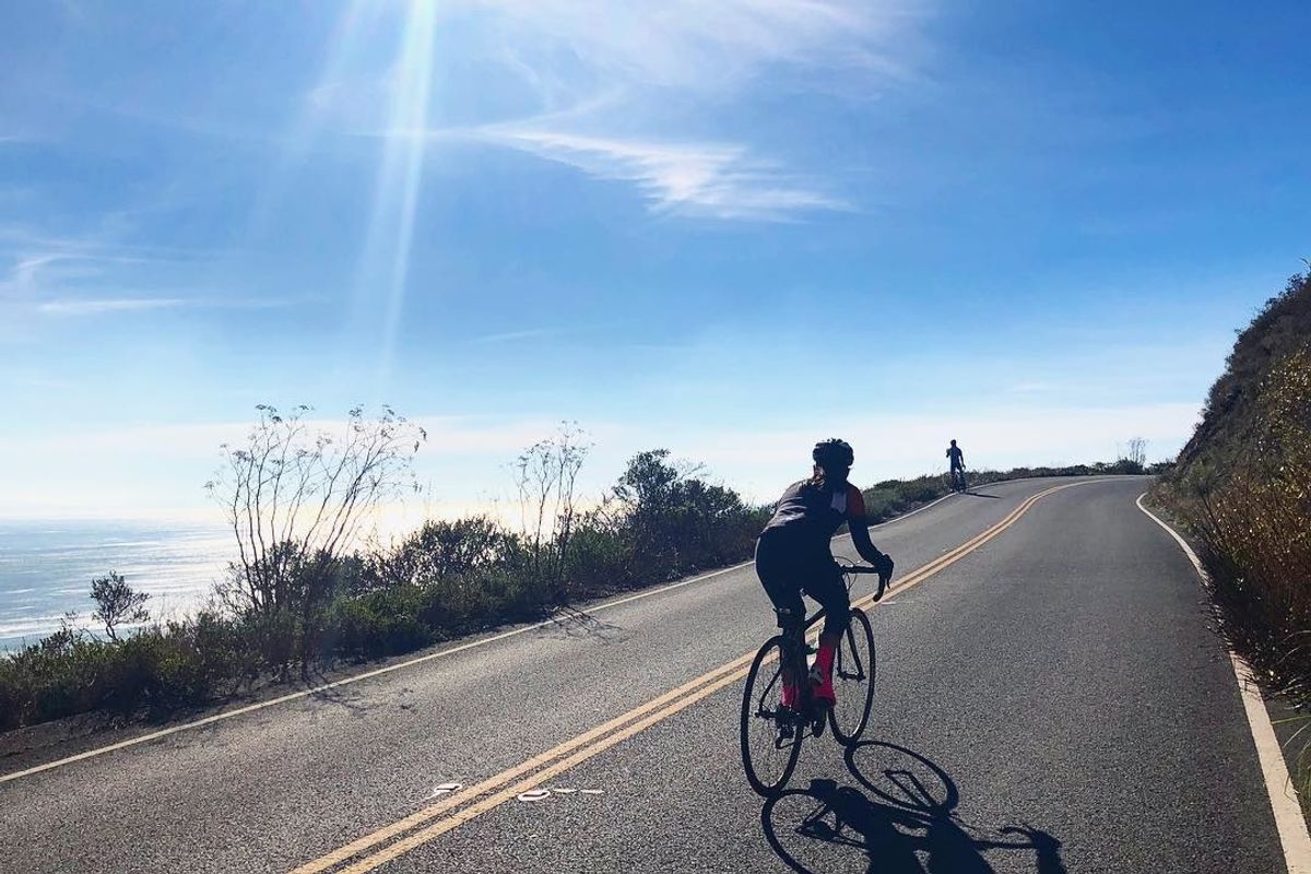
Tired of glancing at the same old span of asphalt on your usual weekday or weekend rides?
Ready your roof racks: Here are five of our favorite coastal trails that promise respite from the hustle and bustle of urban cycling.
Bay Bridge Trail, 4.4 miles
For cyclists seeking convenience along with coastal scenery, the recently opened 4.4 mile (round trip) Bay Bridge Trail allows bike aficionados to travel from Oakland to Yerba Buena Island sans ferry ride—and the views of the San Francisco Bay can't be beat. With three accessible access points in Emeryville—including a weekend public shuttle leaving from Treasure Island—it's just a hop, skip, and jump away for the vast majority of Bay Areans. // Get more details at baybridgeinfo.org.
Angel Island Loop, 5 miles
Beginners and chillax day trippers will relish the five miles of paved road that loops around Angel island—this is, by far, one of the more leisurely coastal trails you'll find in the Bay Area. When you disembark from the Angel Island Ferry, head toward the grassy picnic area and take a right. The road will split into the loop, and all you need to is decide: left or right. // Get more details at angelisland.org.
Half Moon Bay Coastal Trail, 10 miles
Beginning at Half Moon Bay State Beach, this moderately level 10-mile roundtrip ride combs through the celebrated sandy outcrops that hug nearly all the state park's trailheads. Upon setting off, ride north on the Coastal Trail all the way to Pillar Point Harbor, where you'll see one trailhead veer off to Surfer's Beach; feel obliged to wander a bit, should you want to lengthen your ride. Eventually, however, after some spirited cycling on Coast Trail, you'll arrive at beach access points along Pillar Point Harbor, where big views of the ocean on one side and the Montara Mountain Ridge on the other are just begging for an Instagram opp. // Get more details at traillink.com.
Tennessee Valley and Muir Beach Singletrack, 21 miles
Paradise Loop, 38 miles
Appropriately nicknamed Paradise Loop, this 38-mile round trip route meshes together a pleasant mix of secluded nature and urban civility, letting cyclists glide through much of downtown Tiburon before later finding themselves at Richardson Bay overlooking the Marin Headlands. Intermediate athletes can opt for the steep hill climb on Conzelman Road and eventually end up the at the foot of Point Bonita Lighthouse. Not too giddy about a 40-mile loop? Stay straight on San Rafael Boulevard to merge onto Tiburon Road—this will cut five or six miles of calf-straining climbs from your cycling odyssey. // Get more details at bayarearides.com.


