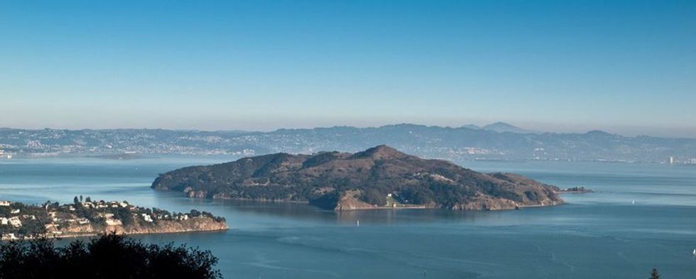
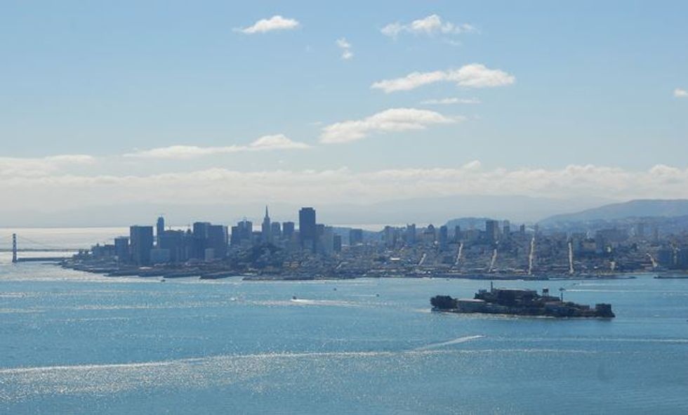
The top of Angel Island’s Mt. Livermore provides one of the Bay Area’s most spectacular and least crowded viewpoints. The only access to this centrally located vista rising 788 feet above San Francisco Bay is by ferry and foot, ensuring that only those willing to make the effort get to enjoy it.
Angel Island State Park is probably the most visible and least visited of all the major parks in the region, but it’s well worth reserving a day to make the trip. In addition to the aforementioned hike to the summit, there are numerous other reasons to explore this historic place.
A complete roundup of all the interesting things to do and see on Angel Island can be found on the California State Parks page, but suffice to say there is a lot of history here. Long a gathering place for the first inhabitants, the Coastal Miwok, it was first used by Spanish explorers as a safe refuge and supply depot for the galleons plying the trade routes to Manila. Later the Russians used the island as a base while hunting sea otters. In 1910 the island was the site of the Immigration Station that processed thousands of Chinese immigrants to the United States; by 1940 the US military had taken over the island to house German and Japanese prisoners of war. The early 1950’s saw the Cold War necessitating the placement of a Nike missile base on the southern end of the island. Ayala Cove became the first part of the island to be used as a state park.
How to Get There
There’s only one way, and that’s by boat, and other than sailing over on your own the best bet is take a commercial ferry. From San Francisco, Oakland and Alameda use the Blue & Gold Ferry Service, from Tiburon use the Tiburon/Angel Island Ferry Service and from Vallejo use San Francisco Bay Ferry.
Getting Around on the Island
There are many ways to access the various places of interest on the island – hike, bike or during summer and busy weekends there is an island tram that circles the island on the lower perimeter road (5.1 miles). The upper, unpaved, perimeter road is also accessible to bikes. We described biking Angel Island in a previous article.
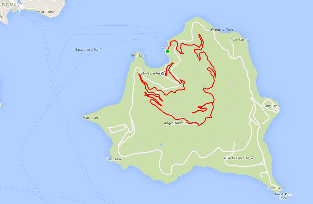
The Hike Up Mt. Livermore
The route described makes a clockwise loop up from Ayala Cove.
- On exiting the ferry walk left, then start to climb up on the North Ridge trail to the Perimeter Rd. (.1 mile),
- Continue climbing up the North Ridge Trail. At .8 miles you’ll cross the Sunset Fire Rd. (upper perimeter road.
- Keep going up, and at 1.7 miles you’ll intersect with the Ida Trail.
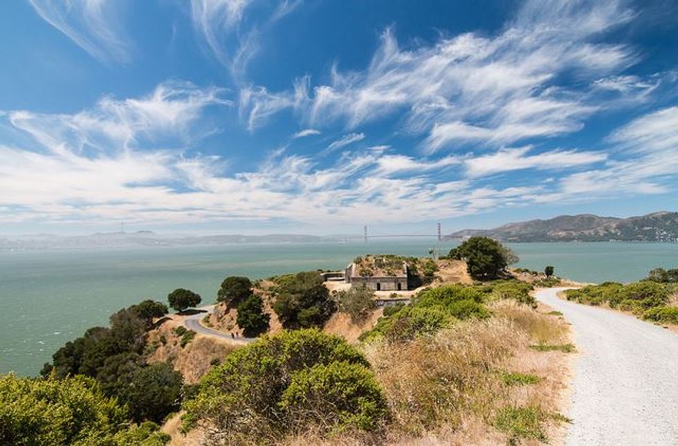
- The summit is another .3 miles up. It’s hard to spend less than five minutes up here, as there is so much to see. The summit was restored a few years ago to its original profile, having been flattened by Army to provide a facility to support the missile launching emplacement.
- Return via the Ida Trail. After one tenth of a mile later turn right on the Sunset Trail Fire Rd. as it loops back via the southern slopes.
- At about the 3.3 mile mark the trail starts a zig-zag down to a paved road that returns to Ayala Cove, so your options are many here, but the most scenic is to meander above the cove towards Point Lone.
- This route covers five miles and some 900 feet of elevation gain and loss.
Other Things to Do
In Ayala Cove there is a café as well as an interesting visitor center for information on Angel island’s history. As mentioned there are many historical spots around the island, such as the immigration station at the north end, sprawling Fort McDowell on the east side, the Nike missile site, numerous gun batteries on the southern side and Camp Reynolds, dating back to the civil war. If you took the ferry over from Tiburon, there are many restaurants just steps away from the dock there. You can download a PDF map and brochure from California State Parks here. Those interested in cycling around the island should check out 7x7.com's Ultimate Sunday Ride: Angel Island.