A great hike doesn’t have to be a hard hike. Sometimes a mellow trail in a nature-rich environment is all you need to recharge.
On this list, you won’t find any steep climbs or large hills, just five easy(ish) hikes that promise more pleasure than pain.
Bayview and Meadowlark Trail (4.9-mile loop)
(Courtesy of @grow.from.it)
For a nice mid-length trail that has pretty views across the bay, check out the Bayview and Meadowlark loop in Fremont’s Coyote Hills Regional Park. The mostly flat, partially paved route is a favorite stopover for birds at the edge of the Don Edwards SF Bay National Wildlife Refuge, and runs along the water and through the gently rolling grasslands where they rest up. Pick up the Bayview Trail from the main parking lot. Parking is $5/vehicle (if you want to bring your furry friends, you’ll have to pay $2 per dog) but note that weekends can get busy and, when there are no more spaces available, they’ll temporarily close the lot. If you’re up for adding another (flat) mile or so to your hike, you can park for free outside the gates. // 8000 Patterson Ranch Rd. (Fremont), ebparks.org
Elevation Gain: 282 feet
Presidio Promenade Trail (4.2-mile loop)
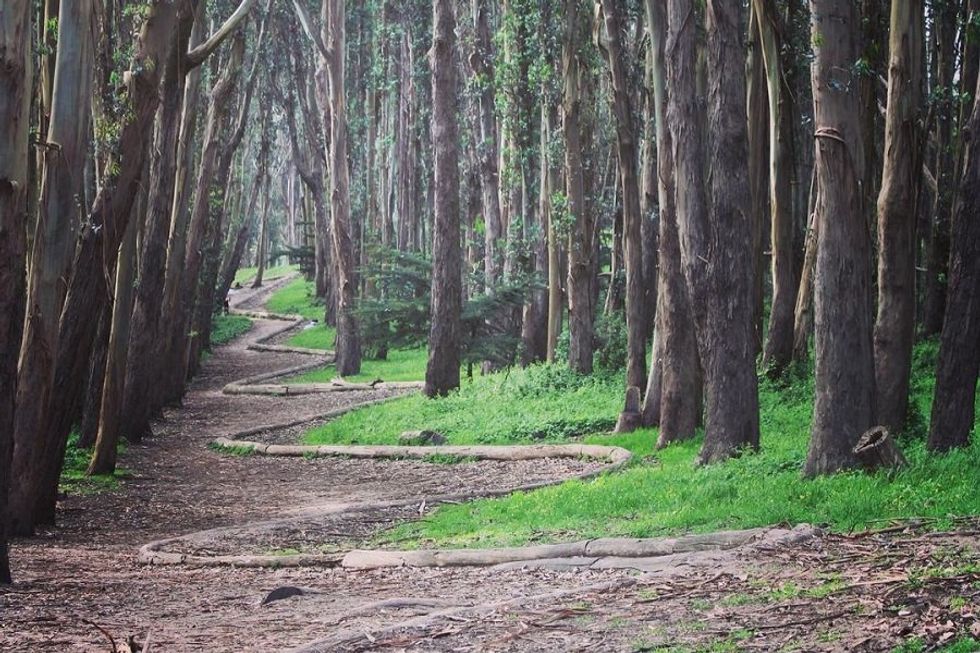
(Courtesy of @megan_cheek)
San Francisco’s Presidio Promenade Trail is a tour of the park’s greatest hits. In just over four miles, you’ll stroll up Lover’s Lane past Andy Goldsworthy’s dramatic "Woodline", take in the views at Inspiration Point, pass by the National Cemetery and Korean War Memorial, check out a second Goldsworthy work ("Spire"; and if the Presidio Officer’s Club is open when you pass by, there’s a third Goldsworthy treat inside), and end by communing with Yoda in fountain form. Park in the lots near the intersection of Ruger and Lombard Streets, then pick up the trail where Simonds Loop meets Ruger. You’ll hit a couple of small hills along the way, but the vast majority of the trail is smooth sailing across varied types of terrain. // San Francisco Presidio, presidio.gov
Elevation Gain: 410 feet
Tennessee Valley Trail (3.6 miles out-and-back)
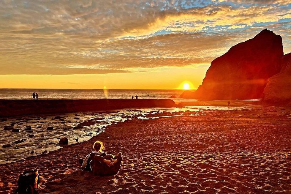
(Courtesy of @parkerhunt)
If you play the Marin Headlands right, you can hike the iconic coastal landscape without ever climbing a single serious hill. On the Tennessee Valley Trail, it’s a virtually straight, 1.8-mile shot to beautiful Tennessee Beach, an irresistible spot for picnicking and other warm weather shenanigans. Pick up the trail from the parking lot on Tennessee Valley Road down the hill from the Miwok Livery Stables. // 591 Tennessee Valley Rd. (Mill Valley), nps.gov/goga
Elevation Gain: 180 feet
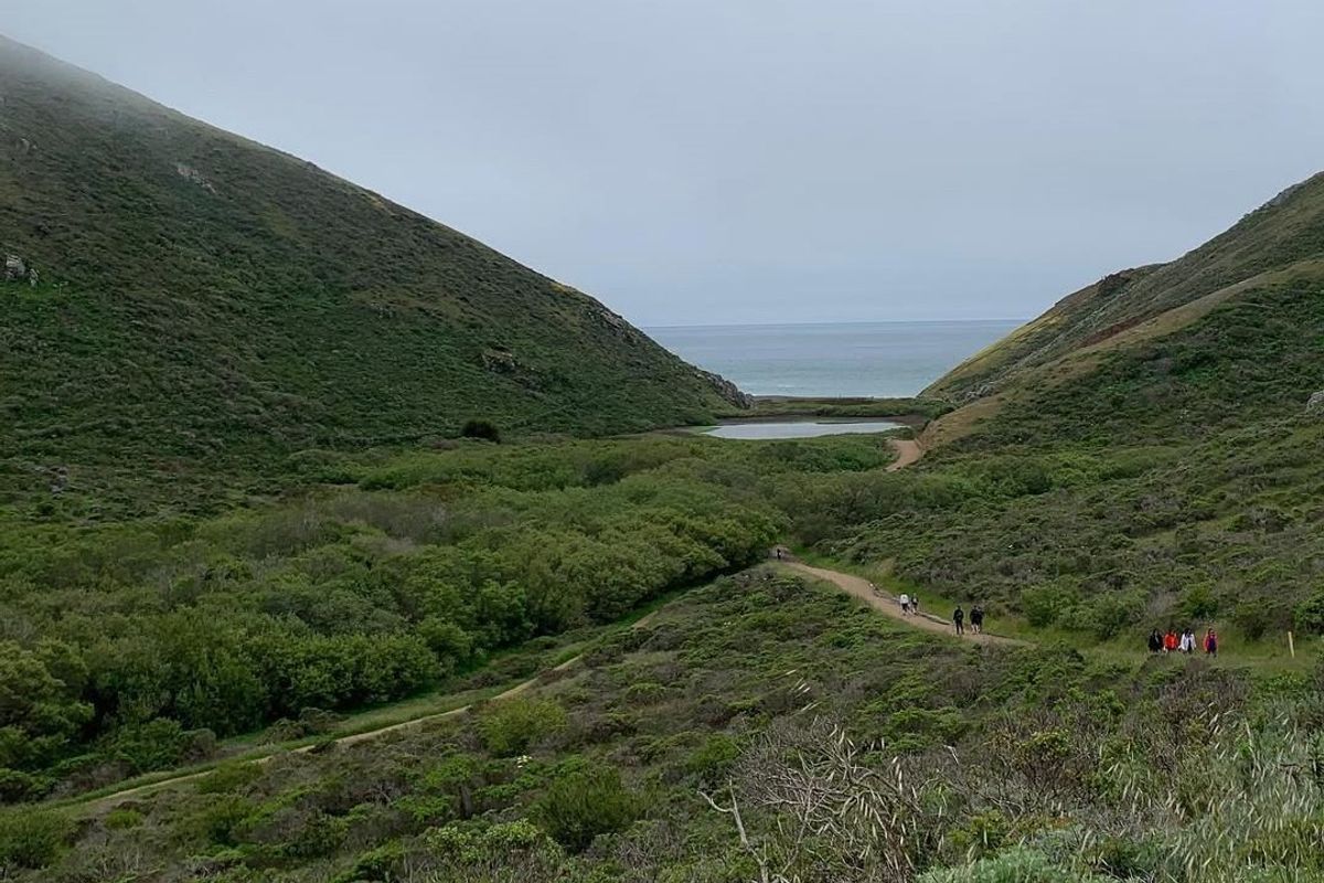
Muddy Hollow Trail to Limantour Spit (6 miles out-and-back)
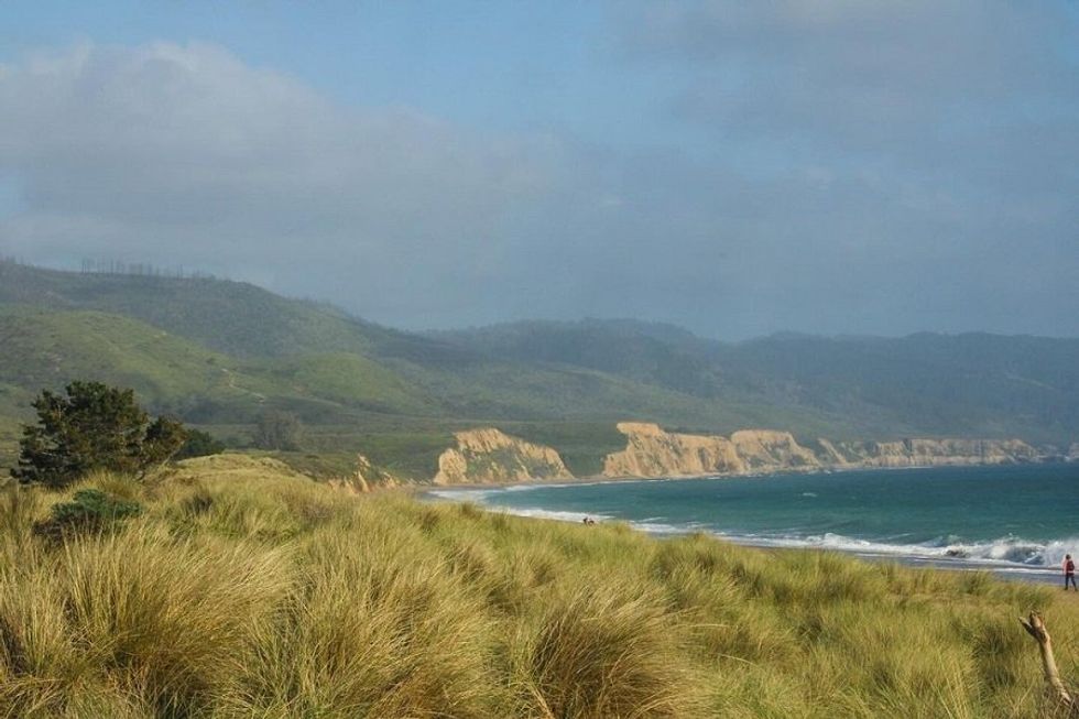
(Courtesy of @the_worldenphotos)
On this six mile trail, there’s plenty of time to catch sight of the wildlife that call Point Reyes National Seashore home. The typically quiet, out-and-back route passes through a lush riparian corridor frequented by Tule elk, over the ridge of Limantour Spit, and out to Limantour Beach where birds flock in the marshes, elephant seals wallow in the sand, and harbor seals play beyond the breakers. Park at the Muddy Hollow Trailhead parking lot, then follow the path to Estero and turn right at Limantour Spit, a distance of about three miles. // Muddy Hollow Rd. (Inverness), nps.gov/goga
Elevation Gain: 203 feet
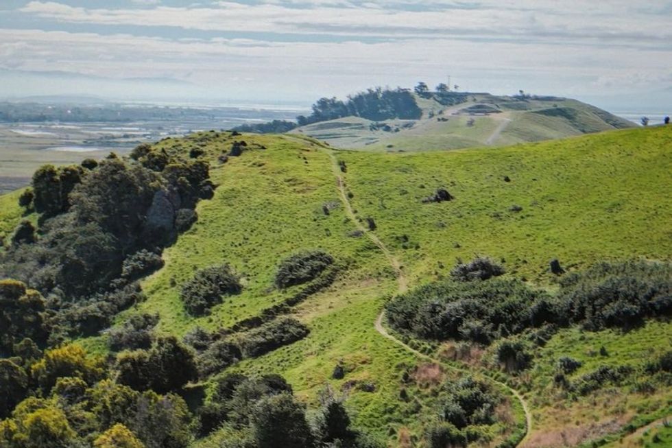
Sunset, Sequoia Bay View, and Chaparral Trail (3-mile loop)
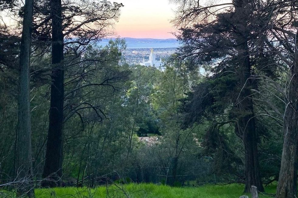
(Courtesy of @ardilaarieldaytrader)
As the name of one of its trails suggests, this popular lollipop loop in Joaquin Miller Park is a great way to catch the sunset as it goes down over the bay. The most challenging of our mellow hikes, there is a small hill to climb at the beginning and one downhill section along the Chaparral Trail that is steep and rocky, but don’t stress. Take it slow, and it’ll be over quickly; the vast majority of the trail is pretty flat. From the main parking lot, walk up Sanborn Drive then turn right at the Sunset trailhead to pick up the loop. // 3300 Joaquin Miller Rd. (Oakland), oaklandca.gov
Elevation Gain: 423 feet