Black Friday is the spectre of Thanksgiving, a day devoted to spending money that starts within mere hours of one dedicated to gratitude.
But it doesn’t have to be.
This year, instead of joining the frenzy of American capitalism on November 28th, do something for yourself instead: get outside. These five Bay Area hikes will help remind you what the holidays are really all about (hint: it’s not shopping).
And if you just can't skip the tradition, shop local! Our Holiday Gift Guide has plenty of ideas from Bay Area brands and shops for everyone on your list.
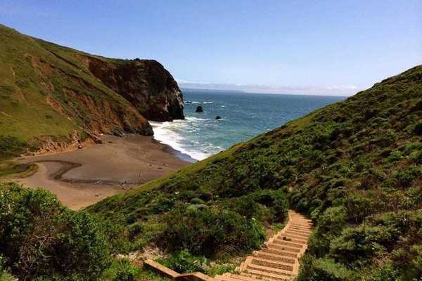
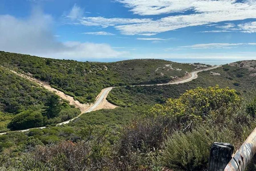 Sweeney Ridge in the GGNRA(Courtesy of @lunalynchart)
Sweeney Ridge Trail, Golden Gate National Recreation Area (5 to 6 miles out-and-back)
History was made on what is today the Sweeney Ridge Trail in the southern section of the Golden Gate National Recreation Area. The first, a stone monument commemorating the location where the 60-man expedition led by Captain Gaspar de Portola first sighted the San Francisco Bay in 1769, is easy to miss. The second, Nike Missile Site SF-51, a Cold War–era battery now abandoned and covered in graffiti, is a little more obvious. To see them both, you can either start from the Skyline College parking lot and hike the Notch Trail south to the Sweeney Ridge Trail or start at the parking lot at Shelldance Nursery, taking the Mori Ridge Trail to the Sweeney Ridge Trail. Both are easy-to-follow and around five to six miles long, out-and-back. // 3660 Sneath Ln (San Bruno), nps.gov
Engelsmans Loop Trail, Wilder Ranch State Park (4-mile loop)
Wilder Ranch State Park in Santa Cruz celebrates its early 20th century ranch and dairy history on the reg, but it's only on the trail that you'll find evidence of the area's once important role in the lime manufacturing industry. Lime kilns operated here from around 1858 to 1909, and remains of the structures are still visible near the trails on the eastern side of the park. From the parking area, head up the right (east) side of the Engelsmans Loop trail. At the junction of Engelsmans and the Long Meadow Trail, a short, unmarked trail will lead you to the historic ruins. When you're done snooping around, take a second detour onto Old Cabin Trail near the junction to see the remains of several old logging cabins. Backtrack to the junction and then return south on the Engelsmans Loop Trail towards the coast to complete the approximately four-mile hike. // 1401 Coast Rd (Santa Cruz), parks.ca.gov
Meadowlark Trail to Woodland Star Trail, Enid Pearson-Arastradero Preserve (4-mile loop)
This four-mile hike, which starts and ends at Rossotti’s Alpine Inn, a Gold Rush–era saloon in Woodside, is all the better for the pizza and beer that awaits you at the end. Park in the Alpine's massive dirt lot, then walk back past the entrance on Alpine Road and turn right on Arastradero Road. Go another couple hundred feet to turn right on John Marthens Lane then walk up it about a quarter mile until you reach the Meadowlark Trailhead. Follow the Meadowlark Trail to the Acorn Trail, where the Meadowlark disappears briefly before reappearing on your left. Pick the Meadowlark back up and continue until reaching the Juan Bautista de Anza Trail. Turn left here and follow it until you find the Woodland Star Trail. From here it's just a little over a half mile back to the Meadowlark Trailhead and the road to lunch. // 3915 Alpine Rd. (Portola Valley), alltrails.com
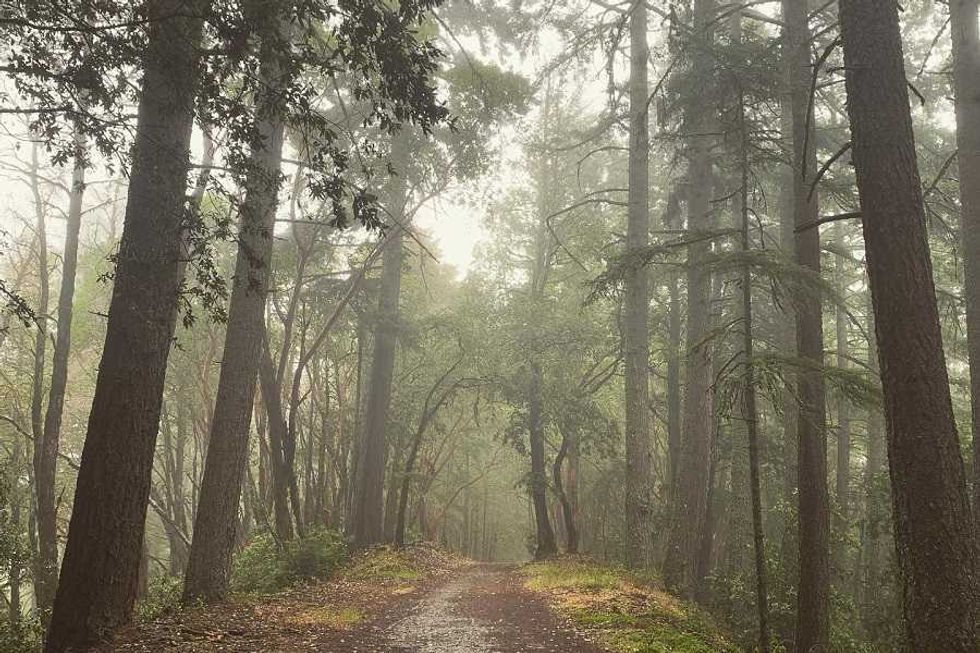 El Corte de Madera Creek Preserve(Courtesy of @delairious)
Resolution Trail, El Corte de Madera Creek Preserve (5.4-mile loop)
In 1953, a plane went down in the Santa Cruz Mountains. The most deadly aviation accident in the country’s history at the time, 20 years later the crash site was enveloped in a new 3,000-acre park, El Corte de Madera Creek Preserve. Named for the fated flight, the Resolution Trail careens for 5.4 miles through foothills shaded in evergreen and redwood. Start the clockwise loop at the Fir Trailhead near the Skeggs Point Parking Area. I won’t tell you exactly what’s there but you’ll find it between miles one and two. You’re not supposed to leave the trail and you definitely shouldn’t touch anything but a good, long look won’t hurt. // 15463 CA-35 (Redwood City), alltrails.com
Belgum to San Pablo Ridge to Wildcat Canyon, Wildcat Canyon (9.1-mile loop)
This pretty 9.1-mile loop through Wildcat Canyon Regional Park has several things going for it: Terrific views of the Bay Bridge, the Golden Gate Bridges, and the sapphire jewel of San Pablo Reservoir; a patchwork of rolling oak lands; and the ruins of the 110-year-old Belgum sanatorium. Best of all, this little park, the lesser visited sister of neighboring Tilden, is literally in the East Bay’s backyard just 12 miles from Oakland—a long, restorative hike that doesn’t require a long, draining drive. // 5755 McBryde Ave. (Richmond), ebparks.org