Q - What do San Francisco, Calgary, Halifax and Santiago have in common?
A - Microclimates.
In this city, temperatures can vary as much as 9 degrees Fahrenheit from block to block, especially in the summer, and 30 degrees throughout the broader Bay Area.
Thus, the common advice to visitors here has always been to “dress in layers.”
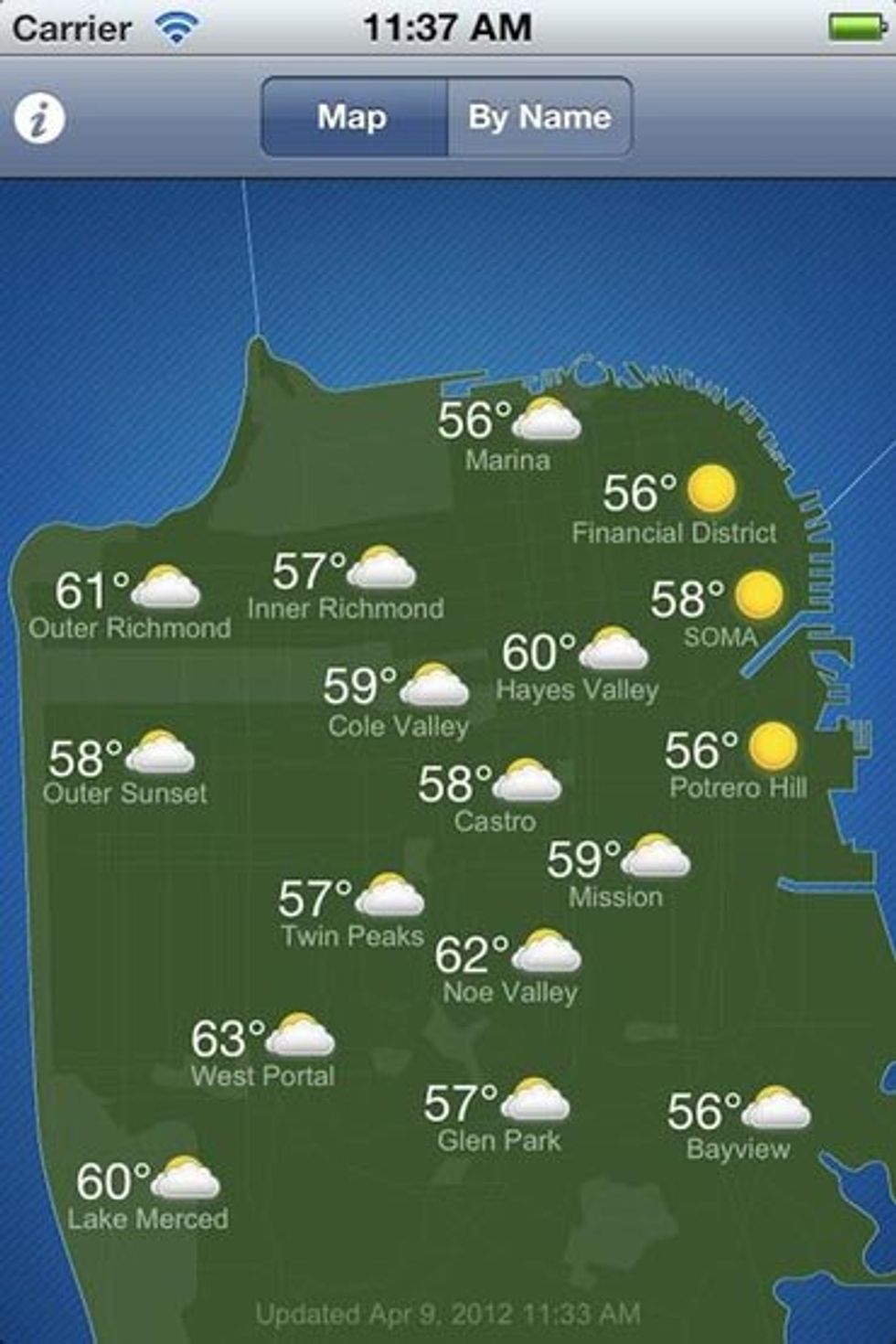
Now there’s an iPhone app that can help you navigate the city’s terrain as well. SF Climates, from Baker Beach Software is the brainchild of Michelle Sintov, who after moving from the sunny Mission District to the foggy Outer Richmond, discovered the need for such a tool first-hand.
“I was biking through the city from the Outer Richmond to SoMa, and somewhere around Divis', I would cross into the sun,” she says. “On weekends, we’d be at home in the fog and I knew from my in-laws in the financial district that it was sunny there.”
The app shows current weather conditions and forecasts for 17 neighborhoods around the city.
It draws data from many of the wireless weather stations around San Francisco that send their data to the Weather Underground.
The first few hundred people downloaded the app last week, and the initial feedback, Sintov says, is very positive.
Her small team will consider adding features to the app, based on feedback, and is also working on developing an Android app to go along with the iOS version.


