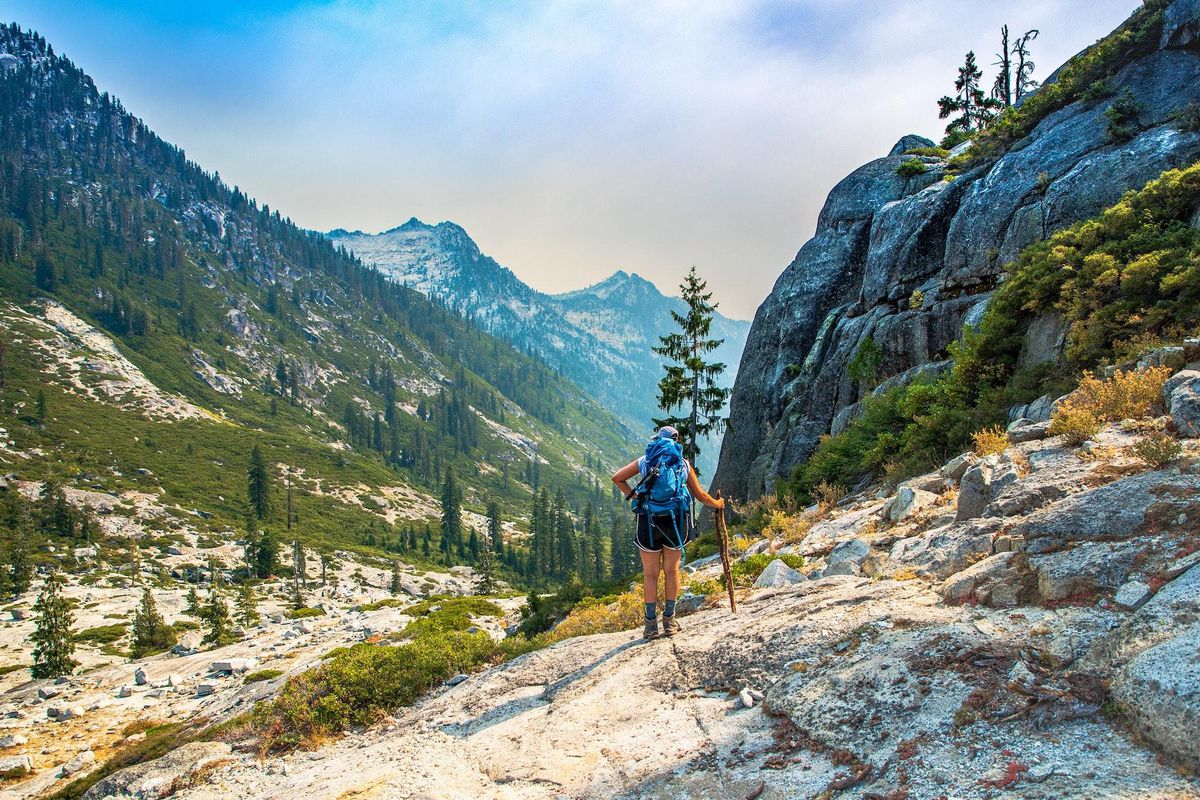
Rising between the Coast Range and the Shasta-Lassen stretch of the Cascades in Northern California, the Trinities are a landscape of imposing alpines, lush forested valleys, serene glacial lakes, and cascading creeks.
Considered a remote and rugged wilderness, the Trinity Alps offer prepared hikers a natural wonderland that is often overshadowed by the nearby Cascades and Sierra Nevada Mountains. Managed under the Shasta-Trinity National Forest, a network of maintained trails ascend steep watersheds up the likes of Canyon Creek, Stuart Fork, Swift Creek and Coffee Creek, yielding access to picturesque lakes and alpine basins. Where trails end, countless adventures await fearless alpine ramblers among the 8,000- to 9,000-foot ridges.
To help you get acquainted with all that the Trinity Alps have to offer, here is a short list of some of our favorite hikes and backcountry excursions.
Before you visit, please note that some campgrounds are closed due to the August Complex wildfire. Find the latest official updates at fs.usda.gov.
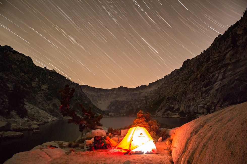
 (Photo by Jason Mandly)
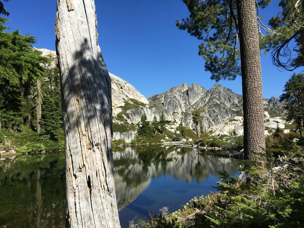
Granite Lake and Seven Up Pass
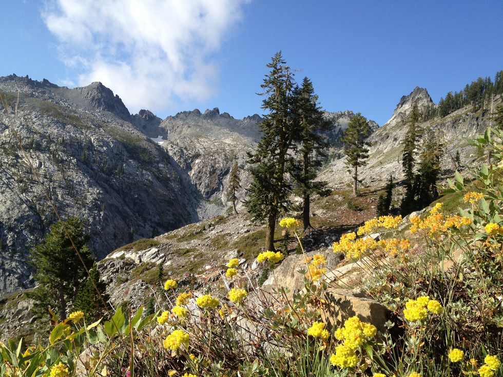
The Red Trinities are a wonderland for botanists, geologists, photographers, and adventurers. The rocks here, stained red with deep mantle-sourced peridotite, contrast beautifully with the White Trinities that are found to the west of the Stuart Fork drainage. Another source of geologic contrast comes from the Gibson Peak pluton, a mass of granite and younger rocks that forcefully intruded right through the heart of the ancient ultramafic rocks that gives the Red Trinities their name. Read more.
PROS: Great views. Wildflowers. Further hiking options.
CONS: Popular destination.
REGION: Trinity Alps + Marble Mountain Wilderness, CA
CONGESTION: Moderate
PREFERABLE SEASON(S): Summer, Fall
DAY-USE/PARKING PASS REQUIRED: Not Required
TOTAL DISTANCE: 13.10 mile loop (21.08 km)
TRAILHEAD ELEV.: 4,060 ft (1,237 m)
NET ELEV. GAIN: 3,424 ft (1,044 m)
TRAIL USES: Hiking, Horseback
TRAIL TYPE: There-and-back/Loop
DOGS ALLOWED: Yes
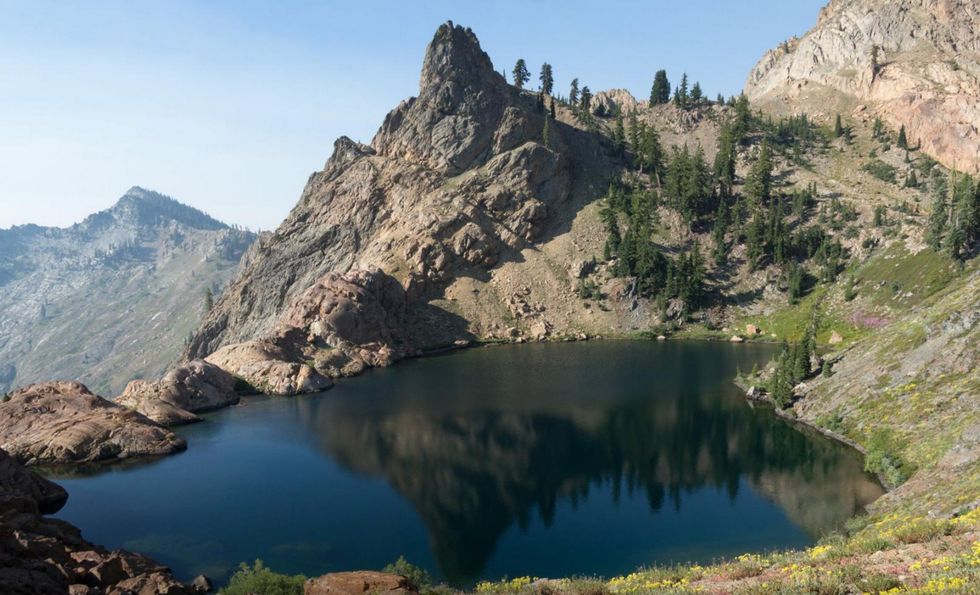
 (photo by Patrick Mueller)
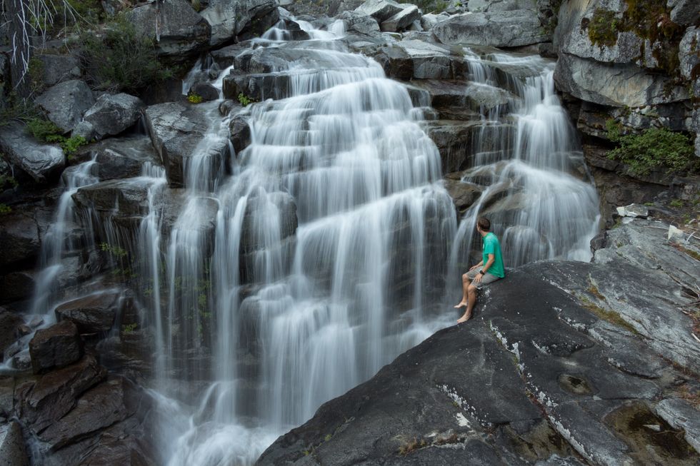
Canyon Creek Lakes
The Canyon Creek watershed is the most popular destination for hiking and backpacking in the Trinity Alps. During the summer months more than five waterfalls can be seen or heard from the trail to the Canyon Creek Lakes. During late spring and early summer over 50 waterfalls can be found in this watershed, some of which require backcountry travel to observe. On calm days the lakes in this area become near perfect mirrors and reflect the surrounding peaks and clouds. Read more.
PROS: Stunning views. Abundant wildlife. Many backcountry sites. Great swimming spots.
CONS: High temperatures in the summer. Very popular location for large groups.
REGION: Trinity Alps + Marble Mountain Wilderness, CA
CONGESTION: Moderate
PREFERABLE SEASON(S): Spring, Summer, Fall
DAY-USE/PARKING PASS REQUIRED: Not Required
TOTAL DISTANCE: 17.00 mi (27.36 km)
TRAILHEAD ELEV.: 3,100 ft (945 m)
NET ELEV. GAIN: 3,500 ft (1,067 m)
TRAIL USES: Hiking, Horseback
TRAIL TYPE: There-and-back
DOGS ALLOWED: Yes
 (photo by Patrick Mueller)
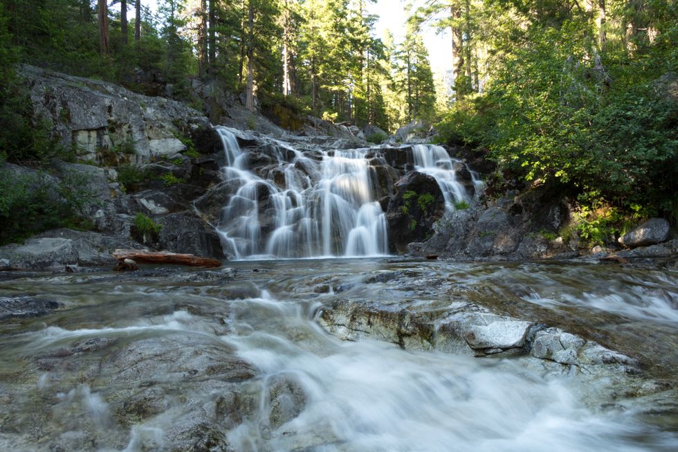
Boulder Creek Lakes
Boulder Creek Lakes lie within the Canyon Creek watershed. During the summer months many large waterfalls and excellent swimming holes lie adjacent to the trail and near many of the backcountry camp sites. Read more.
PROS: Stunning views. Multiple lakes. Many backcountry sites. Great for groups.
CONS: Little shade. Popular location for large groups. Steep scramble near the end.
REGION: Trinity Alps + Marble Mountain Wilderness, CA
CONGESTION: Moderate
PREFERABLE SEASON(S): Spring, Summer, Fall
DAY-USE/PARKING PASS REQUIRED: Not Required
TOTAL DISTANCE: 16.00 mi (25.75 km)
TRAILHEAD ELEV.: 3,100 ft (945 m)
NET ELEV. GAIN: 3,400 ft (1,036 m)
TRAIL USES: Hiking, Horseback
TRAIL TYPE: There-and-back
DOGS ALLOWED: Yes
 (Photo by Patrick Mueller)
Emerald and Sapphire Lakes
Sapphire and Emerald Lakes are nestled comfortably among granite ridges in the heart of the Trinity Alps. The outflow from these bodies of water mark the beginning of the Stuart Fork Creek, which meanders through mountains and meadows until it enters Trinity Lake. Read more.
PROS: Beautiful meadows. Pristine alpine lakes. Wildflowers. Abundant wildlife.
CONS: Long trail. Crowded on holidays.
REGION: Trinity Alps + Marble Mountain Wilderness, CA
CONGESTION: Moderate
PREFERABLE SEASON(S): Summer, Fall
DAY-USE/PARKING PASS REQUIRED: Not Required
TOTAL DISTANCE: 26 mi (20.92 km)
TRAILHEAD ELEV.: 3,000 ft (914 m)
NET ELEV. GAIN: 2,800 ft (853 m)
TRAIL USES: Hiking, Horseback
TRAIL TYPE: There-and-back
DOGS ALLOWED: Yes
 (Photo by Jason Mandly)
Stonewall Pass and Echo Lake
The Stoney Ridge Trail is one of the shorter options to get to the crest of the Red Trinities, but you're in for a relatively steep 4.5 miles to get to Stonewall Pass. Like many of the other passes in the Red Trinities, you'll be treated to amazing views of the surrounding mountains including the dramatic White Trinities that spring up on the western side of Stuart's Fork. If you want to keep hiking, Echo Lake is located another 1.5 miles past Stonewall Pass. Read more.
PROS: Great views. Wildflowers in summer.
CONS: Limited shade. Limited camping at the lake.
REGION: Trinity Alps + Marble Mountain Wilderness, CA
CONGESTION: Low
PREFERABLE SEASON(S): Spring, Summer, Fall
DAY-USE/PARKING PASS REQUIRED: Not Required
TOTAL DISTANCE: 12.00 mi (19.31 km)
TRAILHEAD ELEV.: 4,626 ft (1,410 m)
NET ELEV. GAIN: 2,743 ft (836 m)
TRAIL USES: Hiking
TRAIL TYPE: There-and-back
DOGS ALLOWED: Yes
 (Photo by Patrick Mueller)
Lake Anna via Long Canyon
Lake Anna is a perfect backpacking destination if solitude is your goal. Though the lake is rather close to a very popular hiking trail in the Trinity Alps Wilderness, a very steep hillside dissuades most people from making it to this hidden gem. Some may spend a day hiking to this lake, but few actually backpack to it. Read more.
PROS: Solitude. Abundant wildflowers. Great views. Pristine lake.
CONS: Off-trail section. Very steep climb.
REGION: Trinity Alps + Marble Mountain Wilderness, CA
CONGESTION: Low
PREFERABLE SEASON(S): Summer, Fall
DAY-USE/PARKING PASS REQUIRED: Not Required
TOTAL DISTANCE: 11.00 mi (17.70 km)
TRAILHEAD ELEV.: 3,680 ft (1,122 m)
NET ELEV. GAIN: 3,880 ft (1,183 m)
TRAIL USES: Hiking
TRAIL TYPE: There-and-back
DOGS ALLOWED: Yes
 (Photo by Jason Mandly)
Four Lakes Loop via Long Canyon
The heavily forested west side of the alps form the Green Trinities, and the rugged granite peaks in the heart of the range make up the White Trinities. This trip takes you to the crest of the eastern portion of the Trinity Alps: the peridotite-stained Red Trinities. Read more.
PROS: Lightly visited. Big views. Summer wildflowers. Swimming.
CONS: Strenuous. Dirt road approach.
REGION: Trinity Alps + Marble Mountain Wilderness, CA
CONGESTION: Low
PREFERABLE SEASON(S): Summer, Fall
DAY-USE/PARKING PASS REQUIRED: Not Required
TOTAL DISTANCE: 17.20 mi (27.68 km)
TRAILHEAD ELEV.: 3,760 ft (1,146 m)
NET ELEV. GAIN: 4,000 ft (1,219 m)
TRAIL USES: Hiking, Horseback
TRAIL TYPE: There-and-back/Loop
DOGS ALLOWED: Yes
 (Photo by Jason Mandly)
Bear Lakes
There are several Big Bear Lakes in California, and even more spread across the Western U.S. When there's a Big Bear Lake, there's usually a Little Bear Lake nearby, and the Bear Lakes Basin in the Trinity Alps Wilderness is no exception. Wee Bear Lake lives up to its appellation and adds unique scenery and opportunities to the Trinity Alps version of the Three Bears. Read more.
PROS: Great views. Wildflowers. Meadows.
CONS: Limited camping spots.
REGION: Trinity Alps + Marble Mountain Wilderness, CA
CONGESTION: Low
PREFERABLE SEASON(S): Spring, Summer, Fall
DAY-USE/PARKING PASS REQUIRED: Not Required
TOTAL DISTANCE: 9.20 mi (14.81 km)
TRAILHEAD ELEV.: 3,020 ft (920 m)
NET ELEV. GAIN: 2,850 ft (869 m)
TRAIL USES: Hiking, Horseback
TRAIL TYPE: There-and-back
DOGS ALLOWED: Yes
 (Photo by Jason Mandly)
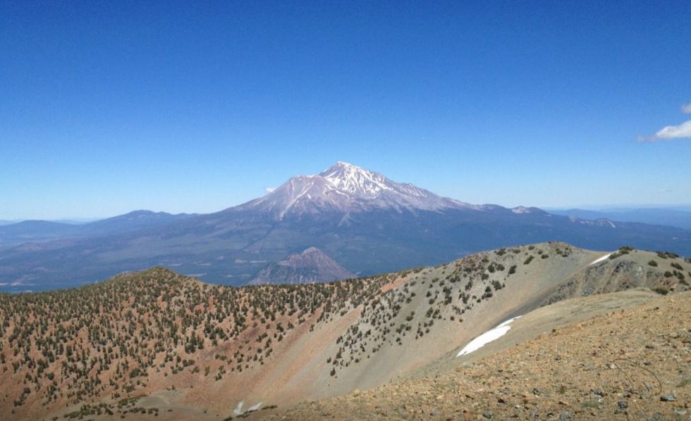
Deadfall Lakes and Mount Eddy
The Trinity Divide is the easternmost subrange of the Klamath Mountains. It is a hydrologic divide, as the western slopes drain into the Trinity and Klamath Rivers and the eastern slopes drain into the Sacramento River system. The highest point in this subrange is the modest Mount Eddy. At 9,026 feet high, Mount Eddy happens to be the highest peak in the contiguous U.S. west of Interstate 5 and is one of nine ultra-prominent peaks in California. Although the view of the peak is not as striking compared to the nearby Trinity Alps or neighboring Mount Shasta, the view from the peak is truly phenomenal. Read more.
PROS: 360-degree views. Wildflowers. PCT access.
CONS: Wet areas near the beginning.
REGION: Trinity Alps + Marble Mountain Wilderness, CA
CONGESTION: Moderate
PREFERABLE SEASON(S): Winter, Spring, Summer, Fall
DAY-USE/PARKING PASS REQUIRED: Not Required
TOTAL DISTANCE: 8.00 mi (12.87 km)
TRAILHEAD ELEV.: 6,472 ft (1,973 m)
NET ELEV. GAIN: 2,554 ft (778 m)
TRAIL USES: Hiking
TRAIL TYPE: There-and-back
DOGS ALLOWED: Yes