The Marin Headlands is one of those places that seem to evade San Franciscans. I grew up in the Bay Area and I'd never been there before stumbling upon it while looking for a wedding venue. I sheepishly thought I was the only one, but the more people I asked, (both locals and transplants) the more shocked I was that no one even knew what I was talking about, let alone had seen the area's crown jewel: The Point Bonita Lighthouse.
Located just north of the Golden Gate Bridge, Marin Headlands is part of the Folden Gate National Recreation Area. Along with the lighthouse, the area has tons of hiking trails, the Marin Headlands Center for the Arts (once-dilapidated officer's club-turned-artist-in-resident-community, more on that in a later post), dog-friendly Rodeo Beach, what's left of Fort Barry and Fort Cronkhite, a sweet little church, an adorably dilapidated YMCA, the abandoned NIKE Missile site from WWII, a mini horse ranch and some incredible ocean vistas – all nestled among rolling golden hills.
There's a parking lot near the lighthouse trailhead for easy access, and although I saw many a foreign tourist sporting hiking boots and Gore-Tex, I was wearing flats and a dress – and managed the half-mile "hike" with no problem. To get to the lighthouse you walk down a dirt path, through a hand-strewn rock tunnel (yeah, this is as cool as it sounds), and then BAM! You're in front of one incredible view.
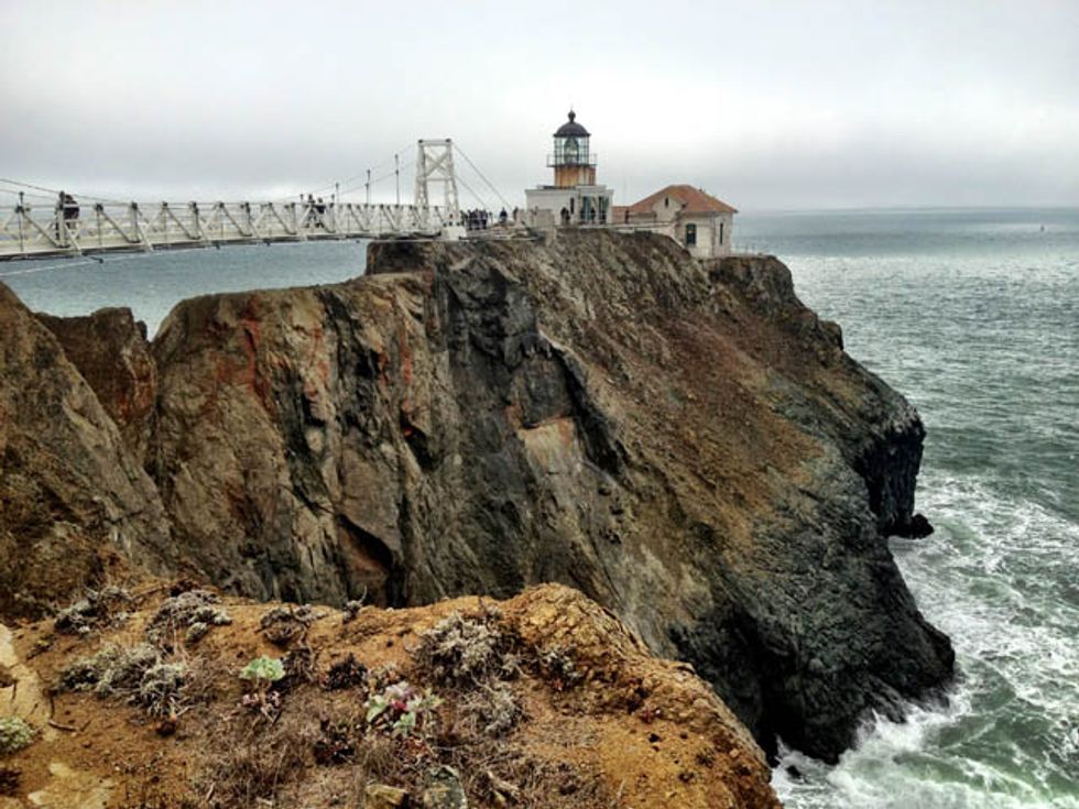
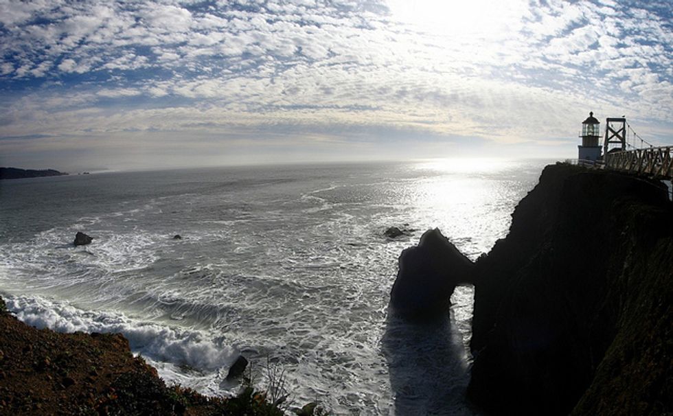
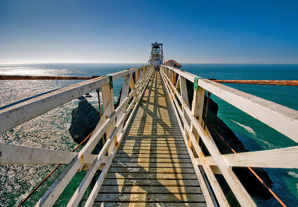
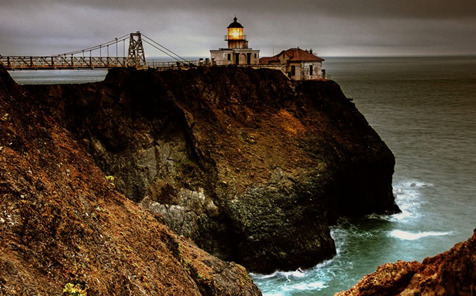
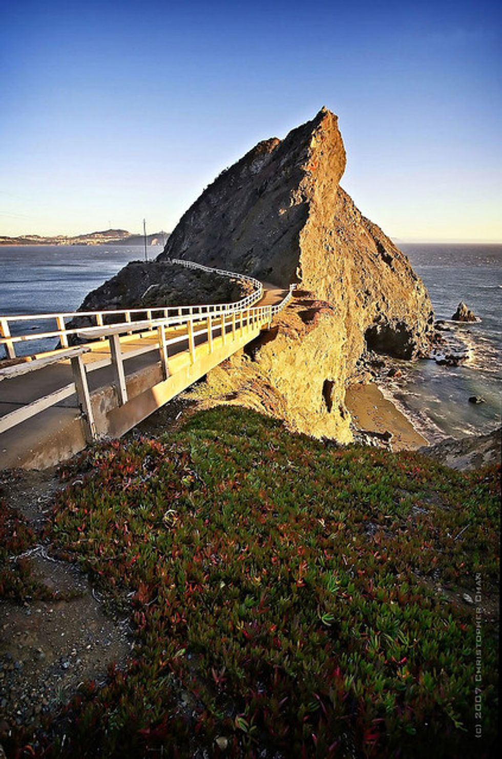
Situated on a rock formation away from the shore, a suspension bridge connects the walking trail to the lighthouse itself. Look down in the middle of the bridge and you'll see lots of craggy rocks, crashing waves, and (possibly) your life flash before your eyes. Hate heights? Afraid of falling to your death? Don't come here – it's really that scary. Fun fact: Until 1940 a path connected the main land to the lighthouse, but erosion caused the trail to become so dangerous and finally crumble away completely. Point Bonita is the only lighthouse in America that can be reached by a suspension bridge (which was rebuilt in April 2012, so we promise it's safe.)
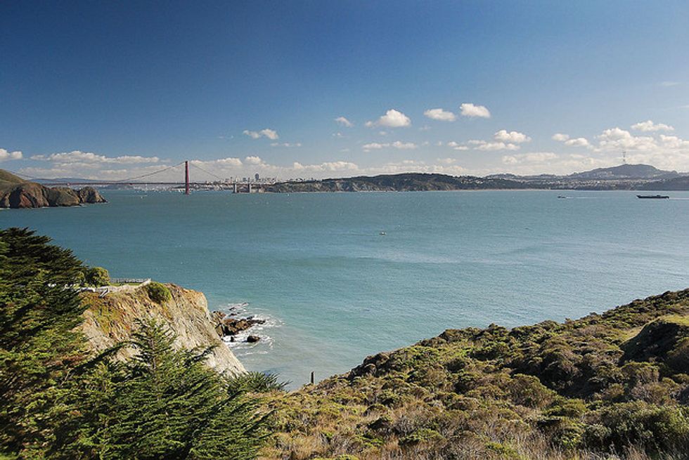
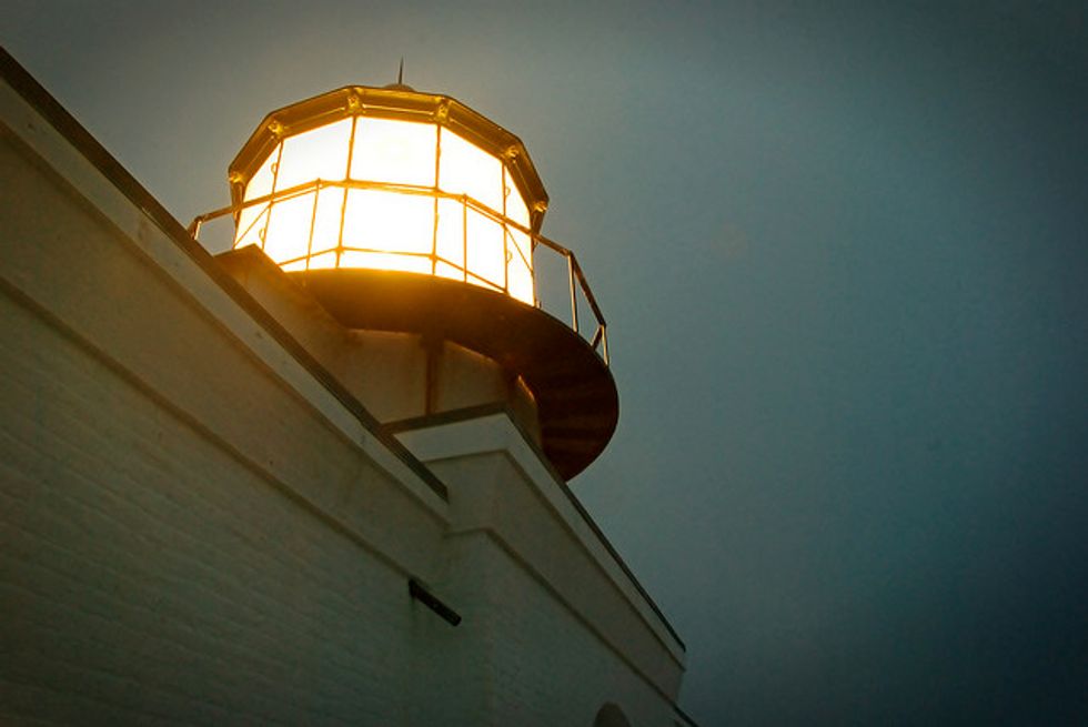
After crossing the death-defying bridge, there's lots to check out in the lighthouse itself. The original French Fresnel lens from 1855 is still in use, and you can walk through what was once the tiny lighthouse living quarters. This is also a perfect spot to take touristy pictures of the Golden Gate Bridge and ruminate on how tranquil the city looks from afar. If you're lucky, a weathered old man volunteer will spend hours explaining the history of the lighthouse and how to tell the difference between various fog horns to a rapt crowd.
Point Bonita is the perfect kind of day trip from the city - you get to take in fresh air, engage in mild physical activity, and it only takes a few hours door-to-door. Happy exploring!
Directions from San Francisco
- Take Hwy 101 northbound across the Golden Gate Bridge.
- Exit Alexander Avenue; bear right.
- Follow Alexander Avenue 0.2-miles; turn left onto Bunker Road.
- On Bunker Road, pass through one way Baker-Barry Tunnel.
- Follow Bunker Road 3-miles; turn left on Field Road.
- Follow Field Road 0.8-miles to Point Bonita parking lot and trailhead.
- Walk the 0.5-mile trail to the lighthouse.