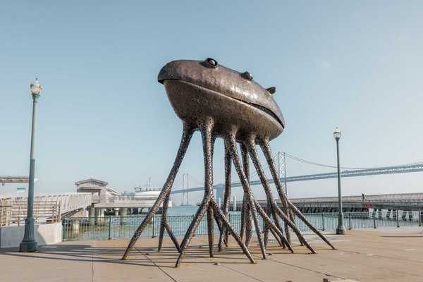
There aren’t many regions in the U.S., let alone in the world, with the kind of ecological diversity of Northern California. With not one but three national parks in the Sierra Nevada Mountains, moody redwood forests, and a dreamy coastline teeming with whales and sea lions, you don’t have to try too hard to find a landscape that inspires.
But the best of the best can’t be seen from a car window or hotel balcony. For the best of the best, you’ll have to go on foot.
Northern California has so many incredible hiking trails that it was truly tough to narrow down our 2022 bucket list. In the end, we selected just 12, one hike for each month this year. From Point Reyes National Seashore to the Sequoia National Park to Big Sur, a year spent hiking these trails will remind you just how good we have it here.
January: Point Reyes National Seashore, Tomales Point Trail (9.7 miles out and back)
Start the year with what is, hands down, one of the best hikes in the Bay Area. Not only are the views along the Tomales Point Trail unbeatable (on a clear day they can reach all the way to the Farallon Islands) but you’ll have ample opportunity to spot the native Tule elk herd that roams the five-mile-long peninsula.
The route starts at the historic Pierce Point Ranch, a dairy ranch from the late 19th century, then meanders along the coastal bluff until it teeters into the bay (careful on the cliffs, they have been known to collapse). As you hike, keep an eye out for gray whales—around 94 percent of them pass within a mile of Point Reyes between December and February.
// Pierce Point Rd (Inverness), nps.gov/pore
February: Almaden Quicksilver County Park, Historic Trail (7 mile loop)
Almaden Quicksilver County Park isn’t well known today but, back in the late 19th and early 20th centuries, it was the center of the American quicksilver mining industry. Nature has reclaimed the former industrial operation, but the ghostly presence of many of its original features, from mine entrances and train trestles to abandoned homes and cemeteries, remain.
The seven-mile Historic Trail weaves through them and rewards your effort with stunning views of the rippling Sierra Azul Mountains and Mount Umunhum at the top of the hill. Signage along the trail provides some descriptions of the ruins, but for extra information download the online Historic Trail brochure before you head out. While this is a great hike any time of year, the exposed route can be brutally hot in the summer months.
// 21785 Almaden Rd (San Jose), parks.sccgov.org
March: Mount Tamalpais State Park, Matt Davis-Steep Ravine Loop (6.4 mile loop)
Mount Tam puts its best foot forward in late winter and early spring, before the bulk of the tourists descend and the rivers are still plump and swift with winter rain. This 6.4 mile loop, which begins right in the town of Stinson Beach, switchbacks through forests of big leaf maple and buckeye. Take in views of the ocean before descending on the Steep Ravine Trail all the way to the canyon floor, past waterfalls and down a wooden ladder. There’s even a reward waiting for you at the end. Just a few easy-walking blocks from the trailhead you can rehydrate with cold drinks and local oysters at the Parkside Cafe.
// Belvedere Ave (Stinson Beach), parksconservancy.org
April: Sunol Wilderness Regional Preserve, McGuire Peaks Trail (5.9 mile loop)
Sunol’s lush meadows bloom with such a colorful array of gooseberry, white fairy lanterns, buttercups, lupine, and tulips each April that the regional preserve traditionally hosts a wildflower festival. While there’s no word yet on whether the festivities will go on in 2022, the wildflowers are guaranteed to make an appearance across this lesser known East Bay park.
You’ll find the rarest among them blossoming along the Maguire Peaks Trail, which travels almost six miles over rolling green hills and through coastal oak groves. Although the route is challenging at times, you won’t find better wildflower action anywhere else in the Bay.
// Welch Creek Rd Trailhead (Sunol), ebparks.org/parks/sunol
May: Shasta-Trinity National Forest, McCloud River Trail (4 miles out and back)
Welcome the summer by diving into the picture-perfect lagoon beneath one of Northern California’s most impressive waterfalls. Although the McCloud River Falls Trail near Mount Shasta is a mellow, mostly flat four-mile, out-and-back trail, its three (yes, three!) waterfalls are truly epic. The most dramatic of the bunch are the Middle Falls, which cascade over a rocky outcropping and drop 50 feet into a sublime swimming hole.
// McCloud River Falls Trailhead, off of Hwy 89 (McCloud), fs.usda.gov/stnf
June: Lassen Volcanic National Park, Bumpass Hell Trail (3 to 7 miles, out and back)
Think you have to go all the way to Yellowstone to see steaming, turquoise hot springs? Lassen Volcanic National Park begs to differ. After a few years of closures due to trail restoration and wildfires, the park’s most fascinating hydrothermal trail, Bumpass Hell, is expected to reopen this summer. You can hike it in one of two ways, from the Bumpass Hell parking area (three miles out and back) or from the park’s southwest entrance (seven miles out and back). Either way, you’ll have panoramic views of volcanic peaks and get up close to the boiling pools, fumaroles, and thumping mud pots.
Tip: Call the park before you go for the latest weather conditions. Remaining snow and ice may prevent the trail from opening until later in the month.
// 38050 Highway 36 E. (Mineral), nps.gov/lavo
July: The Presidio, Inspiration Point to the Presidio Tunnel Tops (approx. 4 mile loop)
The long anticipated Presidio Tunnel Tops, a new park space over the transportation corridor through the Presidio, is expected to open to the public July 17th. This hike takes you straight to it. Start at Inspiration Point, where the views stretch all the way to Alcatraz, pass Andy Goldworthy’s impressive "Spire," then continue down the Bay Ridge Trail to the Trail for Everyone loop. The latter will drop you down near the historic pet cemetery and the Tunnel Tops next door. When you’re done exploring the new space, continue along the Trail for Everyone back to the Bay Ridge Trail and your trailhead.
But wait: Opening day will bring a slate of curated community events. To celebrate the Tunnel Tops opening, enjoy live music, drum and dance performances, Bi-lingual poetry readings, a new an outdoor art installation by Favianna Rodriguez, and more. There is also a picnic area with reservable grills, and daily food trucks are expected soon.
// Inspiration Point, Arguello Blvd (Presidio); for more information and future events, go to presidiotunneltops.gov.
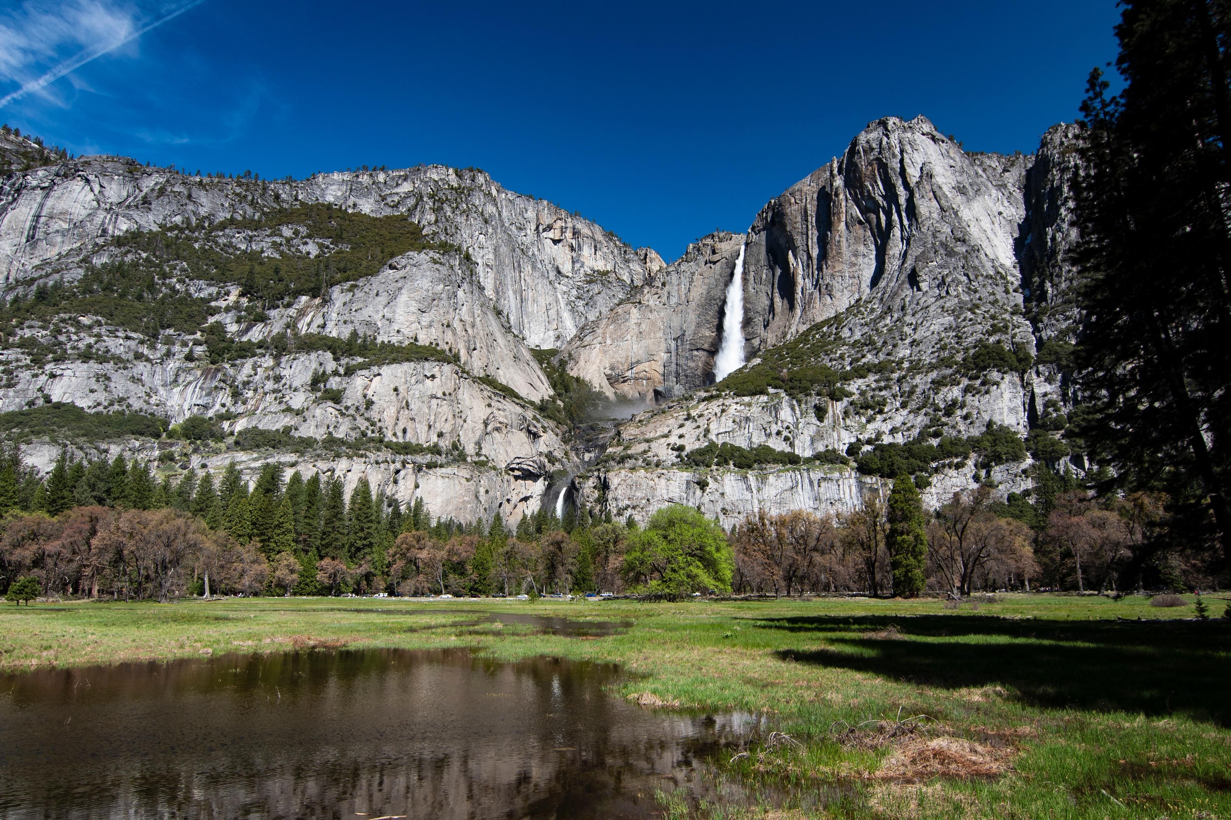
August: Yosemite National Park, Yosemite Falls (2 miles out and back or 7.2 mile loop)
Full disclosure: This hike to Yosemite Falls is arguably the most intense on our list. You’ll climb a thousand feet from the valley floor in the first mile alone, and it doesn’t get much easier from there. But oh the views you’ll see! From this elevation, Half Dome, Sentinel Rock, and the Yosemite basin are pretty as a painting. While you can take some serious Insta-worthy photos from Columbia Rock and cut this hike into a short but strenuous two-mile round trip, continuing to the top of the trail is one of the most rewarding experiences you’ll have this year.
// 9035 Village Dr (Yosemite Valley), nps.org/yose
*UPDATE July 28, 2022: Due to the Washburn and Oak fires, the Mariposa Grove of Giant Sequoias and Wawona Campground are currently closed. Much of the park remains open, however, though some reservations are required for driving through the park at peak hours. Conditions may be smoky. Before you visit, check the latest alerts. You can also donate to the Yosemite Conservancy, which works to protect wildlife and restore trails and habitats.
September: Sequoia and Kings Canyon National Park, Congress to Trail of Sequoias (approx. 3 mile or 7 mile loop)
Although this isn’t a particularly challenging hike—a portion of the route is even paved—and you won’t get the kind of endless views you do at Moro Rock and Big Baldy Ridge, it has one thing they don’t: the largest trees in the world. The journey begins with the daddy of them all, the General Sherman Tree, a 2,200-year-old giant sequoia that stands 275 feet tall and 36 feet in diameter.
Start at the eponymous trailhead then continue onto the Congress Trail. Loop back from here if you’d like to keep your hike to about three miles round trip, or keep things going on the Trail of the Sequoias. Once you get out past the Congress Trail, where most visitors peel away, you’ll have the big, beautiful trees all to yourself.
// Sherman Tree Main Trailhead, Wolverton Rd (Three Rivers); before you visit, check current conditions at nps.gov/seki.
October: Mount Diablo State Park, Twin Peaks Mitchell Rock Loop (4.9 mile loop)
The views from the summit of the East Bay’s Mount Diablo are stunning at any time of year, but in late September and October you’ll want to keep close watch on the trail. It’s there that, in the early fall, the mountain’s randy tarantulas emerge with their eight eyes set on love. Set out on the Twin Peaks Mitchell Rock Loop in the late afternoon for your best chance of seeing the (harmless) oversized arachnids emerging from their burrows to search for a mate. The 4.9 mile route from Eagle Creek Trail to Mitchell Rock Trail loops you from chaparral to savannah to the crest of rocky Twin Peaks then back down again, with the East Bay, in all its majesty, shining far below.
// 96 Mitchell Canyon Rd (Clayton), parks.ca.gov
November: Pinnacles National Park, High Peaks to Balconies Cave (8.4 mile loop)
Autumn, when the intense summer heat has cooled and the endangered California condors are active, is the best time for visiting Pinnacles. This hike, which creeps through the spindles and hoodoos of the High Peaks Trail, will get you high enough to see them soar. But half the fun is the trail itself, which has you climbing precarious ladders and crossing narrow ledges through gardens of rocky rhyolite. It will also take you to the mouth of Balconies Cave, a worthy if short stop for explorers equipped with a flashlight.
// 5000 East Entrance Rd (Paicines), nps.gov/pinn
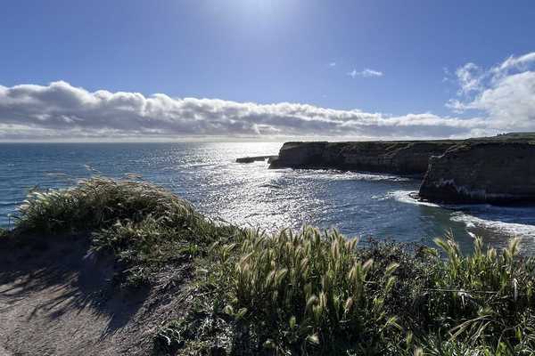
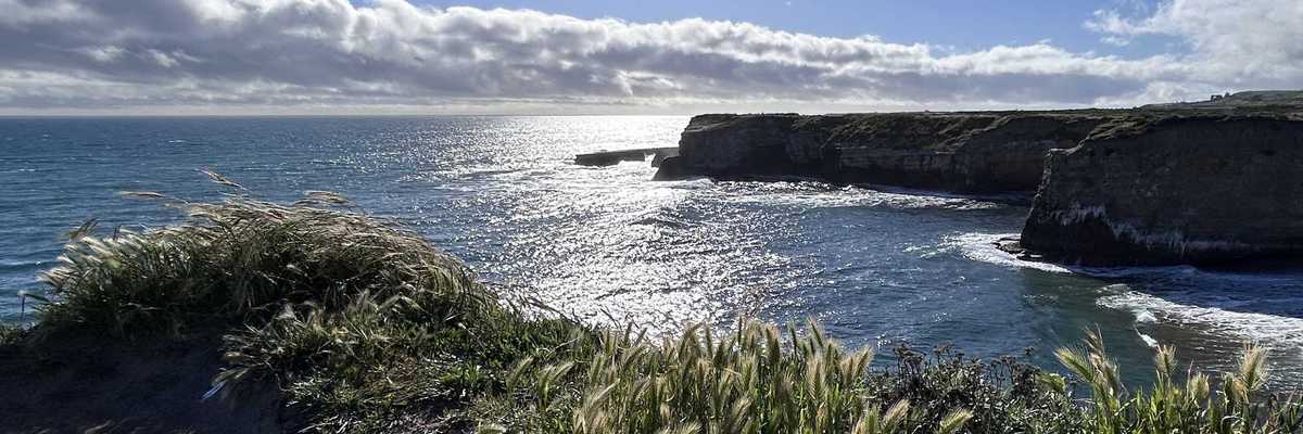
December: Point Lobos State Natural Reserve, Point Lobos Loop Trail (6.7 mile loop)
Finish out the year with breathtaking views of the Pacific and the marine mammals and seabirds that call it home. On the northern edge of the Big Sur coastline, Point Lobos State Natural Reserve’s Point Lobos Loop Trail is a wonder of jagged rocky fingers stretching into impossibly blue waters, groves of swaying Monterey cypress, tide pools swarming with sea creatures, and coves occupied by sunbathing sea lions. But perhaps the best part about this trail is that, unlike some of the options at Julia Pfeiffer Burns and Andrew Molera State Parks, it remains relatively under the radar to visiting tourists, especially in the winter.
// Hwy 1 (Carmel), parks.ca.gov