In 2022, we marked the calendar with a year of epic Northern California hikes.
Month to month, we worked our way through our bucket list, frolicking through wildflowers at Sunol Regional Park in April, edging around hot springs at Lassen Volcanic National Park in June, and swimming under waterfalls in Shasta-Trinity National Forest in May.
But by the end of our December hike at Point Lobos State Natural Reserve, we still weren’t quite ready for the fun to be over. So, we put together a brand new bucket list, one for every month of 2023.
From Santa Cruz to Lake Tahoe, this year’s legendary hiking trails will (literally) take your breath away.
January: Monarch Butterfly Natural Preserve to Natural Bridge State Beach (1.5-mile loop or 3 miles out and back)

(Courtesy of @naturalbridgesstatebeach)
While the rest of the world goes full weekend warrior in pursuit of their New Year’s resolutions this month, we’re easing into 2023 a little more gently. January is peak butterfly season at Santa Cruz’s Monarch Butterfly Natural Preserve, where the flutterbys overwinter among the eucalyptus. An unexpected rebound in their populations over the last two years will have the trees on this gentle trail blossoming with their vivid orange wings through February.
Park at the Natural Bridges State Beach visitor center then enter the preserve through the Monarch Boardwalk. Continue along the Monarch Trail to the Moore Creek Trail, passing through wetlands and down to the beach. You’ll see the park's iconic natural rock bridge to your left but, if you time your visit for low tide, go right instead to check out the marine protected area’s impressive tide pools. If you return to the parking lot straight from the beach, you’ll have covered about 1.5 miles. For a little more exercise, follow the trail back the way you came.
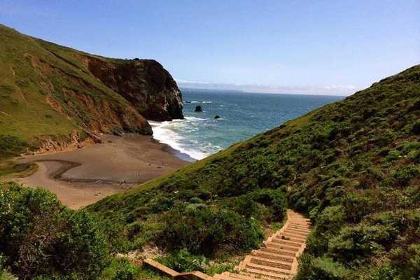
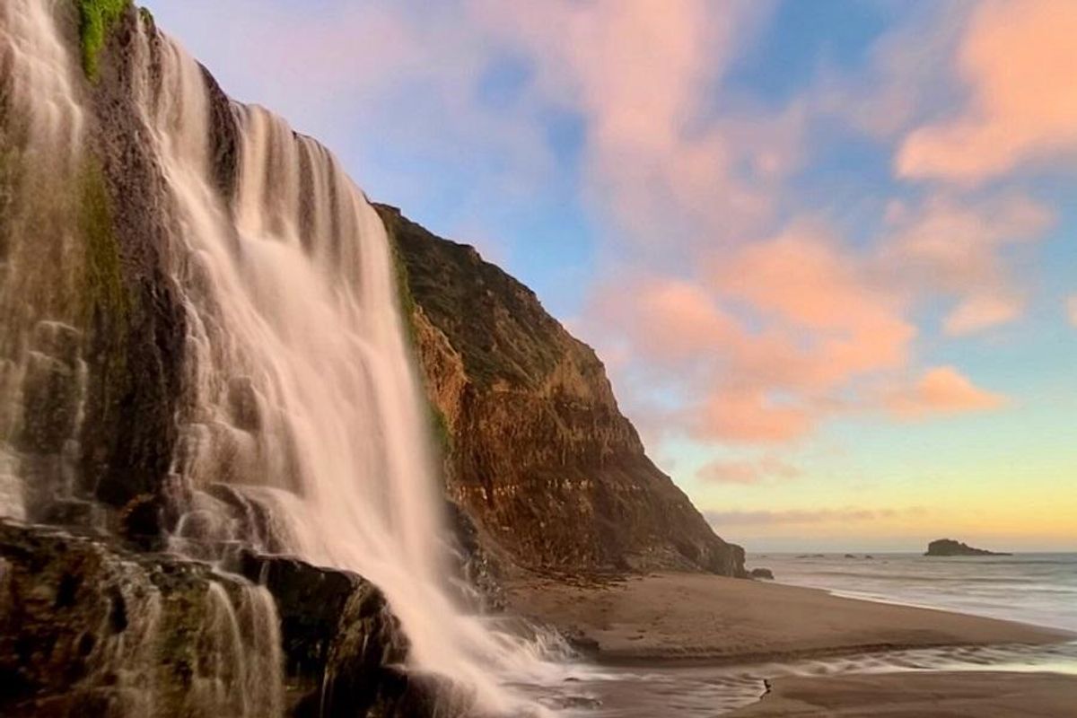
// 2531 W Cliff Dr. (Santa Cruz), parks.ca.govFebruary: Point Reyes National Recreation Area, Alamere Falls (14.8 miles, out and back)
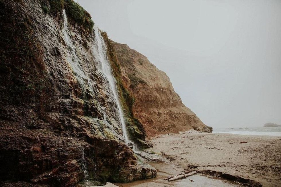
(Courtesy of @siaasta)
Alamere Falls, Point Reyes National Recreation Area’s stunning 40-foot cascade, is one of just four in the U.S. to fall into the ocean. That makes it well worth the approximately 14-mile hike, especially in February when winter rains have fattened up the area’s creeks and rivers. While early 2023's storms have the Palomarin Trailhead near Bolinas temporarily closed, you can still access the falls from the Bear Valley Trailhead (located 4.5 miles south of the Bear Valley Visitor Center near Five Brooks Ranch) if you're willing to add an extra mile to your trek. Follow the mostly flat trail south for 3.1 miles then make a left onto the steadily-climbing Glen Trail. Continue about 1.5 miles to the Stewart Trail where you'll turn right and walk for 1.2 miles (downhill!) to the Wildcat Campground. Walk the last mile to the falls along the beach. It can be dangerous to hike the final stretch when the tides are coming in so check the schedule to be sure you hit this section when they are low. When you've taken all the photos, retrace your steps back to the trailhead.
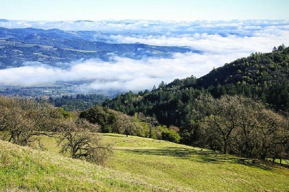
// Bear Valley Trailhead (Point Reyes Station), nps.gov/poreMarch: Joseph D. Grant County Park, Dutch Flat to Dairy Trail (5.7-mile loop)
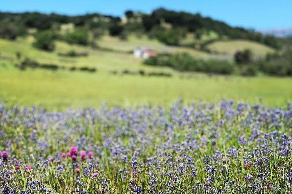
(Courtesy of @clbird)
Scout out wildflowers in the rolling foothills of lovely Joseph D. Grant County Park. The historic ranch land has an abundance of colorful blooms beginning in March. From the main (paid) parking lot, head west on the Dutch Flat Trail then continue on to the Dairy Trail. After about 1.5 miles, you’ll come to a split. Keep right on the Brush Trail for 1.6 miles then stay left as it turns into the Eagle Trail and Lower San Felipe Trail. Finally, take a right at the Snell Trail and follow it for a little less than a mile back to the parking lot.
// 18405 Mt. Hamilton Rd. (San Jose), parks.sccgov.org
April: Prairie Creek Redwoods State Park, Fern Canyon to California Coastal Trail (8.5-mile loop)
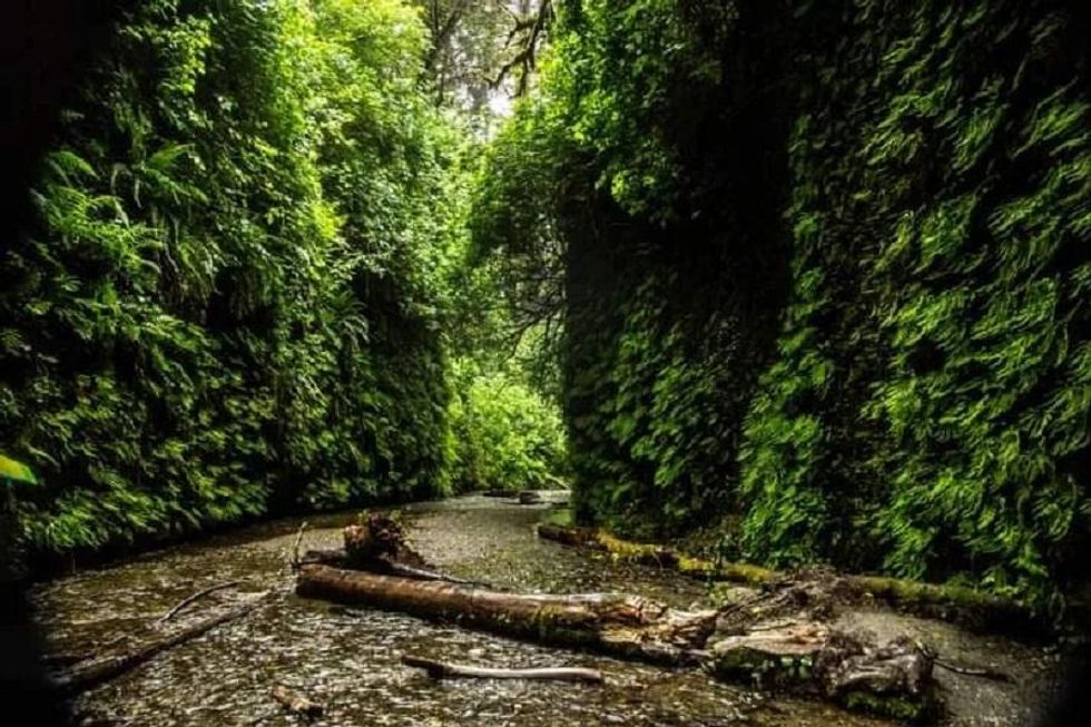
(Courtesy of @nox_vomica)
Fern Canyon in Prairie Creek Redwoods State Park is just as enchanting as it sounds. A World Heritage Site and the backdrop for several films including Jurassic Park, this gully is lined with 50-foot rock walls literally dripping with green. April, when the ferns are lush but the summer tourist season hasn’t yet picked up (free parking permits are required May 1 to Sep 30), is an ideal time to visit. It’s a one mile through the canyon but why stop there? Follow the Fern Canyon Loop to where it connects with the Friendship Ridge Trail. After about 2.8 miles, keep left and follow the West Ridge Trail to the California Coastal Trail, which runs past hidden waterfalls and grazing elk back to the Fern Canyon parking lot.
//127011 Newton B. Drury Scenic Pkwy (Orick), parks.ca.govMay: Garrapata State Park, Soberanes Canyon and Whale Peak Loop (4.7 miles out and back + 1.5-mile loop)
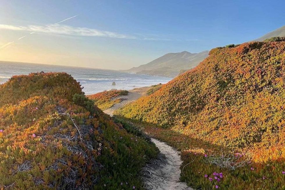
(Coutesy of @anthonybiletsky)
One of Big Sur’s least visited parks, Garrapata nevertheless has all the beauty of its more crowded neighbors. The Soberanes Canyon Loop swings you almost five miles through redwood groves, past a waterfall, and over ocean bluffs. There are top notch views of the coast and Carmel from many points on the trail but if it’s too foggy to see the sights, muster any energy you have left when you reach the parking lot for a quick 1.5 mile loop around Whale Peak, which gets you up close and personal with the Pacific.
// 34500 Hwy 1 (Carmel-By-The-Sea), parks.ca.govJune: Lake Tahoe, Eagle Falls to Eagle Lake (2.5 miles, out and back)
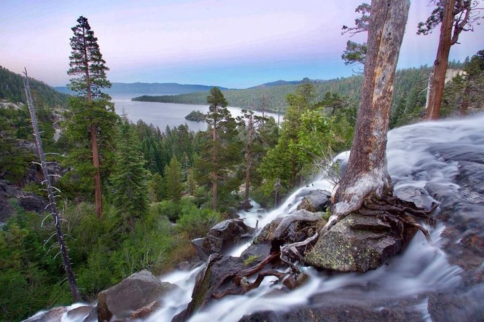
(Courtesy of @eastsidewestside)
Fair warning, unless you go early in the morning or near sunset, the trails to Eagle Falls and Eagle Lake are likely to be packed. But there’s good reason to brave the crowds: This short hike is also one of Tahoe’s most beautiful, with views of Emerald Bay and a stopover at a classic alpine watering hole. Park at the Eagle Falls Trailhead then head up the stone-cut stairs to the waterfall, which should be roaring in June. Cross over the bridge and continue along an uphill trail surrounded by forest and rugged peaks just beyond. About a mile in, follow the sign to Eagle Lake then go left along the shore about 1/4 of a mile to a clutch of rocks with a spectacular view. Have lunch, swim in the icy water, then head back to the parking lot the way you came.
// 138 Emerald Bay Rd. (South Lake Tahoe), fs.usda.govJuly: Pacific Crest Trail to Summit Tunnels (8+ miles, out and back)
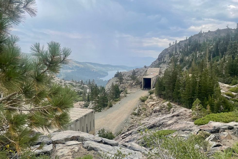
(Shoshi Parks)
One of the most stunning feats of engineering ever accomplished in the U.S. is at the core of July’s hike. In the 1860s, Chinese immigrants carved tunnels through the impossibly hard granite at Donner Pass to connect California to the rest of the country via the transcontinental railroad. Today, though they are covered in a riot of graffiti, they are just as impressive as they were over 150 years ago.
It is possible to park just a five minute walk from the Summit Tunnels but it’s much more epic to approach them via the Pacific Crest Trail (PCT). Start at the parking lot for the eastbound Donner Pass rest area. Step onto the PCT on the south side and follow it over fields of erratic boulders and switchbacks down to Donner Pass Road. Cross the road to the parking lot by the Summit Haus. From there, follow your eyes to the tunnels (don’t forget to read all about them on signs tucked into the side of the parking lot). You can walk through as much or as little of the tunnels as you want, then turn around and follow the PCT back to your car.
// I-80 Donner Pass Eastbound Rest Area (Soda Springs), pcta.orgAugust: Yosemite National Park, Porcupine Creek to North Dome (10.4 miles, out and back)
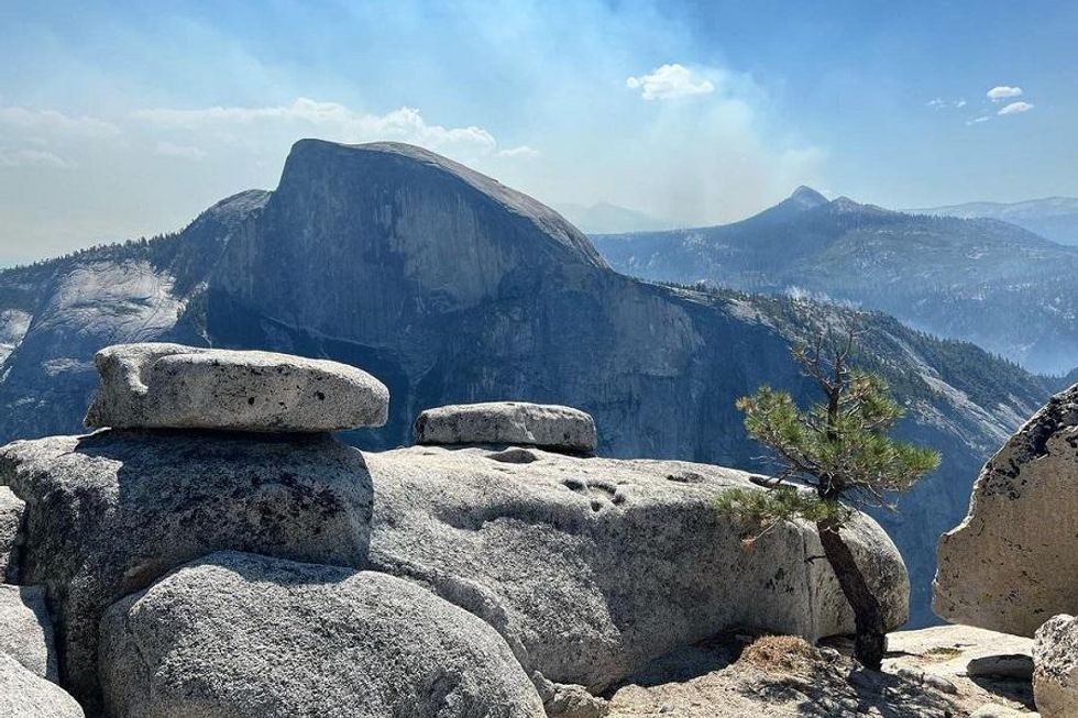
(Courtesy of @jeffreyvandyk)
While August crowds mob Yosemite Valley, head to high country the where views are unreal and the foot traffic is low. On the trail to North Dome, you’ll see the national park’s most iconic sights from a different perspective. Start at the Porcupine Creek Trailhead on a short paved path through a conifer forest. At each junction, follow the signs to North Dome. Close to four miles in, you’ll descend the rocky cliff to the foot of the rounded peak. Climb up to its summit for views of Half Dome and the heart of the park. On your way back, make a quick 1/3 mile detour to the natural arch Indian Rock (follow the sign).
// Tioga Rd, 1.2 miles east of Porcupine Flat Campground (Yosemite), nps.gov/yoseSeptember: Eldorado National Forest, Shealor Lake Trail (3.6 miles, out and back)
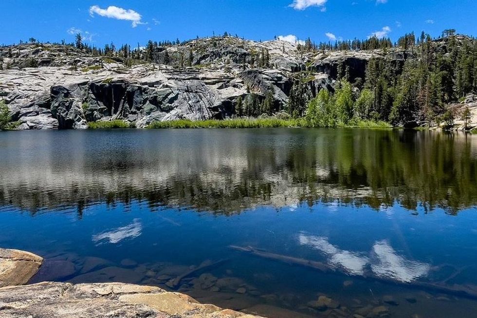
(Courtesy of @thefarouk)
The hike to Shealor Lake has everything you want on a Sierra Nevada trail: rock scrambling, spectacular views, and a cold clear lake for swimming and picnicking. Plus, with around 800 feet of elevation gain over less than four miles, it’s a great option for beginners and kiddos. Park at the Shealor Lake Trailhead then head through the forest and down the granite slopes. The 1.7 mile trail is marked by cairns but even if you get off track, the welcoming lake will soon light your way. When you’ve had your fill of summer sun, head back up the way you came.
// Shealor Lake Trailhead, Hwy 88 (Pioneer), fs.usda.gov/eldoradoOctober: Angel Island State Park, Perimeter Loop (5.5-mile loop)
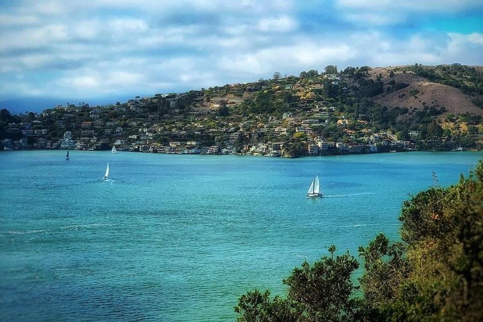
(Courtesy of @brukdahl)
October, when the skies are warm and clear, is the ideal month for a sea-to-land adventure at Angel Island State Park. Take the ferry from San Francisco or Tiburon to Ayala Cove then head clockwise along the paved Perimeter Road. Along the way, stop to explore the remnants of the US Immigration Station (Angel Island was once the West Coast equivalent of New York’s Ellis Island), a Nike missile site, and several batteries and garrisons built in the late 19th century. Pro tip: Go while the Blue Angels are in town during the first week of the month and you’ll have the best vantage point in the entire Bay Area to see the jets fly.
// Angel Island (Tiburon), parks.ca.govNovember: Jack London State Historic Park, Sonoma Mountain Trail (7.5 miles, out and back)
(Courtesy of @jacklondonpark)
Call of the Wild author Jack London loved this slice of Sonoma so much, he bought a ranch there in 1905 and named it Beauty. What’s left of the writer’s home (a fire destroyed much of it in 1913) can still be visited before or after this breathtaking hike to the top of Sonoma Mountain. See Wine Country from above on the steep 3.75 mile Mountain Trail, which starts next to the parking lot at the London Cottage and House of Happy Walls Museum, and ends at the 2,370 foot summit. The trek will get your heart pumping but hang in there: Not only are the views worth it, the way back is all downhill.
// 2400 London Ranch Rd. (Glen Ellen), jackondonpark.comDecember: Año Nuevo State Park, Elephant Seal Guided Walk (3 to 4 miles, out and back)

(Courtesy of @anonuevosp)
End the year by parlaying with elephant seals at the start of their annual breeding season at Año Nuevo State Park. Beginning December 15, you can only see them on guided docent-led tours. During the hike, you’ll travel three to four miles over varied coastal terrain, watch bull seals woo the ladies, and learn about the first months of a pup’s life. Free tours run daily from early morning to mid-afternoon and advance reservations are required.
// 1 New Year’s Creek Rd. (Pescadero), parks.ca.gov