


With backpacking season just around the corner, we've pulled together some of our favorite multi-day backpacking treks throughout the state for your summer planning enjoyment below.
There are definitely no bad options here, but some of below trips require extensive pre-planning and/or are limited by permit quotas (though a limited number of spots remain reserved for walk-ins) or seasonal road access, while other locations are simply show up and go. So dust off those hiking boots, start studying your maps, and consider adding a new backpacking trip in the Golden State to your itinerary this season.
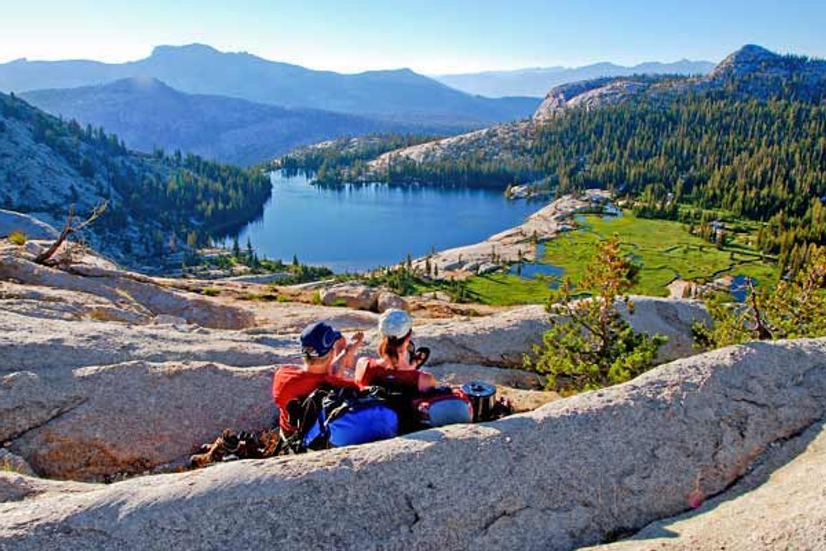
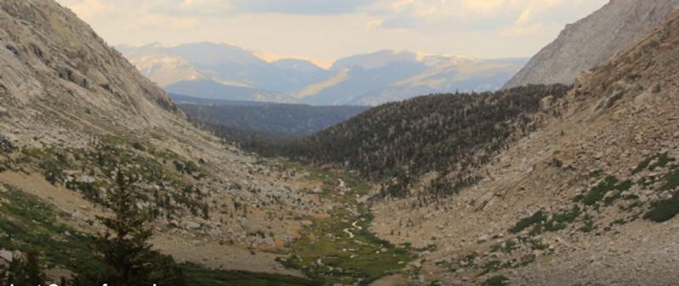
Tuolumne Meadows To Yosemite Valley Via Vogelsang Camp
Established over 120 years ago, Yosemite National Park is one of the most popular and visited parks in the country, and for good reason. With its iconic scenery and mountains, including Half Dome and El Capitan, there are really no other National or State parks like it. Read more.
PROS: Incredible views. Secluded. Natural water slides. Wildlife.
CONS: Crowds on the last day.
REGION: Yosemite + Central Sierra
CONGESTION: Low
PREFERABLE SEASON(S): Spring, Summer, Fall
DAY-USE/PARKING PASS REQUIRED: National Park Pass
TOTAL DISTANCE: 28.00 mi (45.06 km)
DOGS ALLOWED: No
Lost Coast Trail
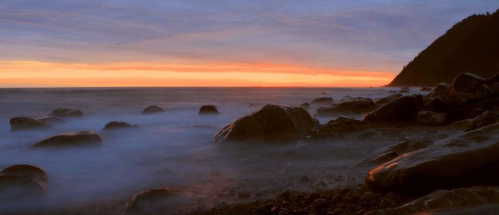 (photo by Brandon Katcher)
The Lost Coast Trail is a wild and unique backpacking adventure along one of the most rugged sections of the Northern California coast. The King Range area is nearly untouched by civilization, with only a few small towns along the two-hour shuttle from Shelter Cove to the Mattole Beach trailhead to the north. The trail provides incredible views, a variety of wildlife and flora, and a glimpse of some rarely seen California coastal terrain. Keep in mind that portions of this trip take a great deal of effort; the majority of the 25-mile, 3-day trip takes place on sandy beaches, which can be exhausting for legs and feet. Read more.
PROS: Beautiful landscape. Only backpackers. Wildflowers. Plenty of water.
CONS: Long shuttle ride. Hard on legs and feet. Many river crossings.
REGION: Humboldt
CONGESTION: Low
PREFERABLE SEASON(S): Spring, Summer, Fall
DAY-USE/PARKING PASS REQUIRED: Not Required
TOTAL DISTANCE: 24.60 mi (39.59 km)
DOGS ALLOWED: Yes
Four Lakes Loop Via Long Canyon
 Diamond Lake with the White Trinities in the background. (photo by Jason Mandly)
With over 600 miles of trails and 500,000 acres of wilderness land, the Trinity Alps form an alpine wonderland in far northern California. This trip takes you to the crest of the eastern portion of the Trinity Alps: the peridotite-stained Red Trinities. Long Canyon is the shortest of several routes that can take you to the Four Lakes Loop. Read more.
PROS: Lightly visited. Big views. Summer wildflowers. Swimming.
CONS: Strenuous. Dirt road approach.
REGION: Trinity Alps + Marble Mountain Wilderness
CONGESTION: Low
PREFERABLE SEASON(S): Summer, Fall
DAY-USE/PARKING PASS REQUIRED: Not Required
TOTAL DISTANCE: 17.20 mi (27.68 km)
DOGS ALLOWED: Yes
Rae Lakes Loop
 JMT to Rae Lakes(photo by Alix Sorrell)
Rae Lakes loop is a scenic Sierra multi-day loop and truly a backpacking trip that has it all. Stunning lake basins, rushing waterfalls, and splendidly carved canyons envelop your being for the three to six days necessary to complete the circuit in Kings Canyon National Park. The mountainscapes encountered here will entice you to begin scheduling your John Muir Trail permit and scouring the High Sierra maps for your next multi-day excursions. For these reasons and more, the parking lot at Road's End in King's Canyon is large enough to accommodate a small amusement park. The loop is one of the most popular in the Sierra, often requiring permits to be reserved in advance. Odds for the greatest solitude are best if you schedule your trip for midweek or wait until autumn. And don't forget that a bear canister is required for this trip. Read more.
PROS: Beautiful lakes. Great High Sierra scenery. Well maintained trail.
REGION: Southern Sierra
CONGESTION: Moderate
PREFERABLE SEASON(S): Summer, Fall
DAY-USE/PARKING PASS REQUIRED: National Park Pass
TOTAL DISTANCE: 42.00 mi (67.59 km)
DOGS ALLOWED: No
John Muir Trail, Overview
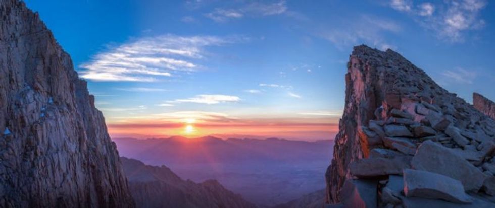 Sunrise from Whitney Massif(photo by Rini Sugianto)
Regarded by many as the premier hiking trail in the country, the John Muir Trail (JMT) runs along the backbone of California's High Sierra between Yosemite National Park and the summit of Mount Whitney, the highest point in the contiguous United States. The 211-mile-long trail commemorates the influential naturalist and founder of the Sierra Club, John Muir. Read more.
PROS: One of the top scenic trails in the country. Trail goes through three national parks. High Sierra scenery.
CONS: Hard to get permit. Thru-hiking is logistically complex.
REGION: Yosemite + Central Sierra
CONGESTION: Moderate
PREFERABLE SEASON(S): Summer
DAY-USE/PARKING PASS REQUIRED: Not Required
TOTAL DISTANCE: 211.00 mi (339.57 km)
DOGS ALLOWED: No
John Muir Trail, Section 1
 Sunset after a thunderstorm at Lower Cathedral Lake. (photo by Rini Sugianto)
This section describes the JMT from its northern terminus at Happy Isles Trailhead in Yosemite Valley to the common resupply/food cache point at Red's Meadow 58 trail miles to the south. Most hikers begin the trip here in Yosemite, an inspiring starting point and the trail's lowest elevation, providing JMT hikers time to adjust to the higher elevations that lie ahead. Included with the permit, hikers have the options of staying at the backpacker camp in Yosemite Valley the night before the hike begins. Read more.
PROS: One of the top scenic trails in the country. Trail goes through three national parks. High Sierra scenery.
CONS: Hard to get permit. Thru-hiking is logistically complex.
REGION: Yosemite + Central Sierra
CONGESTION: High
PREFERABLE SEASON(S): Summer
DAY-USE/PARKING PASS REQUIRED: National Park Pass
TOTAL DISTANCE: 58.50 mi (94.15km)
DOGS ALLOWED: No
John Muir Trail, Section 4
 Fin Dome near Rae Lakes (photo by Rini Sugianto)
This final section of the JMT covers the southernmost 50 miles from the crossing at Woods Creek to the summit of Mount Whitney, heading north to south through the high country of Kings Canyon and Sequoia National Parks. While it's difficult to say which section of the JMT is the most scenic, these final miles may be the most memorable given the beauty of places like the Rae Lakes Basin, the climb up and over the trail's highest pass, and the termination of the JMT at the summit of Mount Whitney, the tallest point in the contiguous United States. Like the rest of the trail, fishing can be decent among the lakes and provide a welcomed opportunity for freshly cooked trout, but mosquitoes can also be a nuisance. Read more.
PROS: One of the top scenic trails in the country. Trail goes through three national parks. High Sierra scenery.
CONS: Hard to get permit. Thru-hiking is logistically complex.
REGION: Southern Sierra
CONGESTION: High
PREFERABLE SEASON(S): Spring, Summer, Fall
DAY-USE/PARKING PASS REQUIRED: Not Required
TOTAL DISTANCE: 50.00 mi (80.47 km)
DOGS ALLOWED: No
Mount Whitney Cottonwood Pack Station
 (photo by Brandon Katcher)
The 14,505-foot Mount Whitney is the highest point in the continental United States. The mountain was named after geologist and surveyor, Josiah Whitney, who was long believed to be the first person to summit the mountain. In actuality, the peak was first visited in 1873 by two fishermen from the nearby town of Lone Pine, which is the source of the mountain's lesser-known title, Fisherman's Peak. Read more.
PROS: Incredible views. Highest point in the continental U.S. Not as crowded as the Whitney Portal route.
CONS: Long route and fast pace. Very dusty. Crowds on the summit ascent.
REGION: Eastern Sierra + White Mountains Area
CONGESTION: Moderate
PREFERABLE SEASON(S): Spring, Summer, Fall
DAY-USE/PARKING PASS REQUIRED: Not Required
TOTAL DISTANCE: 63.00 mi (101.39 km)
DOGS ALLOWED: No
Glacier Pass, Sawtooth Pass + Big Five Lakes Hiking Loop
 Lost Canyon from above (photo by Aron Bosworth)
The Mineral King area of California's Sequoia National Park provides hiking access to some of the most spectacular high country in the southern Sierra. It is well worth enduring the poorly maintained, 25-mile Mineral King Road to access this subalpine glacial valley; you will not be disappointed. There are several day and multi-day backcountry hiking loop options available from the Mineral King Valley. Hiking the Glacier Pass to Sawtooth Pass Loop via Big Five Lakes qualifies at the top of this list. If you are interested in a loop that is approximately 27 miles long and blends cross-country route finding and on-trail travel, stunning alpine landscape, and high Sierra lake fishing, this hike is for you. Read more.
PROS: Quick access to the high Sierra. Good Fishing. Nice mix of trail and cross-country travel.
CONS: Rough access road. Marmot issues at trailhead in late spring and early summer.
REGION: Southern Sierra, CA
CONGESTION: Low
PREFERABLE SEASON(S): Summer
DAY-USE/PARKING PASS REQUIRED: National Park Pass
TOTAL DISTANCE: 27.00 mi (43.45 km)
DOGS ALLOWED: No
Big Pine Creek North Fork Hiking Trail, First and Second Lake
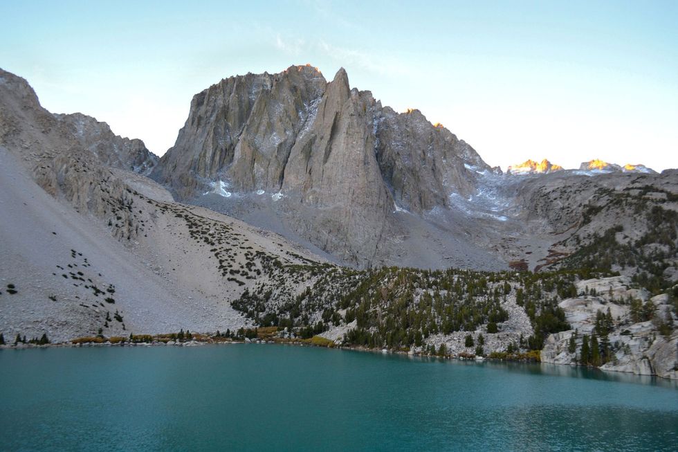 Second Lake(photo by Taylor Reilly)
The Big Pine Creek North Fork Hiking Trail rises into California's High Sierra toward the southernmost glaciers in the United States. Palisade glacier sits above a series of lakes, named First Lake through Seventh Lake, where you'll find some of the best trout fishing in the Sierra Nevada. Also, here in the John Muir Wilderness there are several peaks exceeding 14,000-feet along the Palisade Crest, part of the Great Western Divide. Here you'll find the 14,153-foot Mount Sill and Temple Crag, which is home to some of the tallest rock climbs in the entire Sierra Nevada Range. Read more.
PROS: Access to Palisades Range and High Sierra.
CONS: Trailhead access closed in winter.
REGION: Eastern Sierra + White Mountains Area, CA
CONGESTION: Low
PREFERABLE SEASON(S): Spring, Summer, Fall
DAY-USE/PARKING PASS REQUIRED: Not Required
DOGS ALLOWED: Yes
Sky Trail Loop
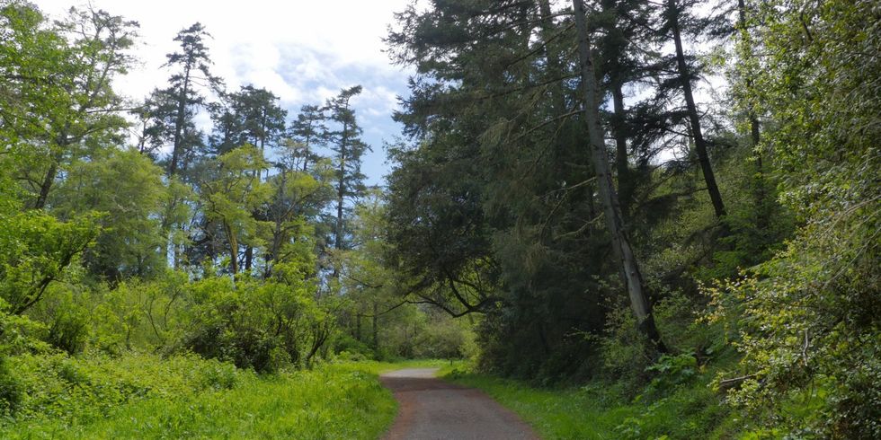 (photo by Brandon Katcher)
This seven-mile hike can be done in a single day; however, overnighters who reserve a spot early enough will have the chance to stay at the beautiful Sky Campground. Begin your hike at the Bear Valley Visitor Center. For the first 1.6 miles you will follow the Bear Valley Trail. There are many offshoot trails that you can take to Sky Trail depending on how many miles you want to travel. Old Pine Trail is a good choice, and it meanders 800 feet up through a rainforest. Read more.
PROS: Beautiful forests and views. Various loops and lengths available.
CONS: Can be crowded.
REGION: Marin
CONGESTION: Moderate
PREFERABLE SEASON(S): Winter, Spring, Summer, Fall
DAY-USE/PARKING PASS REQUIRED: Not Required
TOTAL DISTANCE: 7.00 mi (11.27 km)
DOGS ALLOWED: No
Skyline-to-the-Sea-Hike
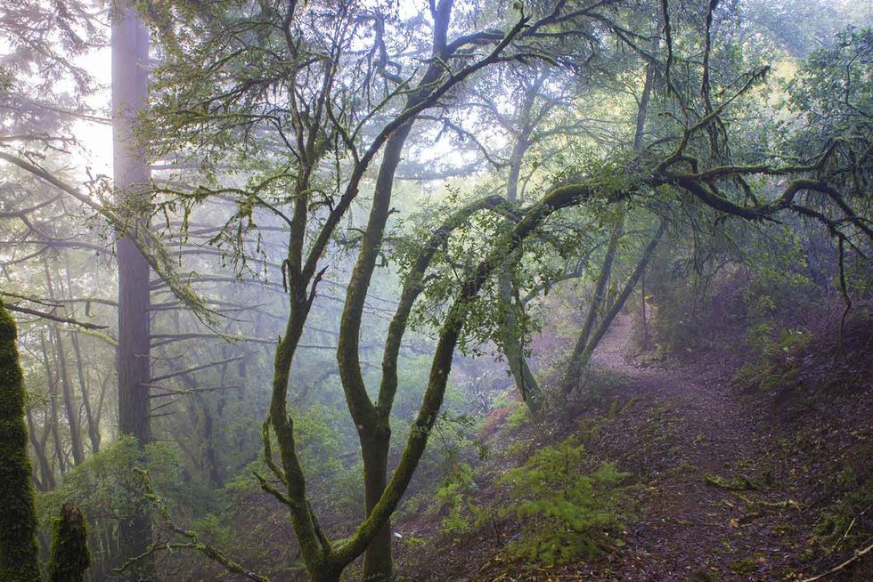 (photo via Redwood Hikes)
If you are looking for one of the best backpacking trips the Bay Area has to offer, look no further. The Skyline-to-the-Sea Trail is 28 miles of awesome views, backcountry camping, old-growth Redwood trees, waterfalls, and more! This hike can be done in a fast paced two day hike or a leisurely three days. Some hardcore thru hikers can do it in one day. However you choose to hike, there are camping options along the way so you can adjust your course accordingly. Read more.
PROS: Big vistas. Old-growth redwoods. Backcountry Camping.
CONS: None.
REGION: San Francisco Peninsula + Santa Cruz, CA
CONGESTION: Moderate
PREFERABLE SEASON(S): Spring, Summer, Fall
TOTAL DISTANCE: 16.50 mi (26.55 km)
DOGS ALLOWED: No
Sykes Hot Springs
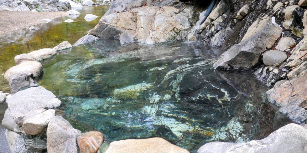 (photo by Brandon Katcher)
What better way to relax after a strenuous 10-mile hike than to take a dip in a soothing hot spring? Sykes Hot Springs in Big Sur is one of the most famous and popular backcountry hot springs in California, and it is easy to understand why. Sykes in nestled deep in the Ventana Wilderness, a 234,000-acre protected area that was first established in 1969. Sykes became popular during the counter-culture movement of the 1960s, and it has since has become a favorite destination for backpackers and locals alike. Read more.
PROS: Beautiful canyons and forests. Relaxing hot springs. Good introductory backpacking.
CONS: Can be extremely crowded. Trash is an issue. No group restrictions.
REGION: Big Sur Coastline, CA
CONGESTION: High
PREFERABLE SEASON(S): Winter, Spring, Summer, Fall
DAY-USE/PARKING PASS REQUIRED: General Day Use Fee ($5.00)
TOTAL DISTANCE: 20.80 mi (33.47 km)
DOGS ALLOWED: Yes


