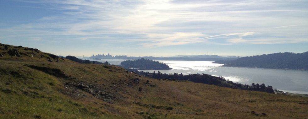
If you're in the mood for all around killer views, great spring wildflowers, and some moderately challenging uphill hiking then Ring Mountain in Tiburon is just the ticket. Easily accessible from both San Francisco and the East Bay, it's a great place to show a new visitor to the Bay Area the dramatic geography that makes this place so special.
To Get There: Take the Paradise Dr. exit from Highway 101 in Corte Madera and proceed east on San Clemente Drive which turns into Paradise Drive just after the 2nd stop light. Go through another two lights, and about two tenths of a mile past Westward Dr. you come to roadside parking and the open space entrance.
What You're In For: The trail starts ascending immediately. If the trail's not too muddy, head to the left at the first fork for the loop trail. You'll cross a couple of small creeks as you head up to Taylor Rd., and the 360 degree views get more and more impressive as you gain altitude. Ring Mountain was an Army installation during the Cold War; at the top you can see numerous graded areas where buildings and radars emplacements were situated. For the return, head west past Taylor Rd. and Turtle Rock (a popular place for free rock climbing) and then stroll down to the saddle and take the Phyllis Ellman trail back to your car.
Treat Yourself: A great picnic lunch can be procured at the deli in the Paradise Foods market on your way in or continue east on Paradise Dr. for a leisurely and scenic drive into Tiburon, where there are numerous lunch and refreshment possibilities. The screenshot below is from the Marin County Open Space District map available to print out here.