With the summer solstice coming up this weekend, the longest days of the year are in full effect—the perfect time for a sunset hike.
In the gloaming, virtually any hike with a view is at peak beauty. But for the most spectacular show, head west. These seven Bay Area trails come alive as day fades to night.
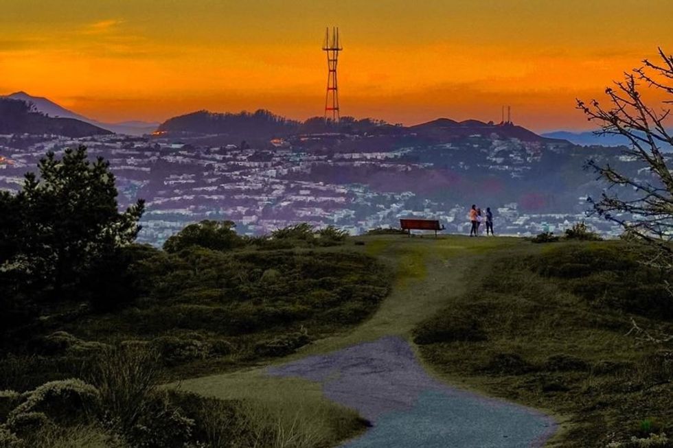 The view from San Bruno Mountain at sunset(Courtesy of @rodpasion)
San Bruno Mountain via Summit Loop, San Bruno (3.6-mile loop)
For a hike that’s a little more of a hike (yet still mellow enough to do in the evening after work), try San Bruno Mountain. The Summit Loop and Dairy Ravine Trails aren’t directly on the coast— they’re high above sea level, where the views stretch not just to the ocean but all the way across a Peninsula glinting in the setting sun. The 3.6-mile loop should take you less than two hours to complete, with enough hill climbing to get your heart pumping. // Guadalupe Canyon Pkwy (San Bruno), parks.ca.gov
Seal Rocks Beach Trail, San Francisco (2.2 miles out-and-back)
Probably just about anyone you ask would say that the one city hike that must be on this list is the Lands End Trail—and they wouldn’t be wrong. But there’s another version of the trail that makes a great, slightly shorter alternative to tackle at sunset: the Seal Rocks Beach Trail. Start from the Lands End parking lot, then head out towards Point Lobos, circle around the peninsula over Hermit Rock, then out to the coastline perch right above the sea. At just 2.2 miles, the dog-friendly route is short, sweet, and spectacularly beautiful. // Lands End (Outer Richmond), alltrails.com
 Bolinas Point at sunset(Courtesy of @thatchrisryan)
Bolinas Point Loop, Bolinas (2.5-mile loop)
With panoramic views of the Pacific, the Bolinas Point Loop gives you a big bang for your buck (in this case, the buck is how hard you actually have to work). This 2.5-mile loop will only take you about an hour from start to finish, but along the way, you’ll pass through multiple ecosystems, from coastal scrub and grasslands to Douglas fir forest. The middle of the hike runs parallel to the coast, where the sunsets are always on point. // Mesa Rd. (Bolinas), alltrails.com
Montara State Beach, Montara (1.4 miles out-and-back)
This short trail in Montara is literally a walk on the beach that the setting sun turns into something extra special. Pick up the trail on the south end, kick off your shoes, and dig your toes into the sand. The entire length of the beach and back is just under 1.5 miles—a low-key way to hike with the setting sun (and your dog). // Hwy 1 (Montara), parks.ca.gov
 The view from Baker Beach at sunset(Courtesy of @nk_aroundtheworld)
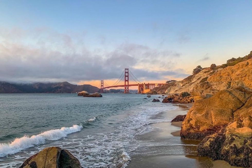
Fort Point—Baker Beach Coast Trail, San Francisco (4.1 miles out-and-back)
Baker Beach is San Francisco’s most beautiful sandy stretch (yeah, we said it—fight us!) and the Fort Point-Baker Beach Coast Trail—which runs from Fort Point, past the batteries, and along the bluffs—makes for one of the most iconic sunsets in the city. The out-and-back is just over four miles total, and you’ll have to put in some effort on the steep stairs, but there’s an added bonus to coming in the evening: you’ll have it (almost) all to yourself. // Fort Point, 201 Fort Mason (Marina), alltrails.com
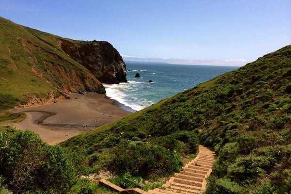
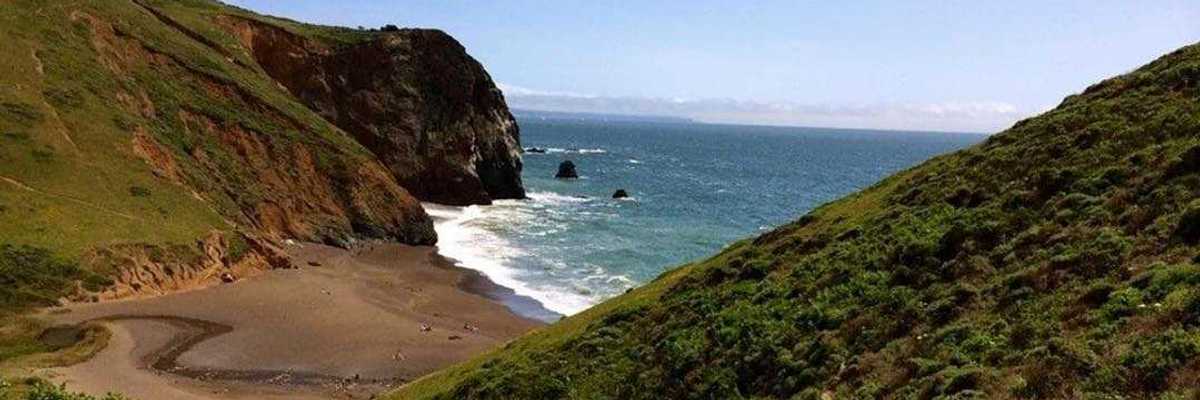
Sculptured Beach via Coastal Trail, Point Reyes National Seashore (6.4 miles out-and-back)
If you’re craving something a little longer, the trail to west Marin’s Sculptured Beach is ideal: 6.4 miles out-and-back without a whole lot of elevation gain. In other words, for only a little more effort than strolling on the beach, you can hike to one that’s romantic and secluded. Park at Limantour Beach, which you’ll walk along for about half a mile before switching to the easy-to-follow, well-marked Coast Trail. The way out will keep you in view of the ocean almost the entire time, so you won’t miss a minute of the sky’s changing colors. The spur trail down to the beach isn't well marked, so make sure there’s still plenty of light for your arrival. You’ll need the last, lingering rays to check out the tidepools anyway. The Coast Trail back will be a cinch—even in the descending darkness. // Point Reyes National Seashore (Tomales), nps.gov
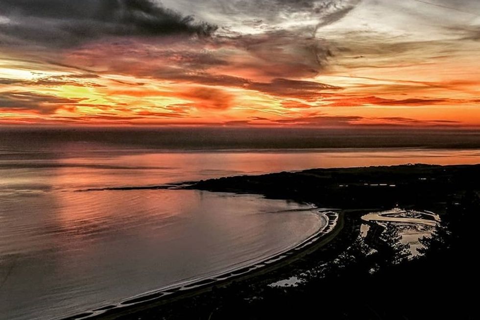
 Thornton State Beach at sunset(Courtesy of @bae_gram/@thesfpeninsula)
Thornton State Beach to Phillip Burton Beach Loop, Daly City (3.1-mile loop)
Just south of SF, this easy loop feels a million miles away. The trail sticks to the dunes, zigzagging in and out of coastal scrub—but multiple short paths connect to the water if you want to sit and stay awhile. Otherwise, besides the shifty sand under your feet, this 3.1-mile trail is a breeze: all the better to keep a watch on that setting sun. // Thornton State Beach Rd. (Daly City), parks.ca.gov